Erika+Manfred's photos
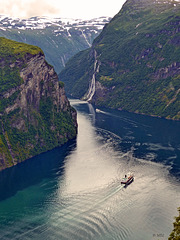
Geiranger-Fjord und die 7 Schwestern
Badetag ...
| |
|
|
|
Casares, Andalusien - eines der weißen Dörfer
| |
|
|
|
Casares liegt an der Grenze der Provinzen Málaga und Cádiz in der Sierra Bermeja (Serranía de Ronda). Nächstgrößere Orte sind Manilva, Estepona und Gaucín.
Die Geschichte Casares reicht archäologischen Funden zufolge ca. bis ins Jahr 1000 v. Chr. zurück, als das Gebiet um das heutige Casares einer ibero-phönizischen Bevölkerung Raum bot. Nach der Eroberung Spaniens durch die Römer im 2. Jh. v. Chr. gründeten diese ca. 4 km vom heutigen Casares entfernt die Stadt Lacipo, die in der Herstellung von Olivenöl ihre ökonomische Basis hatte. Schon vor dem Zerfall des römischen Reiches aber verlor Lacipo zusehends an Bedeutung.
Die eigentliche Entwicklung Casares als eigenständiges Dorf begann dagegen erst zwischen 450 und 650. Mit der Eroberung Andalusiens durch die Mauren ab 711 geriet Casares unter arabische Herrschaft und wurde tributpflichtig. Im Gegenzug dazu wurde es zu einer weitestgehend autonomen „Schutzzone“. Die maurischen Herrscher bauten Casares zu einem regional bedeutenden Verwaltungszentrum aus und versahen es mit einer Festungsanlage, dem Alcázar. Im „Pakt von Casares“ schlossen sich der kastilische König Pedro I. (Pedro der Grausame) und der Nasriden-Herrscher Muhammed V. zu einer Allianz zusammen, die die Wiedereinsetzung Muhammeds als obersten Herrscher verfolgte.
Bis zur Eroberung durch die christlichen Truppen im Rahmen der Reconquista im Jahre 1484 blieb Casares Teil des nasridischen Taifa Granada. Die Vertreibung der jetzt Morisken genannten Mauren aus Andalusien gelang in den unzugänglichen Sierras Andalusiens weniger gut als in den großen Städten, und Reste der ehemals maurischen Bevölkerung schlossen sich 1570 zu einer Rebellion gegen die christlichen Herrscher zusammen. Vor allem in den Alpujarras und in der Serranía de Ronda wurde diese schnell zu einer ernsthaften Bedrohung. Die blutige Niederschlagung der Rebellion durch die Herzöge von Arcos resultierte nicht nur in der Vertreibung der letzten Mauren, sondern führte auch zum allgemeinen Niedergang der Region.
Im Jahre 1885 wurde der spätere Rechtsanwalt Gil Blas Infante geboren. Der „Vater des andalusischen Nationalismus“ wurde am 11. August 1936 zu Beginn des spanischen Bürgerkrieges von nationalistischen Truppen ermordet. Die Casareños gedenken des berühmtesten Sohnes ihres Dorfes mit einer Statue auf der Plaza de España. Q:Wikipedia
The municipality has a population of 4,051 (male: 2,139, female: 1,912), an area of 160 km². It has a density of 25.3. Its geographic coordinates are: latitude: 36° 27' 0N, longitude: 5° 16' 60W, altitude: 246 msl.The town of Casares has Moorish cliff-hugging buildings.
In Roman times the spa of la Hedionda, located on the road to Manilva, was already well known, and this is where Julius Caesar supposedly was cured of a liver complaint, thanks to the sulfuric waters that still pour out of the local spring. For this reason that during the Roman Empire, Casares was allowed by emperors to mint its own coins. The 12th century Castle, around which grew the present town center, was founded by the occupying Moors. In 1361, Peter I of Castile and the dethroned Muhammed V signed the Pact of Casares, by which the Moorish King recuperated his throne, leaving Casares as part of the Nasrid Dynasty. The town surrendered to the Catholic forces after the fall of Ronda in 1485 and was handed over to Rodrigo Ponce de León, Duke of Cádiz. Later during the Rebellion of the Moriscos, Rodrigo's descendent, the Duke of Arcos, accepted the surrender of the rebel Moriscos, the Moors who had "converted" to Christianity. Casares had taken an active part in the Morisco rebellion, put down by Don John of Austria. The town separated from Manilva in 1795, being granted the title of Villa. At a later period, Casares was the only town, apart from Cádiz, that the Napoleonic troops has not been able to take.
More recent history indicates the old village as the birthplace of the father of Andalusian nationalism, Blas Infante Perez de Vargas, labor lawyer, politician, and writer, who is considered to be the largest historic figure in Andalucia. He was born in 1885 and died during the civil struggle in 1936. Since 1978 the historical and artistic heritage of the village has been officially protected. Q:Wikipedia
Der Zaun in der Mutitjilda-Schlucht
| |
|
|
|
- ein ständiges Wasserloch am Fuße des Uluru
Der Uluṟu [uluɹu], auch Ayers Rock, ist ein Inselberg in der zentralaustralischen Wüste, der sich ca. 350 m über sein Umland erhebt.
Der Uluṟu ist etwa 3 km lang, bis zu 2 km breit und hat einen Umfang von rund 9 km. Der Gipfel befindet sich auf einer absoluten Höhe von 863 m. Damit erhebt er sich 348 m über die Dünenlandschaft Zentralaustraliens.
Der Uluṟu liegt im Uluṟu-Kata-Tjuṯa-Nationalpark, nahe dem Ort Yulara, etwa 340 km Luftlinie südwestlich von Alice Springs im Südwesten des australischen Bundesterritoriums Northern Territory. Der 1.325 km² große Nationalpark, in dem neben dem Uluṟu auch die benachbarten Kata Tjuṯa („die Olgas“) liegen, gehört zum UNESCO-Weltnatur- und -kulturerbe.
Die einzige asphaltierte Straße, die zum Uluṟu führt, ist der Lasseter Highway. Dieser verbindet den Berg über den Stuart Highway mit Alice Springs und damit dem Rest Australiens. Außerdem zweigt von ihm die Luritja Road zum Kings Canyon ab, die ebenfalls asphaltiert ist. Bei den Kata Tjuṯa, ungefähr 30 km westlich des Uluṟu, geht der Lasseter Highway in die Great Central Road über, eine unbefestigte Outbackpiste, die bis zum Ort Laverton im Zentrum von Western Australia führt. Sie ist dort als „Docker River Road – to WA Border“ ausgeschildert. Außerdem ist eine Anreise über den lokalen, etwa 10 km von Yulara entfernt gelegenen Connellan-Flugplatz möglich.
Uluru is one of Australia's most recognisable natural landmarks. The sandstone formation stands 348 m (1,142 ft) high, rising 863 m (2,831 ft) above sea level with most of its bulk lying underground, and has a total circumference of 9.4 km (5.8 mi). Both Uluru and the nearby Kata Tjuta formation have great cultural significance for the Aṉangu people, the traditional inhabitants of the area, who lead walking tours to inform visitors about the local flora and fauna, bush foods and the Aboriginal dreamtime stories of the area.
Uluru is notable for appearing to change colour at different times of the day and year, most notably when it glows red at dawn and sunset.
Kata Tjuta, also called Mount Olga or The Olgas, lies 25 km (16 mi) west of Uluru. Special viewing areas with road access and parking have been constructed to give tourists the best views of both sites at dawn and dusk.Quelle: Wikipedia
Cape Cornwall
| |
|
|
|
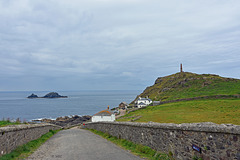
Cape Cornwall (kornisch: Pen Kernow) ist eine schmale Landspitze in Cornwall, Großbritannien. Sie liegt ca. 6,7 Kilometer nördlich vom Land’s End in der Nähe von St Just in Penwith.Der Atlantik wird vom Kap in mehrere Gewässer aufgeteilt: Im Norden beginnt hier der Bristolkanal sowie die Irische See und im Süden der Ärmelkanal. Früher galt die Landspitze als westlichster Punkt Englands, bis genaue Messungen ergaben, dass Land's End der westlichste Punkt ist.Am Cape Cornwall befinden sich ein Aussichtspunkt, ein Parkplatz und öffentliche Toiletten für die Touristen. Der Schornstein auf der Spitze der Landzunge ist ein Denkmal, das an den Bergbau und den damit verbundenen Erzabbau im Bergbaurevier St Just erinnern soll. In direkter Nachbarschaft befindet sich die Letcha Mine, deren Schornstein etwa 800 südöstlich vom Cape Cornwall zu sehen ist. Viele Spuren der Industrialisierung dieser Landschaft sind bis heute erhalten geblieben, das Gebiet um St. Just steht als UNESCO-Welterbe seit 2006 unter besonderem Schutz. Im Meer vor dem Cape liegen "the Brisons", zwei Felsen, die aussehen wie Charles de Gaulle auf dem Rücken liegend.
Cape Cornwall (Cornish: Kilgoodh Ust, meaning "goose back of St Just") is a small headland in west Cornwall, England, UK. It is four miles north of Land's End near the town of St Just.
A cape is the point of land where two bodies of water meet and until the first Ordnance Survey, 200 years ago, it was thought that Cape Cornwall was the most westerly point in Cornwall. Most of the headland is owned by the National Trust. There is also a National Coastwatch look out on the seaward side. The only tourist infrastructure at present is a car park (owned by the National Trust) and a public toilet and refreshments van during the summer.
The Brisons, two offshore rocks, are located approximately one mile southwest of Cape Cornwall and are the starting line of the annual swimming race ending at Priest Cove.
Just one mile from the Cape is the westernmost school on the British mainland, Cape Cornwall School. This is Cornwall's smallest secondary school with (as of January 2008) about 450 young people aged 11 to 16. Commonly known as "Cape" it is Cornwall's only school that specialises in art, photography and music. Most of its pupils come from the town of St Just in Penwith and the nearby villages of Pendeen, Sennen, St Buryan and St Levan but over 10% travel to the school from Penzance and further east.
Ich bin dann mal weg ...
| |
|
|
|
So macht einkaufen Spass
| |
|
|
|
Falmouth, please come in
| |
|
|
|
Falmouth (kornisch Aberfal) ist eine Hafenstadt an der Südküste der Grafschaft Cornwall in England. Die Stadt zählt 20.775 Einwohner (Stand: 2001). Ursprünglich hieß Falmouth Peny-cwm-cuic, was im Englischen zu „Pennycomequick“ verballhornt wurde.
Falmouth ist für seinen Hafen berühmt, der zusammen mit den Carrick Roads den drittgrößten Naturhafen der Welt bildet. Die Stadt ist auch als Start bzw. Ziel einiger Weltumsegelungen bekannt, so z. B. der von Sir Francis Chichester und Dame Ellen MacArthur.
Sir John Killigrew gründete die Stadt Falmouth im Jahr 1613. Bereits um 1540 ließ Heinrich VIII. hier die Küstenfestung Pendennis Castle errichten, um die Carrick Roads zu verteidigen. Während des Englischen Bürgerkriegs war Pendennis Castle die vorletzte Festung, die sich den Parlamentsanhängern ergab. Angesichts der Bedrohung durch die spanische Armada wurden die Befestigungen im späten 16. Jahrhundert durch steile Wallanlagen verstärkt.
Der Schoner Pickle überbrachte in Falmouth die Nachricht vom englischen Sieg und Admiral Nelsons Tod in der Schlacht von Trafalgar.
Während des Zweiten Weltkriegs war Falmouth der Ausgangspunkt für einen Kommandotrupp, der 1942 den deutschen U-Boot-Stützpunkt in Saint-Nazaire unter dem Decknamen Operation Chariot angriff und zerstörte.
Falmouth (/ˈfælməθ/; Cornish: Aberfala) is a town, civil parish and port on the River Fal on the south coast of Cornwall, England, United Kingdom. It has a total resident population of 26,767.
Falmouth Parish Church, Church Street, dedicated to "King Charles the Martyr"
The name Falmouth is of English origin, which recent Cornish language enthusiasts have translated to "Aberfal" (or "Aberfala") based on Welsh precedents. It is claimed that an earlier Celtic name for the place was Peny-cwm-cuic, which has been Anglicized to 'Pennycomequick'.
Early history
Falmouth was the site where Henry VIII built Pendennis Castle to defend Carrick Roads, in 1540. The main town of the district was then at Penryn. Sir John Killigrew created the town of Falmouth shortly after 1613.
In the late 16th century, under threat from the Spanish Armada, the defences at Pendennis were strengthened by the building of angled ramparts. During the Civil War, Pendennis Castle was the second to last fort to surrender to the Parliamentary Army.
After the Civil War, Sir Peter Killigrew received Royal patronage when he gave land for the building of the Church of King Charles the Martyr, dedicated to Charles I, "the Martyr".
The seal of Falmouth was An eagle displayed with two heads and on each wing with a tower (based on the arms of Killigrew). The arms of the borough of Falmouth were Arg. a double-headed eagle displayed Sa. each wing charged with a tower Or. in base issuant from the water barry wavy a rock also Sa. thereon surmounting the tail of the eagle a staff also proper flying therefrom a pennant Gu.
The Falmouth Packet Service operated out of Falmouth for over 160 years between 1689 and 1851. Its purpose was to carry mail to and from Britain's growing empire. As the most south-westerly good harbour in Great Britain Falmouth was often the first port for returning Royal Navy ships.
Da kommt Sonne ins Haus
Bucht von Calvi
| |
|
|
|
Calvi ist eine französische Hafenstadt an der Nordwestküste Korsikas und Hauptort der Landschaft Balagne. Mit 5422 Einwohnern (Stand 1. Januar 2013) ist sie die fünftgrößte Gemeinde auf Korsika.
Calvi liegt 95 km von Bastia und 24 km von L’Île-Rousse entfernt am Golf von Calvi.
Die Stadt besteht aus der Unterstadt, in der das Rathaus, der Marktplatz und der bedeutende Yacht- und Fährhafen liegen, und der Oberstadt, die vom Gouverneurspalast und der Zitadelle dominiert wird.
Auf Korsika gibt es sieben Häfen, die von Transportschiffen oder Fähren von der französischen (Marseille, Toulon, Nizza) oder italienischen (Savona, Genua, La Spezia, Livorno, Piombino) Küste sowie aus Sardinien (Santa Teresa di Gallura, Porto Torres, Palau) angefahren werden. Diese sind L’Île-Rousse, Calvi, Propriano, Ajaccio, Bonifacio, Bastia und Porto-Vecchio.
Calvi (French: [kal.vi]) is a commune in the Haute-Corse department of France on the island of Corsica.
It is the seat of the Canton of Calvi, which contains Calvi and one other commune, Lumio. Calvi is also the capital of the Arrondissement of Calvi, which contains, besides the Canton of Calvi, three other cantons: L'Île-Rousse, Belgodère, and Calenzana.
The 2nd Foreign Parachute Regiment (2ème REP) of the French Foreign Legion is based in the citadel of Calvi.
According to legend, Christopher Columbus supposedly came from Calvi, which at the time was part of the Genoese Empire. Because the often subversive elements of the island gave its inhabitants a bad reputation, he would have been expected to mask his exact birthplace. Q:Wikipedia
Einsames Gehöft?
| |
|
|
|
Neben den bekannteren und weniger bekannten Sehenswürdigkeiten Dartmoors gehören die verstreut liegenden schönen Weiler und Dörfer zu den Anziehungspunkten; einigen von ihnen hat die Parkverwaltung den Status von „Conservation Areas“ zugesprochen.
Die Bank unter der Brücke im Trebah Garden
| |
|
|
|
Dartmoor
| |
|
|
|
Das Gefängnis ist die große Häusergruppe, fast in der Mitte hinten.
Neben den bekannteren und weniger bekannten Sehenswürdigkeiten Dartmoors gehören die verstreut liegenden schönen Weiler und Dörfer zu den Anziehungspunkten; einigen von ihnen hat die Parkverwaltung den Status von „Conservation Areas“ zugesprochen. Am südöstlichen Rand des Parks ist die Kleinstadt Buckfastleigh einen Besuch wert; von dort fährt die South Devon Railway, eine wiederhergestellte Normalspur-Eisenbahnlinie, den Dart River entlang nach Totnes. Nahe der Stadt befindet sich die Benediktiner-Abtei Buckfast Abbey, eines der wenigen noch aktiven Klöster in Großbritannien.
Ganz im Norden des Parks liegt über dem Flusstal des Teign das Castle Drogo; es ist das letzte Landschloss, das in Großbritannien gebaut worden ist. Weiter flussabwärts kommt man zur Fingle Bridge, einem massiven, dreibogigen Bauwerk. Weiter nordwestlich geht es nach Lynford. Dort steht die Kirche St Michal’s de Rupe auf Brentor. In Lydford wurde 1195 das für seinen rüden Umgang mit Gefangenen bekannte erste Gefängnis Dartmoors erbaut.
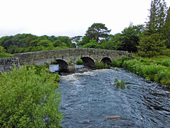
Von Südwesten her fährt man durch das Zentrum des Parks auf alten Straßen über Bennet’s Cross und Warren House, dem abgelegensten Inn, zur Ortschaft Postbridge, wo die größte noch erhaltene, über den East Dart errichtete „clapper bridge“ zu sehen ist. Sie stammt aus dem 13. Jahrhundert und wurde erbaut, um das Zinn von den Minen mit Packpferden zu den Schmelzöfen von Tavistock und Chagford transportieren zu können. Der nächste Ort ist Princetown, bekannt für sein düsteres Zuchthaus, das 1806 ursprünglich für Gefangene aus den Napoleonischen Kriegen gebaut wurde. Der Ort beherbergt außerdem das Verwaltungszentrum der Duchy of Cornwall. Immer noch im Zentrum, aber in der Osthälfte, liegt das wahrscheinlich am häufigsten besuchte Dorf Dartmoors, Widecombe-in-the-Moor. Schon von weitem ist der 36 m hohe Turm der Gemeindekirche zu sehen. Er wurde nach 1638 errichtet; in jenem Jahr schlug während eines Gottesdienstes ein gewaltiger Blitz in das Gebäude ein und forderte vier Todesopfer.
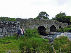
Dartmoor alte Brücke
| |
|
Dartmoor, Rundbogenbrücke gegenüber der Clapper Br…
| |
|
|
|
Picture ist taken from the Clapper Bridge.
Postbridge is a hamlet in the heart of Dartmoor in the English county of Devon. It is situated on the B3212, roughly midway between Princetown and Moretonhampstead.
Postbridge is situated next to the East Dart river, one of two main tributaries of the River Dart, and consists of a few houses, a shop, a pub, and a national park tourist information centre.
Postbridge is best known for its fine example of an ancient clapper bridge over the river. First recorded in the 14th century, the bridge is believed to have been built in the 13th century to enable pack horses to cross the river, carrying tin to the stannary town of Tavistock. The clapper bridge which is a Grade II* listed structure, is still complete, and stands alongside another bridge, a Grade II listed structure built in the 1780s
Cadgwith, Cornwall
| |
|
|
|
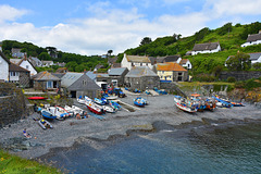
Cadgwith (Cornish: Porthkajwydh, meaning cove of the thicket) is a village and fishing port in Cornwall, England, United Kingdom. It is on the Lizard Peninsula between The Lizard and Coverack.
The village has its origins in medieval times as a collection of fish cellars in a sheltered south-east facing coastal valley with a shingle cove. Fishing subsidised local farmers' livelihoods. Cadgwith was originally called 'Porthcaswydh', becoming 'Por Cadjwydh' in Late Cornish, and is derived from the Cornish word for 'a thicket', literally meaning battle of trees, probably because the valley was densely wooded. From the 16th century, the village became inhabited, with fishing as the main occupation. Subsequently houses, lofts, capstan houses, and cellars constructed of local stone or cob walls and thatched or slated roofs were built along the beach and up the sides of the valley leading to Cadgwith's characteristic Cornish fishing village appearance. In recent times a very small Anglican church was built, next to the path from the car park down to the seafront, dedicated to St Mary. Q:Wikipedia
Coverack Hafen
| |
|
|
|
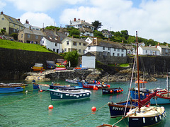
Coverack ist ein kleiner Ort an der Südküste von Cornwall. Die Fischer sind mit kleinen Booten zum fischen rausgefahren, alles strahlte eine zufriedene Ruhe aus. Das Cafe in dem kleinen Haus oberhalb der Treppe nutzte die öffentlichen Bänke an der Straße.
Coverack (Cornish: Porthkovrek, meaning cove of the stream) is a coastal village and fishing port in Cornwall, UK. It is on the east side of the Lizard peninsula, about nine miles south of Falmouth.
Coverack has several hotels and a youth hostel. The area is a centre for watersports, particularly wind surfing, sailing and diving. The nearby rocks known as The Manacles have been the site of many shipwrecks and as a consequence are now a favourite diving destination.
Der Zaun und die Treppen zu Tintagel Castle
| |
|
|
|
HFF - Happy Fence Friday to all, and have a good weekend!
Tintagel (kornisch Dintagell oder Tre war Venydh) ist eine Ortschaft an einem zerklüfteten Küstenabschnitt der Grafschaft Cornwall im äußersten Südwesten Englands.Die Ortsbezeichnung ist vor allem bekannt durch die in der Nähe am Meer liegende Burgruine Tintagel Castle, die der Chronist Geoffrey of Monmouth 1136 in seiner Historia Regum Britanniae zu König Artus' Residenz erklärt hat. Im Dorf leben etwa 700 Menschen, die Gemeinde hat 1820 Einwohner (Volkszählung 2001). Bis zur Mitte des 19. Jahrhunderts hieß der Ort Trevena, und Tintagel war die Bezeichnung für das Gemeindegebiet und das Oberland. Die Umbenennung erfolgte durch die Postverwaltung. Erstmals urkundlich erwähnt wurde Tintagel in der Chronik von Monmouth mit der lateinischen Bezeichnung Tintagol.In der Spätantike (ca. 5. bis 7. Jahrhundert) befand sich hier eine größere Siedlung, die von den Archäologen teils als Kloster, teils als Fürstensitz interpretiert worden ist. Auffällig ist, dass sich in den Ruinen große Mengen an aus Ostrom importierter Keramik fanden, was auf recht enge Kontakte zum Mittelmeerraum hinweist. Später wurde der Komplex unter unklaren Umständen aufgegeben. In normannischen Zeiten wurde dann im kleineren, nahgelegenen Dorf Bossiney eine Burg errichtet, was wohl vor der Entstehung des Domesday Books und damit also vor 1086 geschah. Als Bezirke wurden Tintagel und Bossiney im Jahre 1253 unter Richard von Cornwall etabliert. Im Jahr 1927 wurde hier der Orden der Gefährten von den Rittern der Tafelrunde (Order of the Fellowship of the Knights of the Round Table) von Frederick Thomas Glasscock gegründet, drei Jahre später errichtete er für diesen Orden ein Gebäude mit dem Namen King Arthur's Hall, das heutzutage hauptsächlich als Museum dient.
Tintagel Castle (Cornish: Dintagel, meaning "fort of the constriction") is a medieval fortification located on the peninsula of Tintagel Island, adjacent to the village of Tintagel in Cornwall, England, in the United Kingdom. The site was possibly occupied in the Romano-British period, as an array of artefacts dating to this period have been found on the peninsula, but as yet no Roman era structure has been proven to have existed there. It subsequently saw settlement during the Early Medieval period, when it was probably one of the seasonal residences of the regional king of Dumnonia. A castle was built on the site by Richard, Earl of Cornwall in the 13th century, during the Later Medieval period, after Cornwall had been subsumed into the kingdom of England. It later fell into disrepair and ruin. Archaeological investigation into the site began in the 19th century as it became a tourist attraction, with visitors coming to see the ruins of Richard's castle. In the 1930s, excavations revealed significant traces of a much earlier high status settlement, which had trading links with the Mediterranean during the Late Roman period. The castle has a long association with Arthurian legends. This began in the 12th century when Geoffrey of Monmouth described Tintagel as the place of Arthur's conception in his fictionalized account of British history, the Historia Regum Britanniae. Geoffrey told the story that Arthur's father King Uther Pendragon was disguised by Merlin's sorcery to look like Gorlois, Duke of Cornwall, the husband of Igraine, Arthur's mother. Tintagel Castle has been a tourist destination since the mid-19th century. Owned by Charles, Prince of Wales as part of the landholdings of the Duchy of Cornwall, the site is currently managed by English Heritage.
see: en.wikipedia.org/wiki/Tintagel_Castle

