Erika+Manfred's photos
Mauerblümchen
| |
|
|
|
Lizard Point, Cornwall
| |
|
|
|
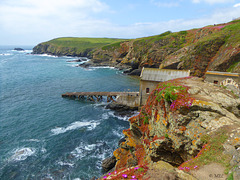
Lizard Point in Cornwall ist der südlichste Punkt der Lizard Halbinsel und gleichzeitig der südlichste Punkt Englands auf der Hauptinsel Großbritanniens. Sein nördliches Gegenstück ist Dunnet Head in Schottland.
Lizard Point markiert die nördliche Einfahrt in den Ärmelkanal und ist der einzige Landpunkt der britischen Hauptinsel, der – wenn auch nur eine Winzigkeit – südlicher als der 50. Breitengrad gelegen ist (entspricht dem deutschen Mainz oder dem nordfranzösischen Amiens); selbst Land’s End, das fälschlicherweise oft als der südlichste Punkt Englands angesehen wird, liegt nördlich des 50. Breitengrades.
Direkt auf der Spitze befinden sich einige Häuser, der eigentliche Ort The Lizard befindet sich etwa einen Kilometer nördlich. Unterhalb der Häuser an der Spitze befindet sich die alte Station der Royal National Lifeboat Institution, die aber nicht mehr in Betrieb ist. Des Weiteren stehen etwas östlich der Spitze die beiden Leuchttürme Lizard Lighthouse, von denen nur noch einer in Betrieb ist. Daneben befindet sich das in viktorianischer Zeit gebaute Hotel, das vom National Trust verwaltet wird, um es vor dem Verfall zu schützen. Es wird heute als Jugendherberge genutzt (YHA Lizard Youth Hostel). Ebenso wie das Hotel befindet sich auch Lizard Point im Besitz des National Trust und steht damit seit 1987 unter dessen Schutz.
Im Sommer kommen pro Tag bis zu 2500 Besucher an den Lizard Point. Um die Landschaft zu schützen, und den Durchgangsverkehr vom Besucherverkehr zu trennen, hat der National Trust Wege und Parkplätze angelegt. Zur Verschönerung der Landschaft wurden oberirdisch verlegte Strom- und Telefonkabel in den Boden verlegt und 51 Telegrafenmasten entfernt.
Lizard Point (from Cornish an Lysardh, meaning "the high court") in Cornwall is at the southern tip of the Lizard Peninsula. It is situated half-a-mile (800 m) south of Lizard village in the civil parish of Landewednack and about 11 miles (18 km) southeast of Helston.
Lizard Point is the most southerly point on mainland Great Britain at 49° 57' 30" N. With the exception of parts of the Isles of Scilly it is the southernmost part of England.
Lizard Point is for many ships the starting point of their ocean passage and a notorious shipping hazard. The Lizard Lighthouse is situated at Lizard Point. Immediately below the lighthouse, situated in what used to be a hotel, is the YHA Lizard Youth Hostel. Lizard Point is situated within Caerthillian to Kennack SSSI (Site of Special Scientific Interest), noted for its biological and geological interest. Polpeor Cove is a small cove to the east of Lizard Point.
The area is famous for its carved serpentine items, which range from ornaments to the pump handles in the local public house, the Lizard Inn (The Top House). The geology of Lizard can be interesting to some, with a number of planned walks available from local tourist authorities to discover more about the local rocks.
The first sighting of the Spanish Armada on mainland Britain was off Lizard Point at 3 pm on 29 July 1588. This was one of the greatest invasion fleets in history and consisted of 120 ships armed with over 1,000 cannon and with 29,000 men on board.
The Battle at the Lizard, a naval battle, took place off The Lizard on 21 October 1707. Q:Wikipedia
Eden Project - PIP: in den Kuppeln
| |
|
|
|
PIP 1: Der Tropenwald
PIP 2: Mediterran
Das Eden Project ist ein botanischer Garten bei Bodelva in Cornwall, England, etwa 5 Meilen nordöstlich von St Austell. Die Anlage ist rund 50 Hektar groß und stellt eine bedeutende Sehenswürdigkeit im Süden Englands dar: 2011 wurde sie von über einer Million Menschen besucht.
Das Eden Project entstand nach einer Idee des englischen Archäologen und Gartenliebhabers Tim Smit in einer stillgelegten Kaolingrube nahe St Austell. Von der Idee im Jahr 1995 bis zur Eröffnung der Anlage im März 2001 dauerte es sechs Jahre. Charakterisiert wird der Garten durch die zwei riesigen Gewächshäuser, die aus jeweils vier miteinander verschnittenen geodätischen Kuppeln in der Bauweise von Richard Buckminster Fuller bestehen. Hier werden verschiedene Vegetationszonen simuliert. Die Gewächshäuser des Eden Projects sind derzeit die größten der Welt.
Im größeren der beiden Gewächshäuser des Komplexes wird eine tropisch-feuchte und im kleineren eine subtropisch-trockene und mediterrane Klimazone simuliert. Ziel ist es, eine natürliche Umgebung nachzuahmen, um Pflanzen und auch einige Tierarten der ganzen Welt dort unterbringen zu können. Auch die Kaolingrube selbst wurde landschaftlich gestaltet, bepflanzt und mit Skulpturen ausgestattet. Allerdings ist der Garten immer noch im Aufbau, Erweiterungen innerhalb des Geländes sind geplant.
Laut eigener Aussage des Eden Projects beherbergen das Freigelände und die Gewächshäuser 100.000 Pflanzen aus ca. 5.000 Arten. Vor allem handelt es sich hier um Nutzpflanzen aller Art. Besonderer Wert wird dabei auf die Darstellung und Nachzucht vom Aussterben bedrohter seltener und alter Sorten gelegt, um die Arten- und somit genetische Vielfalt von Nutzpflanzen zu erhalten.
Das Projekt verfolgt einen bewahrenden und erzieherischen Ansatz. Den Besuchern wird neben den Namen der Pflanzen auch deren medizinische Verwendung und deren Bedeutung für unsere Umwelt nähergebracht, um die Menschheit durch Aufklärung von der Zerstörung der Umwelt abzuhalten. Regelmäßige Kunstausstellungen und Informationsveranstaltungen, die einen Bezug zum Thema Natur und Umwelt haben, gehören daher auch zum Programm des Parks.
The Eden Project (Cornish: Edenva) is a visitor attraction in Cornwall, England. Inside the two biomes are plants that are collected from many diverse climates and environments. The project is located in a reclaimed Kaolinite pit, located 2 km (1.2 mi) from the town of St Blazey and 5 km (3 mi) from the larger town of St Austell, Cornwall.
The complex is dominated by two huge enclosures consisting of adjoining domes that house thousands of plant species, and each enclosure emulates a natural biome. The biomes consist of hundreds of hexagonal and pentagonal, inflated, plastic cells supported by steel frames. The largest of the two biomes simulates a Rainforest environment and the second, a Mediterranean environment. The attraction also has an outside botanical garden which is home to many plants and wildlife native to Cornwall and the UK in general; it also has many plants that provide an important and interesting backstory, for example, those with a prehistoric heritage.
The name Eden Project stems from the 1994 TV series Earth 2
At the bottom of the pit are two covered biomes:
The Tropical Biome, covers 1.56 ha (3.9 acres) and measures 55 m (180 ft) high, 100 m (328 ft) wide, and 200 m (656 ft) long. It is used for tropical plants, such as fruiting banana plants, coffee, rubber and giant bamboo, and is kept at a tropical temperature and moisture level.
The Mediterranean Biome covers 0.654 ha (1.6 acres) and measures 35 m (115 ft) high, 65 m (213 ft) wide, and 135 m (443 ft) long. It houses familiar warm temperate and arid plants such as olives and grape vines and various sculptures.
The Outdoor Gardens represent the temperate regions of the world with plants such as tea, lavender, hops, hemp and sunflowers, as well as local plant species.
The covered biomes are constructed from a tubular steel (hex-tri-hex) with mostly hexagonal external cladding panels made from the thermoplastic ETFE. Glass was avoided due to its weight and potential dangers. The cladding panels themselves are created from several layers of thin UV-transparent ETFE film, which are sealed around their perimeter and inflated to create a large cushion. The resulting cushion acts as a thermal blanket to the structure. The ETFE material is resistant to most stains, which simply wash off in the rain. If required, cleaning can be performed by abseilers. Although the ETFE is susceptible to punctures, these can be easily fixed with ETFE tape. The structure is completely self-supporting, with no internal supports, and takes the form of a geodesic structure. The panels vary in size up to 9 m (29.5 ft) across, with the largest at the top of the structure. Q: Wikipedia
Canada Place und Convention Centre
| |
|
|
|
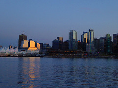
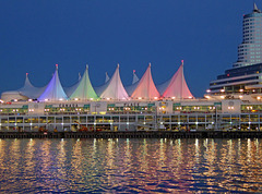
Canada Place ist ein markantes Gebäude im Zentrum der kanadischen Stadt Vancouver, am Ufer des Burrard Inlet. Es beherbergt das Messe- und Kongresszentrum Vancouver Convention & Exhibition Centre, das Pan Pacific Hotel und das weltweit erste IMAX-Kino. Darüber hinaus ist es Anlegestelle der meisten ab Vancouver verkehrenden Kreuzfahrtschiffe.
Erbaut vom Architekten Eberhard Zeidler als kanadischer Pavillon der Expo 86, war Canada Place der einzige Teil dieser Weltausstellung, der sich nicht auf dem Ausstellungsgelände am Nordufer des False Creek befand.
Canada Place is a building situated on the Burrard Inlet waterfront of Vancouver, British Columbia. It is the home of the Vancouver Convention Centre, the Pan Pacific Vancouver Hotel, Vancouver's World Trade Centre, and FlyOver Canada (a virtual flight ride which replaced the world's first permanent IMAX 3D theatre and which ceased operation on October 1, 2009). The building's exterior is covered by fabric roofs resembling sails. It is also the main cruise ship terminal for the region, where most of Vancouver's famous cruises to Alaska originate. The building was designed by architects Zeidler Roberts Partnership in joint venture with Musson Cattell Mackey Partnership and DA Architects + Planners.
Canada Place can be reached via the SkyTrain line at the nearby Waterfront Station terminus or via West Cordova Street in Vancouver. The white sails of the building have made it a prominent landmark for the city, as well as drawing comparisons to the Sydney Opera House in Sydney, Australia and the Denver International Airport in Denver, Colorado.[citation needed]
The structure was expanded in 2001 to accommodate another cruise ship berth and in 2009/10, for the 2010 Winter Olympics, Canada Place served as the Main Press Centre. Q:Wikipedia
Seeadler über Sechelt
| |
|
|
Die Sechelt (engl. Aussprache: „SEA-shelt“) oder Shishalh, (in Sechelt: Shishá7lh) sind eine der kanadischen First Nations in der Provinz British Columbia und zählen kulturell als auch sprachlich wie die eng verwandten Pentlatch (Puntletch oder Puntledge) und die Comox-Gruppen (Comox (K'omoks), Homalco (Xwemalhkwu), Klahoose (ƛohos) und Sliammon (ɬəʔamɛn oder Tla’amin)) zu den Küsten-Salish an. Zur zeit des ersten Kontakts mit den Europäern zählten die Shishalh (Sechelt) schätzungsweise ca. 26.000 Stammesmitglieder.
Die Sechelt (Shíshálh) First Nation, offiziell Sechelt Indian Band genannt, befindet sich heute gegenüber der Ostküste von Vancouver Island auf der östlichen Seite der Strait of Georgia mit dem nach ihnen benannten Ort Sechelt als Verwaltungssitz. Heute (September 2013) zählt sie 1.328 eingetragene Stammesmitglieder, von denen 630 in den eigenen Reservaten leben, 29 in anderen Reservaten sowie die restlichen 669 Stammesmitglieder außerhalb.
The Sechelt or Shishalh people, (in their language spelled Shishá7lh) are an indigenous people of Canada. At the time of the first European contact the Sechelt had a population of close to 26,000.[citation needed] Sechelt women were famous for their beautiful cedar woven baskets, which were made using materials such as cedar tree roots, cannery grass and birch bark.
The Sechelt First Nations settlement included four villages on British Columbia's Sunshine Coast, two in Jervis Inlet, and one each on Pender Harbour and on Sechelt Inlet. As the Europeans settled in the region, the Sechelt people experienced numerous changes. Disease brought over by the Europeans (especially smallpox) became rampant, and resulted in a severe decrease of the Sechelt population at their various traditional settlements.
The language of the Sechelt is called sháshíshálh. "Shashishalhem" is considered the most practical English spelling of this word. Sháshíshálh is part of the Coast Salish language group. As of 2014, the Coastal Corridor Consortium, "an entity made up of board members from First Nations and educational partners to improve aboriginal access to and performance in postsecondary education and training" has created a Sechelt Nation language certificate. Q: Wikipedia
Und täglich ein Möhrchen ...
| |
|
|
|
Die Bank und der Zaun in Port Alberni
| |
|
|
|
HFF to all and have a nice weekend
Port Alberni ist eine Stadt mit knapp 18.000 Einwohnern in der kanadischen Provinz British Columbia. Sie befindet sich auf der Insel Vancouver Island am Ende des Alberni Inlet und ist Hauptort des Verwaltungsbezirks Alberni-Clayoquot.
Für die Wirtschaft der Region, aber auch die Kultur der First Nations, ist der Pacific-Rim-Nationalpark ebenso von erheblicher Bedeutung wie der Strathcona Provincial Park und der Sproat Lake.
In der Umgebung des Ortes und im Ort selbst leben Angehörige der Nuu-chah-nulth, etwa von den umwohnenden First Nations der Tseshaht, Hupacasath, Huu-ay-aht oder Hesquiaht.
Port Alberni is a city located on Vancouver Island in the province of British Columbia, Canada.
Port Alberni is well known for offering affordable real estate and an active lifestyle. The city has a total population of 17,743, and a census agglomeration area of 25,396.
Port Alberni is a deep port city which lies within the Alberni Valley at the head of the Alberni Inlet, Vancouver Island's longest inlet. It is the location of the head offices of the Alberni-Clayoquot Regional District. Q:Wikipedia
SS Sicamouse in Penticton
| |
|
|
|
SS Sicamous is a large five decked sternwheeler commissioned by the Canadian Pacific Railway (CPR) and built by the Western Dry Dock and Shipbuilding Company for Okanagan Lake service between the fruit communities of Penticton, and other towns of Kelowna and Vernon, British Columbia. Launched in 1914, Sicamous ran for many years connecting rail lines and areas. The vessel operated until 1937 and is currently beached as a part of a heritage shipyard operated by the S.S. Sicamous Restoration Society in Penticton. The vessel today is operated both as a museum and events and banquet facility.
sssicamous.ca/history-of-the-sicamous
Totem in Victoria
| |
|
|
|
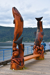
Totem poles are monumental sculptures carved on poles, posts, or pillars with symbols or figures made from large trees, mostly western red cedar, by indigenous peoples of the Pacific Northwest coast of North America (northwestern United States and Canada's western province, British Columbia). The word totem derives from the Algonquian (most likely Ojibwe) word odoodem [oˈtuːtɛm], "his kinship group". The carvings may symbolize or commemorate cultural beliefs that recount familiar legends, clan lineages, or notable events. The poles may also serve as functional architectural features, welcome signs for village visitors, mortuary vessels for the remains of deceased ancestors, or as a means to publicly ridicule someone. Given the complexity and symbolic meanings of totem pole carvings, their placement and importance lies in the observer's knowledge and connection to the meanings of the figures.
Totem pole carvings were likely preceded by a long history of decorative carving, with stylistic features borrowed from smaller prototypes. Eighteenth-century explorers documented the existence of decorated interior and exterior house posts prior to 1800; however, due to the lack of efficient carving tools, sufficient wealth, and leisure time to devote to the craft, the monumental poles placed in front of native homes along the Pacific Northwest coast probably did not appear in large numbers until the late eighteenth or early nineteenth century. Trade and settlement initially led to the growth of totem pole carving, but governmental policies and practices of acculturation and assimilation sharply reduced totem pole production by the end of nineteenth century. Renewed interest from tourists, collectors, and scholars in the 1880s and 1890s helped document and collect the remaining totem poles, but nearly all totem pole making had ceased by 1901. Twentieth-century revivals of the craft, additional research, and continued support from the public have helped establish new interest in this regional artistic tradition. Q:Wikipedia
Canada Place
| |
|
|
|
Canada Place ist ein markantes Gebäude im Zentrum der kanadischen Stadt Vancouver, am Ufer des Burrard Inlet. Es beherbergt das Messe- und Kongresszentrum Vancouver Convention & Exhibition Centre, das Pan Pacific Hotel und das weltweit erste IMAX-Kino. Darüber hinaus ist es Anlegestelle der meisten ab Vancouver verkehrenden Kreuzfahrtschiffe.
Erbaut vom Architekten Eberhard Zeidler als kanadischer Pavillon der Expo 86, war Canada Place der einzige Teil dieser Weltausstellung, der sich nicht auf dem Ausstellungsgelände am Nordufer des False Creek befand.
Canada Place is a building situated on the Burrard Inlet waterfront of Vancouver, British Columbia. It is the home of the Vancouver Convention Centre, the Pan Pacific Vancouver Hotel, Vancouver's World Trade Centre, and FlyOver Canada (a virtual flight ride which replaced the world's first permanent IMAX 3D theatre and which ceased operation on October 1, 2009). The building's exterior is covered by fabric roofs resembling sails. It is also the main cruise ship terminal for the region, where most of Vancouver's famous cruises to Alaska originate. The building was designed by architects Zeidler Roberts Partnership in joint venture with Musson Cattell Mackey Partnership and DA Architects + Planners.
Canada Place can be reached via the SkyTrain line at the nearby Waterfront Station terminus or via West Cordova Street in Vancouver. The white sails of the building have made it a prominent landmark for the city, as well as drawing comparisons to the Sydney Opera House in Sydney, Australia and the Denver International Airport in Denver, Colorado.
The structure was expanded in 2001 to accommodate another cruise ship berth and in 2009/10, for the 2010 Winter Olympics, Canada Place served as the Main Press Centre. Q:Wikipedia
Der Zaun am Emerald Lake, Yoho National Park, Cana…
| |
|
|
|
HFF - Happy Fence Friday to you
Emerald Lake is located in Yoho National Park, British Columbia, Canada. It is the largest of Yoho's 61 lakes and ponds, as well as one of the park's premier tourist attractions. Emerald Lake Lodge, a high-end lodge perched on the edge of the lake, provides local accommodation. A 5.2 km (3.2 mi) hiking trail circuits the lake, the first half of which is accessible to wheelchairs and strollers. During the summer months, canoe rentals are available; in the winter, the lake is a popular cross country skiing destination.
The lake is enclosed by mountains of the President Range, as well as Mount Burgess and Wapta Mountain. This basin traps storms, causing frequent rain in summer and heavy snowfalls in winter. This influx of moisture works with the lake's low elevation to produce a unique selection of flora. Trees found here are more typical of B.C.'s wet interior forests, such as western red cedar, western yew, western hemlock and western white pine. The alluvial fan on the northeast shore produces wildflowers in abundance during late June and early July.
Due to its high altitude, the lake is frozen from November until June. The vivid turquoise color of the water, caused by powdered limestone, is most spectacular in July as the snow melts from the surrounding mountains.
The first European to set sight on Emerald Lake was guide Tom Wilson, who stumbled upon it by accident in 1882. A string of his horses had gotten away, and it was while tracking them that he first entered the valley. The lake had an impression on even the most seasoned of explorers: "For a few moments I sat [on] my horse and enjoyed the rare, peaceful beauty of the scene." It was Wilson who gave the lake its name because of its remarkable colour, caused by fine particles of glacial sediment, also referred to as rock flour, suspended in the water. However, this was not the first time Wilson had dubbed a lake 'Emerald'. Earlier that same year he had discovered another lake which he had given the same moniker, and the name even appeared briefly on the official map. This first lake however, was shortly renamed Lake Louise. Q:Wikipedia
Konferenz der Murmeltiere
| |
|
|
|
Die Murmeltiere (Marmota), in der Schweiz auch Munggen, in Oberbayern und Österreich auch Mankei genannt, sind eine aus vierzehn Arten bestehende Gattung bis zu 50 Zentimeter langer Echter Erdhörnchen (Marmotini), die in Eurasien und Nordamerika verbreitet sind. Bei den Murmeltierarten handelt es sich primär um Bewohner kalter Steppen. Das heute nur noch in Gebirgslagen jenseits der Baumgrenze lebende Alpenmurmeltier kam während der pleistozänen Eiszeiten im europäischen Tiefland von den Pyrenäen bis zur Ukraine vor. Es fehlte dagegen in den mit einer dicken Eisschicht bedeckten Alpen. Mit dem Ende der Eiszeit boten nur noch die hochalpinen Lagen der Alpen dieser Art geeigneten Lebensraum (Eiszeitrelikt). Murmeltiere können bis zu 15 Jahre alt werden.
Marmots are large squirrels in the genus Marmota, of which there are 15 species. Some species live in mountainous areas, such as the Alps, northern Apennines, Carpathians, Tatras, and Pyrenees in Europe and northwestern Asia; the Rocky Mountains, Black Hills, Cascades, Pacific Ranges, and Sierra Nevada in North America; and the Deosai Plateau in Pakistan and Ladakh in India. Other species prefer rough grassland and can be found widely across North America and the Eurasian steppes. The similarly sized, but more social, prairie dog is not classified in the genus Marmota but in the related genus Cynomys.
Marmots typically live in burrows (often within rockpiles, particularly in the case of the yellow-bellied marmot), and hibernate there through the winter. Most marmots are highly social and use loud whistles to communicate with one another, especially when alarmed.
Marmots mainly eat greens and many types of grasses, berries, lichens, mosses, roots, and flowers.Q: Wikipedia
Weinberge im Okanangan Valley, BC, Canada - PIP
| |
|
|
|
PIP - Die Winzer dort haben noch recht bescheidene Anwesen
Okanagan Lake ist ein langer, schmaler Binnensee in der kanadischen Provinz British Columbia. Der rund 135 km lange und 4-5 km breite See mit einer Oberfläche von 351 km² schlängelt sich im südlichen Teil von British Columbia durch das Okanagan-Becken und geht rund 55 km vor der Grenze zum US-Bundesstaat Washington in den gleichnamigen Fluss über.
Die größte Stadt am Ufer des Sees ist mit 117.312 Einwohnern Kelowna, die sich Anfang des 20. Jahrhunderts entwickelte, als zahlreiche Europäer das Tal besiedelten. Die Bewohner entlang des Sees, darunter viele deutschstämmige Kanadier, leben insbesondere vom Fremdenverkehr, sowie von der Land- und Forstwirtschaft. Insbesondere in Kelowna entwickelte sich zudem ein ertragreiches Dienstleistungsgewerbe. Die Gegend ist innerhalb von Kanada insbesondere für den Anbau von Obst und Wein bekannt.
Der Legende nach lebt im Okanagansee das Seeungeheuer Ogopogo.
Okanagan Lake is a large, deep lake in the Okanagan Valley of British Columbia, Canada. The lake is 135 km long, between 4 and 5 km wide, and has a surface area of 348 km².
Okanagan Lake is called a fjord lake as it has been carved out by repeated glaciations. Although the lake contains numerous lacustrine terraces, it is not uncommon for the lake to be 100m deep only 10m offshore. Major inflows include Mission, Vernon, Trout, Penticton, Equesis, Kelowna, Peachland and Powers Creeks.[7] The lake is drained by the Okanagan River, which exits the lake's south end via a canal through the city of Penticton to Skaha Lake, whence the river continues southwards into the rest of the South Okanagan and through Okanogan County, Washington to its confluence with the Columbia.
The lake's maximum depth is 232 metres near Grant Island (Nahun Weenox). There is one other island known as Rattlesnake Island, much farther south by Squally Point. Some areas of the lake have up to 750 metres of glacial and post-glacial sediment fill which were deposited during the Pleistocene Epoch.
Notable features of the Okanagan Valley include terraces which were formed due to the periodic lowering of the lake's predecessor, glacial Lake Penticton. These terraces are now used extensively for agriculture such as fruit cultivation. Q:Wikipedia
Lillooet Lake
| |
|
|
|
Lillooet Lake ist ein See in der kanadischen Provinz British Columbia.
Der See liegt in den südlichen Coast Mountains, etwa 120 km nordnordöstlich von Vancouver. Er wird vom Lillooet River in südlicher Richtung durchflossen. Ein weiterer Zufluss an seinem nördlichen Ende ist der Birkenhead River. 12 km nördlich des Sees befindet sich der Ort Pemberton. Der See hat eine Länge von 25 km und eine Wasserfläche von 33,5 km². Wenige Kilometer südlich des Sees befindet sich der Little Lillooet Lake, der ebenfalls vom Lillooet River durchflossen wird.
Lillooet Lake is a lake in British Columbia, Canada about 25 km in length and about 33.5 square kilometres (22 mi²) in area. It is about 95 km downstream from the source of the Lillooet River, which resumes its course after leaving Little Lillooet Lake, aka Tenas Lake (tenass in the Chinook Jargon means little). Immediately adjacent to the mouth of the upper Lillooet River is the mouth of the Birkenhead River and just upstream along the Lillooet is the confluence of the Green River, which begins at Green Lake in the resort area of Whistler.
The community of Pemberton is about 12 km upstream from the head of Lillooet Lake, while the eastern edge of the Mount Currie Indian Reserve of the Lil'wat branch of the St'at'imc people is the lakeshore itself. The eastern ramparts of the mountain ranges of Garibaldi Provincial Park overlook Lillooet Lake from the west, while to the east are the northern reaches of the Lillooet Ranges which lie between the Lillooet-Harrison drainage and the Fraser River.
Lillooet Lake was part of the "Lakes Route" or Douglas Road, once if only briefly the principal route between the Coast and the Interior during the days of the Fraser Canyon Gold Rush. Several steamers and innumerable smaller watercraft served the busy freight and passenger traffic in those days. The best-known and largest of these was the SS Prince of Wales, whose wreckage was visible on the shores of the lake near Mount Currie for many years.
Bow River/Sea im Banff National Park
| |
|
|
|
Der Bow River ist ein 623 Kilometer langer Fluss in der kanadischen Provinz Alberta.
Der Bow River entspringt dem Bow Lake, der vom Bow-Gletscher gespeist wird. Nahe bei Grassy Lake fließt er mit dem Oldman River zusammen und bildet den South Saskatchewan River.
Der Fluss ist wichtig für die Bewässerung, für die Energie und eine wichtige Trinkwasserquelle. Der Fluss stellt einen wichtigen Lebensraum dar.
Der Fluss ist sehr fischreich. Es leben Regenbogenforellen, Bachforellen, Stierforellen (Salvelinus confluentus), Bachsaiblinge und zahlreiche kleinere Fische im Fluss. Grund dafür ist die Aussetzung von ungefähr 45.000 Fischen in den Bow River.
The Bow River is a river in the Canadian province of Alberta. It begins in the Rocky Mountains and winds through the Alberta foothills onto the prairies where it meets the Oldman River, the two then forming the South Saskatchewan River. These waters ultimately flow through the Nelson River into Hudson Bay. The Bow River runs through the city of Calgary, taking in the Elbow River at the historic site of Fort Calgary near downtown. The Bow River pathway, developed along the river's banks, is considered a part of Calgary's self-image.:41-2
First Nations peoples made varied use of the river for sustenance before settlers of European origin arrived, such as using its valleys in the buffalo hunt.:37-41 The name "Bow" refers to the reeds that grew along its banks and were used by the local First Nations peoples to make bows; the Peigan name for the river is "Makhabn", meaning "river where bow reeds grow".
The river is an important source of water for irrigation and drinking water. Between the years 1910 and 1960, the Bow River and its tributaries were engineered to provide hydroelectric power, primarily for Calgary's use. This significantly altered the river's flow and certain ecosystems. Q: Wikipedia
Sea Otter in Vancouver Aquarium
| |
|
|
|
Hier kann man die Seeotter live sehen:
www.vanaqua.org/learn/see-and-learn/live-cams/sea-otter-cam
Es kann etwas dauern, bis die Otter in den Bereich der Kamera kommen. und den Zeitunterschied nicht vergessen: - 9 Stunden
Der Zaun in Vancouver Downtown
| |
|
|
|
HFF - Happy Fence Friday to all of you
PIP: aufgenommen vom Schiff
Man sieht es an den Balkonen: Das sind alles Wohnhäuser!
Lake Louise
| |
|
|
|
Der Lake Louise ist ein See in der kanadischen Provinz Alberta im Banff-Nationalpark. Es ist ein Ort für Freizeitaktivitäten wie Wandern, Klettern, Skifahren und Kanu-Fahren. Die türkisblaue Farbe des Sees stammt von Steinmehl, das von Gletscherschmelzwasser in den See gespült wird und auch als rock flour oder glacial flour bezeichnet wird.
Lake Louise ist nach Prinzessin Louise Caroline Alberta, einer Tochter von Königin Victoria, benannt.
Der Ort Lake Louise liegt neben dem Trans-Canada Highway, 180 km westlich von Calgary. Hinter dem Lake Louise erheben sich einige schneebedeckte Berge wie Mount Temple (3543 m), Mount Whyte (2983 m) und Mount Niblock (2976 m).
Am Ostufer des Sees steht das Château Lake Louise, ein elegantes Fünf-Sterne-Hotel. Es wurde 1890 als bescheidenes Chalet erbaut und später zu einem zweistöckigen Hotel ausgebaut, das zu einem Zentrum für Kletterexpeditionen wurde. Eine Feuersbrunst 1924 zerstörte das Schlosshotel, welches durch die heute noch bestehende Konstruktion ersetzt wurde. Viele Wanderwege starten direkt beim Schlosshotel.
Lake Louise, named Lake of the Little Fishes by the Stoney Nakota First Nations people, is a glacial lake within Banff National Park in Alberta, Canada. It is located 5 km (3.1 mi) west of the Hamlet of Lake Louise and the Trans-Canada Highway (Highway 1).
Lake Louise is named after the Princess Louise Caroline Alberta (1848–1939), the fourth daughter of Queen Victoria and the wife of the Marquess of Lorne, who was the Governor General of Canada from 1878 to 1883.
Lake Louise from eastern shoreline, facing west.
The emerald colour of the water comes from rock flour carried into the lake by melt-water from the glaciers that overlook the lake. The lake has a surface of 0.8 km2 (0.31 sq mi) and is drained through the 3 km long Louise Creek into the Bow River.
Fairmont's Chateau Lake Louise, one of Canada's grand railway hotels, is located on Lake Louise's eastern shore. It is a luxury resort hotel built in the early decades of the 20th century by the Canadian Pacific Railway.
Moraine Lake and Lake Agnes are also accessible from Lake Louise. Q:Wikipedia


