Evening Light.
Roses in the Stream
Public House at Night!
A Ben Nevis Morning
Carnasserie Castle
Sea Wall Seating,
North Coast 500,
Walls and Windows
Moist!
Horse Island
Edge of the Levels
Bay at Sundown!
Ferry.
A beach with Teeth
Ashton Windmill
Misty Evening, (2 notes)
On the Hill
A view of the Vale.
When I grow Up
Dovecote
HMY Ioaire Names
Memorial to Shipwreck Victims, (2 pips,)
Abbey Ruins.
Golden Sunset, HWW!
World Photography Day
Loch Alsh
Duck on a Rock
Built 1720s
Castle Walls
Salmon Fishing
Inverness Castle,
From the Basin
Loch Caron
Reflections of Loch Carron,
The Road down.
Applecross
Catering
Taking in the view
Loch Torridon/ Sheildag
DSC03172 (4) edited-1
Gairloch Beach,
The Way Down,
Down the Valley,
Ullapool, Scotland
Shore Street,
1/160 • f/10.0 • 24.0 mm • ISO 100 •
SONY ILCE-7M3
FE 24-70mm F4 ZA OSS
Location
Lat, Lng:
You can copy the above to your favourite mapping app.
Address: unknown
You can copy the above to your favourite mapping app.
Address: unknown
See also...
Keywords
Authorizations, license
-
Visible by: Everyone -
All rights reserved
-
290 visits
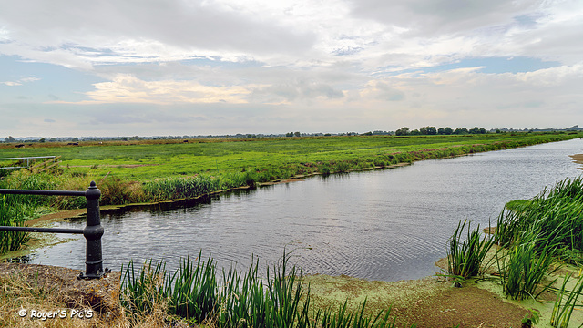
The Levels!


A wide angle view of a small section of the flat lands that are the Somerset Levels, . The levels have an area of 160,000 area (650 km2) with the majority of land just above sea level,
This waterway is the North Drain so called because that's what they do, drain the levels., they are fed by a series of Rhynes pronunced Reens (Ditches) which surround almost every pasture.
Originally captured for World Photography Day
HFF and a good weekend,,,,,,,,,,,,,,, in 16.9 format so a large view recommended,
Smiley Derleth, Paolo Tanino, Gudrun, Valeriane ♫ ♫ ♫¨* and 37 other people have particularly liked this photo
- Keyboard shortcuts:
Jump to top
RSS feed- Latest comments - Subscribe to the comment feeds of this photo
- ipernity © 2007-2025
- Help & Contact
|
Club news
|
About ipernity
|
History |
ipernity Club & Prices |
Guide of good conduct
Donate | Group guidelines | Privacy policy | Terms of use | Statutes | In memoria -
Facebook
Twitter

Sign-in to write a comment.