Bergfex's photos
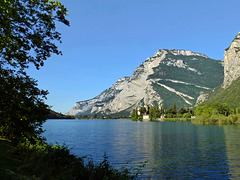
Lago di Toblino
| |
|
|
|
Here from the very top of the fixed rope route 'Che Guevara'.
~~~~~
Der See von ganz oben. (Sieht man ja nicht so oft.)
Via FERRATA
| |
|
|
|
Our italian friends LOVE Iron! But it could be worse, than in this picture! (Perhaps note: I had only a pocket camera with me at that day, because it was our first exploration tour of that route.)
~~~~~
Unsere italienischen Bergfreunde LIEBEN Eisen! Aber es kann schlimmer sein, als hier im Bild zu sehen. (Nebenbei bemerkt: An dem Tag war nur die kleine Pocket-Kamera dabei, weil es sich um eine erste Erkundung dieser Tour handelte.)
~~~~~
Captured by Helga W.
The WALL
| |
|
|
|
How to master the task of capturing a wall of 1.300 meters of altitude?
(The eastern rock wall of the Monte Casale, Trentino, Italy.)
I don't know. This was a trial.
(Better see on black to identify the fixed rope!)
~~~~~
Wie schafft man es, eine 1.300 Meter hohe Felswand gut in Szene zu setzen?
(Zu sehen ist die Ostwand des Monte Casale im Trentino, Italien.)
Ich weiß es auch nicht. Dies hier war ein Versuch.
(In der Vollansicht erkennt man das stählerne Fixseil gang gut.)
~~~~~
View out of the trail:
H.F.F with Che Guevara
| |
|
|
|
Guidepost at the edge of the industrial zone of Pietramurata (Trentino, Italy). Such informations often are rudimental at our southern neighbours - or they are missed in total. It's better to make an own proper scheduling. (For a good website see the link below.)
~~~~~
Hinweistafel am Rande des Industriegebiets von Pietramurata (Trentino, Italien). Solche Tafeln sind bei unseren südlichen Nachbarn oft abenteuerlich - oder fehlen ganz. Am besten verlässt man sich auf die eigene gute Tourenvorbereitung, am allerbesten über diese Website mit den weltbesten Topos:
www.bergsteigen.com/klettersteig/trentino-suedtirol/gardasee-berge/ferrata-ernesto-che-guevara-klettersteig
~~~~~
Near this guidepost we found those boots::
~~~~~
Some facts about the fixed rope route you'll find here:
Monte Casale
| |
|
|
|
The Monte Casale (1.632m) is situated near the famous 'Lake Toblino' (Trentino, Italy). Within it's high eastern rock wall is one of the longest fixed rope routes of the alps: Via Ferrata Che Guevara (1.200 climbing meters, 1.400 meters total difference of altitude, duration approx. 8 hours - without any breaks or foto stops. To be safe, calculate 12 hours, because you have to descent trough the shown forest in total darkness - only with light from your helmet lamp - at November time. NOTHING for beginners! Knowledge of the place is strongly recommended for night tours!)
~~~~~
Der Monte Casale (1.632m) liegt südwestlich des bekannten Toblino-Sees (Trentino, Italien). In seiner hohen Ostwand befindet sich einer der längsten Klettersteige der Alpen: die Via ferrata Che Guevara (1.200 Klettermeter, 1.400m Höhendifferenz incl. Zustieg, Gehzeit rund 8 Stunden - netto, ohne Pausen und Fotostopps. Um auf der sicheren Seite zu sein, muss man im November 12 Stunden einkalkulieren, weil man im Dunkeln - nur mit dem Licht der Helmlampe - durch den Wald absteigen muss, der im Bild zu sehen ist. Das ist NICHTS für Anfänger! Weder im Aufstieg, noch im Abstieg. Für Abstiege im Dunkeln ist gute Ortskenntnis unerlässlich! Gerade hier, wo man keine Hilfe erwarten kann. Nicht nachts, und nicht in der Nachsaison.)
~~~~~
Und so sieht's von oben aus:
Nature is a Different Thing
| |
|
|
|
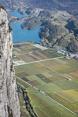
Winegrowing in the Trentino (Italy), captured out of the eastern cliff of the Monte Casale (Pietramurata). The picture was taken at best weather conditions last year in November.
~~~~~
Weinanbau im Trentino (Italien), fotografiert aus der Ostwand des Monte Casale bei Pietramurata, ca. 600 Meter über dem Talgrund. Aufgenommen bei schönstem Herbstwetter im November letzten Jahres.
~~~~~
Aufgenommen von dort:
Valle del Sarca
| |
|
|
|
The Valley of Sarca, one of the most awesome spots of the Trentino (Italy) - as well at the valley bottom as by birds eye view. Here a view from 600 meters of altitude, captured out of the eastern cliff of the Monte Casale (Via Ferrata 'Che Guevara', Pietramurata, Italy). In the background you'll see the Lake Toblino. The picture was taken at best weather conditions last year in November.
~~~~~
Das Sarca-Tal, eine der eindrucksvollsten Gegenden des Trentino - sowohl im Talgrund, als auch von oben. Hier im Bild der Blick aus dem Klettersteig 'Che Guevara' in der Ostwand des Monte Casale bei Pietramurata, ca. 600 Meter über dem Talgrund. Im Hintergrund der Lago di Toblino. Aufgenommen bei schönstem Herbstwetter im November letzten Jahres.
~~~~~
The Lago di Toblino:
Arco
| |
|
|
|
View from the Cima Capi (909m) to Arco with it's castle in the middle ot the city.
~~~~~
Blick vom Cima Capi (909m) auf Arco mit der Burg inmitten der Stadt.
Trentino - Upper Floor
| |
|
|
|
At the end of October, when wintertime knocks on the door in Tyrol, it's the best time for mountaineering in the Trentino (Italy): Not so hot and not so overcrowded as in summertime.
(Picture: Lake Garda with the mouth of the river Sarca near Torbole, seen from the westward mountains. out of 'Via Ferrata Fausto Susatti')
~~~~~
Ende Oktober, wenn in Tirol bereits der Winter an die Tür klopft, ist die beste Zeit für Bergtouren im Trentino (Norditalien). Es ist nicht mehr so heiß und vor allem nicht so überlaufen wie im Sommer.
(Bild: Der Gardasee mit der Mündung des Sarca-Flusses bei Torbole, gesehen vom Klettersteig 'Via Ferrata Fausto Susatti' - hoch über dem westlichen Ufer.)
~~~~~
How go get there:
Highway for Skiers
| |
|
|
|
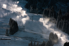
Ski slope in Fieberbrunn (Austria) in the early morning, before the ski tourists start. (It's high season now in North Tyrol.)
~~~~~
Skipiste in Fieberbrunn (Tirol) frühmorgens, bevor die Ski-Touristen starten. (In Nordtirol ist jetzt Hochsaison.)
The Simple Method
| |
|
|
|
Cheaper and enery-efficient - but not mobile.
~~~~~
Billig und energieeffizient - aber nicht mobil.
~~~~~
In row:
Snow Canon
Preparing the Slopes
| |
|
|
|
Morning view out of my living room window to the ski slopes at Kitzbüheler Horn. (600mm with NIKON D7200 = equivalent to 900mm KB)
At that moment the sun had raised high enough to produce this wonderful grazing light.
~~~~~
Morgentlicher Blick aus meinem Wohnzimmer auf die Pisten am Kitzbüheler Horn.
(600mm Tele an NIKON D7200 = 900mm KB-Äquivalent)
Die Sonne stand in dem Moment gerade hoch genug, dass sie dieses schöne Streiflich produzierte.
~~~~~
Another day, another place:
Helpless Answer to Global Warming
| |
|
|
|
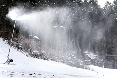
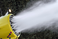
Production of artificial snow with a snow canon.
~~~~~
So sieht's aus: Künstlicher Schnee aus der Schneekanone.
~~~~~
Detailed:
In Vain - But Not For Free!
| |
|
|
|
Not a picture from today, because I wasn't outside. It's raining cats and dogs. But this two years old picture shows exactly, what I saw today, looking through our living room window to the ski slopes at the Kitzbüheler Horn.
~~~~~
Vergeblich, aber nicht umsonst! Und: Nein, das Bild ist nicht von heute. Denn bei dem Sauwetter bin ich nicht raus. Aber genau so sah's aus, als ich heut Nachmittag zu den Skipisten am Kitzbüheler Horn rüber geschaut habe.
Dieses Foto aufgenommen am Unterberghorn, Kössen:
webtv.feratel.com/webtv/?cam=5610&design=v3&c0=0&lg=de&s=0
~~~~~
Das Kitzbüheler Horn:
Full Moon
| |
|
|
|
The MOON, how it was to be seen in Tyrol some days ago.
Location explored via:
app.photoephemeris.com/?ll=47.512980,12.327379¢er=47.5129,12.3270&dt=20161114174600%2B0100&z=18&spn=0.00,0.01
~~~~~
Der Vollmond, wie er sich vor einigen Tagen in Tirol gezeigt hat.
Die optimale Fotoposition über www.photoephemeris ausbaldowert (siehe Link).
~~~~~
Do you remember that church?
No Way Back When Going Down
| |
|
|
|
No - NOT left-hand! See PiP to identify the trail! It leads back to the starting point.
(Another seven hours to the car parking area. It's time to hurry from now on, because it's not a good idea to descent in the dark. No further picture stops.)
~~~~~
"Beim Abstieg gibt es kein Zurück!"
Nein - NICHT links runter! Im PiP erkennt man den weiteren Weg. Er führt hinter dem Felsen rechts hinten zurück zum Ausgangspunkt.
(Bis zum Auto liegen noch rund sieben Stunden Gehzeit vor uns, davon vier im Steilgelände. Es ist Zeit, sich zu beeilen. Denn es ist keine gute Idee, im Dunkeln abzusteigen. Das heißt leider auch: keine weiteren Fotostopps.)
The Escape Route
| |
|
|
|
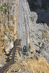
This trail might be used as an escape route: The 'Gamsängersteig'. It's a stand-alone fixed rope route, which also is used as the easiest way up to the summit. It leads down 1250 meters in total - of course not only via those ladders. Till the 'Gruttenhütte' - a mountain hut with service - you need roughly two and a half hours.
Dies wäre ein Notabstieg von der Ellmauer Halt: Die 'Jägerwand' im Gamsängersteig. Er ist ein eigenständiger Klettersteig, der auch als einfachster Zustieg zum Gipfel benutzt wird. Es geht insgesamt 1.250 Meter runter - natürlich nicht nur über solche Leitern. Bis zur Gruttenhütte, wo man zur Not abwettern könnte, braucht man gut zweieinhalb Stunden.


