Herb Riddle's photos
Birds of Crawton Cliffs
| |
|
|
|
When walking around these cliffs, one cannot hold back from taking hundreds of photos of the birds here. Spoiled for choice as to what to share on Ipernity I give you these four which were some of my favorites.
They are, from top left: Razorbills, Guillemot looking backwards, Puffin and Guillemot pair.
Everyone's favourite of course is the puffin.
Enjoy large
Crawton Cliffs and waterfall
| |
|
|
|
A wonderful side-trip brings us to these cliffs, south of Aberdeen. The spectacular cliffs at Fowlsheugh Nature reserve are packed with more than 130,000 breeding seabirds during the spring and summer months. These include guillemots, razorbills and kittiwakes, along with some puffins and fulmars too.
You see here, only a tiny part of these cliffs.
See PiP
Better full screen!
Girdle Ness Lighthouse, Aberdeen
| |
|
|
|
Another construction by the engineer Robert Stevenson, completed in 1833. It is situated near Torry Battery on the Girdle Ness peninsula just south of the entrance to Aberdeen's harbour, in Scotland.
In 1813 the whaler Oscar was blown ashore in a storm into Greyhope Bay, at the entrance to Aberdeen Harbour. Despite rescue attempts only two men of the forty four on board were saved. The disaster had nothing to do with the lack of a light – the crew were drunk and incapable – but there were strong calls for a lighthouse to be built on the headland above the bay and this was achieved twenty years later here.
Aberdeen - Granite City
| |
|
|
|
A view of Castlegate square with the Mercat Cross (1686) circular structure to the right. This denoted the market area. This open-arched structure, 6 m in diameter and 5m high, is a large hexagonal base from the centre of which rises a shaft with a Corinthian capital, on which is the royal unicorn. The base is highly decorated, including medallions illustrating Scottish monarchs from James I to James VII. According to local legend, the ghost of a unicorn can be seen to circle the Castlegate when a full moon is visible.
The tall castle-like building is actually the City Hall now housing the City Council and part of a drinking establishment too. In the late Middle Ages a fortification,was situated near here on Castle Hill. It was burned down by King Robert the Bruce in June 1308, during the Wars of Scottish Independence.
See larger PiP of City Hall
A country glimpse of Montrose
| |
|
|
|
Taken at the edge of the tidal basin at Montrose are reed beds aplenty. A natural home for water fowl and visiting birds that populate this area. For me to see the soft sway of the reeds almost as a slow blur was enchanting and you see it here framed by natural gorse.
Elephant Rock and the Old Graveyard
| |
|
|
|
This is just up the coast a little from Boddin Point and makes a great stroll. First we see the distinctive natural stone feature of Elephant Rock and can see easily why it has that name. Second we see perched on the edge of that rock headland on the right a very old graveyard where you can find the grave of one George James Ramsay. Not a well known man: but one who, according to his gravestone, was born on 24 November 1859, nineteen years after his death on 17 December 1840.
Middleton Top Engine House
| |
|
|
|
A walk not too far from the village of Cromford is a well known trail 'The High Peak Trail'. Most of that runs over the old railway line. At one place there is a very steep hill and so a solution had to be found to overcome that. This was part of it. A steep railway line where the wagons were pulled up and lowered down with chains driven from a wheel by this Engine house. You can just see two of its great boilers in the red brick. You can also just see the top of the railway incline at the signal. A fascinating place to walk by. See PIPS
"Situated at the top of Middleton Incline on the High Peak Trail is the restored Middleton Top Engine House, which was built in 1829. In the past it was used to haul wagons up the incline.
Middleton Top Engine House is the sole survivor of nine that once stood at the top of every incline along the Cromford and High Peak Railway. It is designated as an Ancient Monument, together with its Butterley beam engine which in the past hauled the cables up the track. Originally timber was supplied daily to fire the boilers, now it is compressed air that does the job." www.derbyshire-peakdistrict.co.uk/middletontop.htm
See Pips
Irish rustic fence
| |
|
|
|
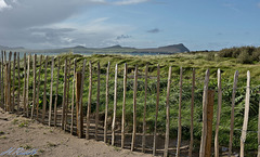
Taken in one of the northern bays of the Dingle peninsular showing the three sisters in the background.
I wish you all, a great weekend, Herb
Boddin Point Lime Kilns
| |
|
|
|
A ride and walk just south of Montrose brings us to this spit of land steeped in history. Dating back to the 1700s. An old salmon fishing station is just to the North of here but these boats, just at the top of a collapsed slipway, are probably just old fishing boats that caught lobsters. Near here is also another landmark: Elephant Rock.
Limestone was first extracted from the headland at Boddin in 1696 when lime was in high demand, and that the lime workings were abandoned in 1831. Three kiln bowls are depicted on the 1st Edition OS survey map of 1865. Today, two of the kilns are clearly visible; the third kiln is now almost completely buried within an earthwork mound.
Enjoy large.
Scurdie Ness Lighthouse
| |
|
|
|
Enjoy another lighthouse from me. This at Ferryden, Montrose.
"Scurdie Ness is a headland located on the South side of the River South Esk estuary, Montrose, Scotland. The lighthouse is listed as a building of Architectural/Historic interest. In 1867 the sea-faring community of Ferryden made representations to the Commissioners of Northern Lighthouses to have a light established on Montrose Point at the rock-bound shore stretching between the Bell Rock and Girdle Ness which had been the scene of numerous shipwrecks and great loss of life. The lighthouse was built by David and Thomas Stevenson and on Tuesday 1 March 1870 at 1800 hours the tower was lit for the first time amidst cheers from the multitude gathered on the links and the sands. Originally the light character was fixed white but in 1907 was changed to isophase white 60 seconds (i.e, light 30 seconds, eclipse 30 seconds). The light currently flashes (3) white every 20 seconds and has a range of 23 nautical miles."
Dunottar Castle view
| |
|
|
|
A bit of good weather brings me back to this castle for a blue-sky traditional shot.
Dunnottar Castle is a ruined medieval fortress located upon a rocky headland on the northeastern coast of Scotland, about 2 miles south of Stonehaven. The surviving buildings are largely of the 15th and 16th centuries, but the site is believed to have been fortified in the Early Middle Ages.
Follow PiP for more info
Enjoy large.
Storm approach at Montrose
| |
|
|
|
A short walk in sunshine and then I turn behind me and see this. A raging storm of hail and sleet approaching us fast. We are stood near the port of Montrose here on another bridge looking towards the railway bridge over the river South Esk where moments before taking this, the Scot Rail Intercity flew across. A dash to the car, parked nearby before the ground turned white. Some minutes later, the sun was trying again.
Enjoy, Herb
Ploughed field closeup
Ploughed field
| |
|
|
|
You see here 'Master Ploughing' at its best! Seen just outside the village of St Cyrus in Aberdeenshire, Scotland. Fields like this are not what we usually associate with Scotland -more like wild mountain or Island Higlands and Lochs. For me however, a very pleasant surprise and I take my hat-off to the farmer who ploughed this field with such precision and care.
As usual, best viewed full screen.
See adjacent picture
Lone church and tree
| |
|
|
|
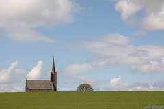
Its actually St Cyrus Church in the village of St Cyrus, in rural Aberdeenshire. A striking 'Church-of-Scotland'' church built in 1787 and then largely rebuilt in the mid 19th century. Its tall tower and spire make it a local landmark, accompanied here with a lone tree.
Of course for me an exercise in the rule of thirds again.
PiP
Battle for the beach!
| |
|
|
|
Enjoy with me these pieces of drift-wood battling it out for dominance on this beach of St Cyrus, Scotland. We are just short of some teeth on the highest sea-serpents head here.
Enjoy large.
Scottish rope fence
| |
|
|
|
Its anchors away in this St Cyrus garden, overlooking a wide expansive beach behind and below me. Here we are looking west, towards fields of rapeseed that seems to do well in this Northern part of the British Isles at almost sea-level. This was a very busy salmon fishing area where migrating fish were caught going up and down the river Esk and so there would be no shortage of all kind of rope but more likely this thick rope was brought from one of the bigger ships visiting the nearby Montrose port. The approaching rains you can see here never did get to us. -Correction , yes it did some hours later.
I wish you all, a great weekend, Herb
Dunottar Castle
| |
|
|
|
A rather dramatic view of this splendid castle upon almost an Island just south of Aberdeen, Scotland. It was possible to visit inside too but I had to resist that temptation.
Dunnottar Castle is a ruined medieval fortress located upon a rocky headland on the northeastern coast of Scotland, about 2 miles south of Stonehaven. The surviving buildings are largely of the 15th and 16th centuries, but the site is believed to have been fortified in the Early Middle Ages.
More Info
As always best viewed full screen.


