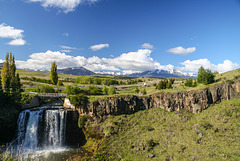
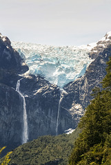
Gudrun's photos with the keyword: Waterfall
Gljúfrabúi
| 05 Apr 2025 |
|
|
|
Gljúfrabúi, the hidden waterfall, lies at the foot of Eyjafjallajökull volcano and is part of Katla Geopark. It is just 600m from much better known Seljalandsfoss and much less crowded. To get to the waterfall you either have to wade the stream or balance on wet rocks and once you are in front of the falls you get a full shower - I stayed outside;-)
See note for context.
Urriðafoss
| 03 Apr 2025 |
|
|
|
These falls in the river Þjórsá have the highest average flow rate (360 m³/s) of any waterfall in Iceland. Sadly its days might be numbered because there are plans for a dam and power station.
Dettifoss
| 25 Nov 2022 |
|
|
|
Dettifoss, 45m high and 100m wide, is one of Europe's mightiest waterfalls. River Jökulsá a Fjöllum comes from the northern side of Vatnajökull and has carved a deep gorge (Jökulsárgljúfur) with several waterfalls.
www.vatnajokulsthjodgardur.is/en/areas/jokulsargljufur/interpretation-and-knowledge/about-dettifoss
www.iceland.de/virtuelle-islandreise/nordostisland/der-dettifoss
Rjúkandi
| 06 Sep 2022 |
|
|
|
Rjúkandi is a 93m high waterfall in Jökuldalur. Its waters flow into Jökulsá á Brú river (also called Jökulsá á Dal or Jökla).
Seljalandsfoss Rainbow
| 03 Sep 2022 |
|
|
|
I didn't fancy queueing up to go behind the waterfall this year and was rewarded wih a rainbow.
In the note a 2016 photo from behind the veil, the parking lot spoils the view.
Fagrifoss
| 20 Aug 2022 |
|
|
|
EXIF: Canon EOS 6D/ EF24-70mm f/4L IS USM/ 1/80 • f/8.0 • 38.0 mm • ISO 250
Fagrifoss (literally: the beautiful waterfall) is near Road F206 to the Laki craters. Here the river Geirlandsá drops 80m into a canyon which is shot through with basalt dykes
Stirling Falls
Bowen Falls
| 13 Dec 2018 |
|
|
|
At Milford Sound in NZ's Fiordland National Park, part of Te Wahipounamu World Heritage Area
whc.unesco.org/en/list/551
Selfoss
| 27 Sep 2018 |
|
|
|
Selfoss is the southernmost waterfall at Jökulsárgljúfur, just 1 km from better known Dettifoss. It is 10m high and horseshoe shaped. Dettifoss may be higher and mightier but Selfoss is more varied and much less visited.
www.bbc.com/news/science-environment-31356229
Selfoss ist der südlichste der Wasserfälle in Jökulsárgljúfur, nur 1 km vom bekannteren Dettifoss entfernt. Er ist 10m hoch und hufeisenförmig. Dettifoss mag höher und mächtiger sein, aber Selfoss ist abwechslungsreicher und viel weniger überlaufen.
de.wikipedia.org/wiki/J%C3%B6kuls%C3%A1_%C3%A1_Fj%C3%B6llum
Goðafoss
| 07 Dec 2017 |
|
|
|
Goðafoss is the best known of the falls of Skjálfandafljót river (because it's near the Ring Road).
Panorama stitched from 7 verticals
EXIF: 1/80 • f/9.0 • 88.0 mm • ISO 100/ Canon EOS 6D/ EF24-105mm f/4L IS USM
Surely a troll!
| 06 Dec 2017 |
|
|
|
Cliffs of the former coastline at the foot of Eyjafjallajökull. The top of hidden waterfall Gljúfrabúi is just visible behind the troll.
Die Klippen der früheren Küstenlinie unterhalb des Eyjafjallajökull. Der obere Teil des verborgenen Wasserfalls Gljúfrabúi ist gerade noch hinter dem Troll sichtbar.
End of season
| 29 Nov 2017 |
|
|
|
Angelica archangelica seedheads at Gullfoss
Echte Engelwurz vor dem Gullfoss
Gljúfrabúi
| 27 Jul 2017 |
|
|
|
Gljúfrabúi, the hidden waterfall, is just a short walk from better known Seljalandsfoss. Lying under Eyjafjallajökull volcano, it is 40m high and mostly hidden by palagonite rocks in front of it. Getting a nearer view involves scrambling up the rocks or wading the river, both can be hazardous.
Vertical panorama stitched from 6 photos.Inset a detail and the falls seen from a distance.
www.katlageopark.com/geosites/seljalandsfoss-gljufrabui
stuckiniceland.com/south-iceland/the-hidden-beauty-of-gljufrabui
Gljúfrabúi, der vesteckte Wasserfall, ist einen kurzen Spaziergang vom bekannteren Seljalandsfoss entfernt. Er ist 40 m hoch, liegt unterhalb des Eylafjallajökull und ist weitestgehend von Palagonitfelsen verdeckt. Näher heran kommt man nur, wenn man entweder den Felsen hochklettert oder den Fluss durchwatet, beides nicht ganz ungefährlich.
Vertikalpano aus 6 Aufnahmen, im PiP ein Detail und eine Gesamtaufnahme aus der Entfernung.
Salto del Rio Pollux
| 29 Apr 2015 |
|
|
|
Small waterfall on the Carretera Austral some 15 km south of Coyhaique
Ventisquero colgante
| 21 Mar 2016 |
|
|
|
Ventisquero Colgante is the main attraction of Queulat National Park. Although the park covers 1541 km² only small sections along Ruta 7 (Carretera Austral) are open to the public, the large part is undisturbed rainforest, mountains and glacier.
The hanging glacier originates from a small 80 km² icefield and can often be heard and seen calving into the lagoon below it. On our visit a large chunk broke off, sadly we were in the forest at the time and the trees were in the way of a decent photo.
The inset photos are from the eastern viewpoint
and from Laguna de los Témpanos (the footpath to the western mirador was closed).
Salto San Martín
| 15 Aug 2016 |
|
|
|
San Martín Falls in the Argentinean part of Iguazú as seen from the river.
The falls and the surrounding rain forest are on the border between Argentina and Brasil and have UNESCO world heritage status since 1984. Río Iguazú tumbles down the basalt of the Paraná plateau over a length of 2,7 km in numerous falls between 60-82m high.
whc.unesco.org/en/list/303
www.iguazuargentina.com/maravilla-natural/patrimonio-natural
Die San Martín-Fälle auf der argentinischen Seite von Iguazú vom Fluss aus gesehen.
Iguazú und der umgebende Regenwald liegen auf der Grenze zwischen Argentinien und Brasilien und haben Welterbestatus seit 1984. Der Río Iguazú stürzt hier auf einer Breite von 2,7 km in unzähligen Wasserfällen von 60-82m Höhe über den Basaltabbruch des Paraná-Plateaus.
de.wikipedia.org/wiki/Iguaz%C3%BA-Wasserf%C3%A4lle
Wet, wetter, Skógafoss
| 26 Jul 2017 |
|
|
|
Skógafoss is a 15m wide and 62m high waterfall where the Skógá river tumbles down the cliffs of the former coastline. It lies in Katla geopark between Eyafjallajökull and Katla volcanoes. Also see inset photos.
en.wikipedia.org/wiki/Sk%C3%B3gafoss
www.katlageopark.com/geosites/skogarfoss
Skógafoss ist ein 15m breiter und 62m hoher Wasserfall des Flusses Skógá, der hier über die Klippen der eiszeitlichen Küstenlinie fällt. Skógafoss liegt zwischen den Vulkanen Eyfjallajökull im Westen und Katla im Osten und ist Teil des Katla Geoparks.
Foss á Siðu
| 06 Nov 2016 |
|
|
|
11 km east of Kirkjubæjarklaustur, this waterfall drops over basalt cliffs that once formed Iceland's (ice age) coastline. Also see inset photo!
11 km östlich von Kirkjubæjarklaustur fällt dieser Wasserfall über Basaltklippen, die in der Eiszeit Islands Küstenlinie bildeten. Siehe auch PiP!
Jump to top
RSS feed- Gudrun's latest photos with "Waterfall" - Photos
- ipernity © 2007-2025
- Help & Contact
|
Club news
|
About ipernity
|
History |
ipernity Club & Prices |
Guide of good conduct
Donate | Group guidelines | Privacy policy | Terms of use | Statutes | In memoria -
Facebook
Twitter


