Berny's photos
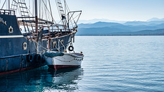
Deres - Venetian settlement
| |
|
Cretan Blue
Pirates of Crete
the big and the small
Greetings from Falasarna
| |
|
|
|
Late greetings from our usual beach in West Crete, actually I'm already back again ;-) We took the cheaper umbrellas, by the way.....
Ruta 12 - little Kangoo's adventures
Ruta 12 - Rio San Juan - drive carefully
| |
|
|
|
This is the place, where the most upstream reservoir is constructed with the dam "Dique el Tambolar". If you look carefully, you can see a red car, which crashed down from the dangerous road (little red dot, see PiP). - scanned slide, Minolta X700
Ruta 12 - Rio San Juan - Dique Caracoles
| |
|
|
|
The road winds upwards in the steep slopes, where now is the northern end of the reservoir "Dique Caracoles". - scanned slide, Minolta X700
Ruta 12 - Rio San Juan
| |
|
|
|
In the meantime, here is the huge reservoir "Dique Caracoles" (the new dam is shown in the PiP, source: Von Giuliano gb - Eigenes Werk, CC BY-SA 4.0, commons.wikimedia.org/w/index.php?curid=47967913) ). The dam ist 136 m high, the volume of the reservoir is 565 Mio. m³. - scanned slide, Minolta X700
Ruta 12 - Rio San Juan
| |
|
the red dot
| |
|
Ruta 12 - Rio San Juan - Dique Caracoles
| |
|
Looking back downstream, which is now the upstream end of the reservoir Dique Caracoles. The slopes down from the road to the river are pretty steep here ;-) - scanned slide, Minolta X700
Ruta 12 - Rio San Juan
| |
|
Looking downstream, the whole valley is now a lake, the reservoir "Dique Caracoles". I love such roads by the way ;-) - scanned slide, Minolta X700
Ruta 12 - Rio San Juan
| |
|
Rio San Juan - Dique Caracoles
| |
|
|
source: Von Giuliano gb - Eigenes Werk, CC BY-SA 4.0, commons.wikimedia.org/w/index.php?curid=47967913
Ruta 12 - Rio San Juan
| |
|
|
|
Why do I post many photos of the same valley? Because it's a documentation of a wild and lonesome landscape and a free river, which is gone now due to the construction of several large reservoirs. - scanned slide, Minolta X700
I will be away for a time and wish you happy days, stay safe!
Ruta 12 - Rio San Juan
| |
|
|
|
This image of the valley shows what's now the upstream part of the large reservoir "Punta Negra", used for power generation and irrigation purposes. The PiP shows a section, which is situated a little bit more downstream. The region was very lonesome back then. Now the old road is mostly under water, its course can still be seen on Google Earth. - scanned slide, Minolta X700
Ruta 12 - Rio San Juan
| |
|
In the meantime we would drive here along the shore of the reservoir "Punta Negra". - scanned slide, Minolta X700


