Location
Lat, Lng: 56.505001, 21.008788
You can copy the above to your favourite mapping app.
Address: Pētertirgus
You can copy the above to your favourite mapping app.
Address: Pētertirgus
See also...
Keywords
Authorizations, license
-
Visible by: Everyone -
All rights reserved
-
82 visits
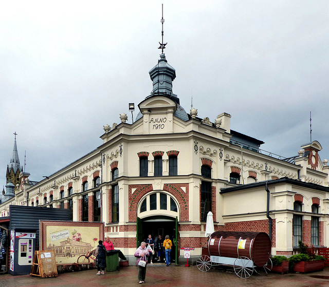
Liepāja - Pētertirgus


The settlement was first mentioned as "Lyva" in 1253. It was a small unfortified harbour town in the state of the Livonian Order. In the 14th century it was burnt down several times by the Lithuanians.
As a result of the Reformation, two Lutheran parishes emerged in Libau. One congregation was formed by the Protestants of Latvian language, the other one for German speaking Protestants.
The granting of the town charter took place in 1625. Soon after the construction of the harbour began. In 1698, a major fire destroyed most of the town's wooden buildings. The Great Plague of 1708 to 1714 claimed the lives of a third of the citizens.
The market wall was erected in 1910.
www.petertirgus.lv/
- Keyboard shortcuts:
Jump to top
RSS feed- Latest comments - Subscribe to the comment feeds of this photo
- ipernity © 2007-2025
- Help & Contact
|
Club news
|
About ipernity
|
History |
ipernity Club & Prices |
Guide of good conduct
Donate | Group guidelines | Privacy policy | Terms of use | Statutes | In memoria -
Facebook
Twitter


Sign-in to write a comment.