Jaap van 't Veen's photos
Nederland - Broek in Waterland
| |
|
|
|
Broek in Waterland is one of the villages in the Netherlands I do like very much. For me it is almost unbelievable to find such an authentic and picturesque place less than ten kilometres from Amsterdam and without the crowds in other more touristy places around.
Broek in Waterland was originally a fishermen's village and for that reason its church is dedicated to St. Nicolas (PiP 2), the patron saint of seafarers. From the mid 16th century this activity was rapidly replaced by stock farming and the production of dairy. The dairy products were transported to Amsterdam by boat. The harbour - called Havenrak (PiP3) remained important for the village and is still the heart of Broek en Waterland.
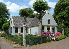
In the 17th and 18th century it was a popular village for the extremely rich (grain) merchants of this area and many impressive houses were built. The tiny village offers almost hundred meticulously renovated and preserved state monuments from the Dutch Golden Age period. Much of these traditional ‘Broeker houses’ have just one floor - due to the weak ground - and are constructed with a timber frame and walls. Much of them are nowadays painted in the famous Broeker grijs (main picture).
Broek in Waterland is surrounded by ditches and meadows and the ‘centre’ of the village is the Havenrak, a widening of the Ee rivulet (PiP4), which flows through Broek. The village has a couple of narrow streets, all lined with the traditional ‘Broeker houses’: having just one floor, due to the weak ground, constructed with a timber frame and walls and most of them are painted in the famous ‘Broeker grey’ (main picture). Some of them do have beautifully decorated entrance doors (PiP 1).
Nederland - Marken
| |
|
|
|
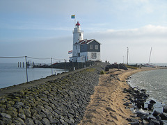
Marken, a former island, has still a lighthouse, which is called Paard van Marken (Horse of Marken). It is situated on the eastern tip of the island and is only accessible on foot or bike.
The current lighthouse was built in 1839; it has a height of 16 meters and a light range of 16.7 km. In 1700 the tower started as a square lighthouse. This was one of three lighthouses near Marken, which was decided to mark the route from the sea to Amsterdam. The three towers were equipped with oil lamps.
In 1839, the square stone tower was replaced by a round iron one on the old foundations. Later on, a brick building with a house and storage place was built, which provided the lighthouse its characteristic shape.
Till 1957 the small fishing village of Marken was an island in the IJsselmeer (the former Zuiderzee ). From that moment on it was connected by the mainland of the Province of Noord-Holland by a dike. The village is situated rather close to Amsterdam and part of the municipality of Waterland. About 2.000 people are living on the peninsula.
Marken (together with Volendam) is one of the most well-known tourist destinations in the Netherlands; it has its own charm with its quaint green coloured wooden houses on poles and the very colourful traditional costumes.
Nederland - Roermond, stadhuis
| |
|
|
|
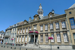
The stadhuis (town hall), of Roermond is situated on the market square. The building has a long history, as already in 1399 there is talk of a ' raithuys ' (medieval for raadhuis = town hall). In 1554 a deliberately lit fire destroyed three quarters of the city, including the town hall.
In the late 17th century the rebuilt town hall was renovated and extended with a couple rooms. From then on it served also as a meeting place for the government of the Overkwartier van Gelre (Upper Guelders).
In 1876, the facade of the town hall was plastered by concrete, which was very popular in that time. The facade was further embellished by reinstatement of the old entrance door. The three dormers with the weapons van Limburg, Roermond and Gelre also dating from that time.
After World War II the city and town hall were severely damaged, but again it was rebuilt. Eight years later the building had to be renovated completely as it was in a seerious state of disrepair. In 1955 the restoration of the old part of the town hall was completed. The main external change was the facade; the concrete layer was removed and the facade with its characteristic pilasters, cornices and fries was lined with tuff.
(PiPs: The town hall has a tower with a carillon. This carillon was donated in 1982 by companies and private inhabitants to mark the 750th anniversary of the city of Roermond. In 1995, the chimes were supplemented by a group of moving images that revolve around the tower of the town hall every afternoon at 12.00 pm.)
Germany - Oberstdorf, Söllereck
| |
|
|
|
Söllereck is family friendly ski area offering easy and intermediate ski runs with a total of 12 km of slopes. It has one cable car and four ski-lifts. At the base station is a large area for children.
The Söllereck ski area is situated between the elevations of 1.000 and 1.450 m. The area is well known for its winter hiking trails.
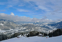
The main picture shows the view from the top of the Schrattenwanglift (1.450 m) looking down to Oberstdorf and the valley of the river Iller. The PiP shows the main down hill slope, which has a length of almost 2.800 m.
Nederland - Torenmolen van Gronsveld
| |
|
|
|
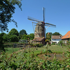
Although the mill is called Torenmolen van Gronsveld it is actually located in suburb of Maastricht. The city was during the construction of the windmill not as big as it is now and all local farmers were only allowed by the local governement to use this windmill.
The Tower Mill of Gronsveld was built between 1618 and 1623 - in the elevationon which the mill is built a stone can be found with the inscription “1622”. The construction took place on behalf of Count Joest Maximilliaan van Gronsveld. De Molen van Gronsveld is the most southerly windmill in the Netherlands and the oldest in the province of Limburg. It is one of the few brick windmills in the Netherlands.
Probably in 1766 the windmill was made a bit taller. This can be seen at the top end of the windmill. These kind of windmills usually go straight up, but its the top turns slightly inwards at the top (PiP).
Between 1924 and 1930 the windmill was taken out of use. In 1941 it was restored. During the fighting on 13 September 1944 with the liberation of Maastricht the windmill and one of the houses next to it were shot at and caught fire. The flour mill has been restored again in 1959. In the beginning of the ‘70’s the windmill has been made in working order and is now regularly in use, grinding grain for farmers and bakers.
Torenmolen van Gronsveld can be visted for free, although the opening hours are limited.
Switzerland - Basel Minster
| |
|
|
|
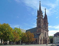
The Basel Minster ( Basler Münster ) is a medieval cathedral, situated on a twenty metres high hill high above the river Rhine. The Romans already had a fortress on this hill. The bishopric of Basel was founded in 343, with a residence in Augusta Raurica. In the early middle ages the bishop moved to Basel and the place served as temporary residence of the German kings, which was (and is) called Pfalz (PiP5), offering wonderful views over the Rhine.
Basel's first cathedral was built by bishop Haito (805-823). A larger church, named Heinrichsmünster after German king Heinrich II, was consecrated in 1019. Towards the end of the 11th century a tower on the west side was added - which is still part of today's Georgsturm . A new church building was erected between 1220 and 1230, but almost completely destroyed, due to an earthquake and fire in 1356.
This building was restored using basically the same ground plan, but with some Gothic style elements and consecrated in 1363. Attached to the church is a former monastery with two cloisters (PiP4). During the 16th century reformation the monastery was closed and the bishop expelled from the city.
The building as it stands today dates back for the most part to the late Romanesque building constructed in the last third of the 12th century and completed around 1225. The Basel Minster with its red sandstone architecture (PiP1), impressive interior (PiP2) and beautiful stained glass windows (PiP3) is one of the main landmarks of Basel and still an important tourist attraction.
Nederland - Vechtdal
| |
|
|
|
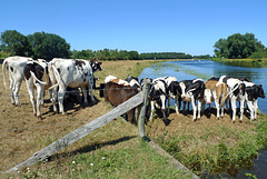
Waiting for a swim (??) to cool down a little bit on a hot sunny Sunday along the river Vecht.
(PiPs: The picture was taken next to the ferry for pedestrians and cyclists over the river Vecht near the village of Dalfsen. I have used many ferries, but never a fully automatic one like this.)
Nederland - Santpoort, Kasteel Brederode
| |
|
|
|
Kasteel Brederode (better known as Ruïne van Brederode ) was founded in the second half of the 13th century by Willem I van Brederode. He was a descendant of the lords Van Teylingen , who were related to the counts of Holland. The castle formed part of the high lordship Brederode, which had been given in loan in the 13th century to the lords of Brederode by the count of Holland.
The name Brederode is a reference to a wooded area called Brede Roede (literally: broad wood), which was cleared and where the castle was built. In its early days the castle was nothing more than a tower. In the year 0f 1300 Dirk II van Brederode had the tower pulled down and replaced it with a more appropriate castle.
The castle remained in the possession of the Brederode family until the year of 1679, when Wolfert , last lord of Brederode, died. The ruins became property of the States of Holland and the Dutch Republic. In the 19th century the ruins were one of the first buildings to be restored by the government and they became the first national monument of the Netherlands.
The ruins can be visted, but have limited opening hours; reason why I couldn’t take more and other pictures.
Nederland - Roermond, Munsterkerk
| |
|
|
|
The Munsterkerk , or officially Onze Lieve Vrouwe Munsterkerk (Munster Church of our Blessed Mother Mary) is located in the heart of Roermond and is considered being one of the most beautiful remaining examples of late Roman architecture in the Netherlands. Together with some other churches, the town hall and the Princenhof it reflects the glory of the city’s past.
Munsterkerk was built during the period from 1220 to 1265 as an abbey church and place of burial for its founders. For almost six centuries - until 1798 - it served as a monastery. In the 19th century a military barracks was housed in the abbey and the church became part of the barracks.
The church has been mostly spared by calamites and has therefore retained much of its official character. The most far reaching restoration took place at the end of the 19th century under the supervision of the famous Dutch architect P. Cuypers. In 1992 Munsterkerk was struck by an earthquake, after which the eastern towers had to be rebuilt.
Having been an abbey church for the Cistercian order of nuns in Roermond for almost six centuries its interior is not as sumptuous as in many aother catholic churches. Although not that huge I was quite impressed by the sober, yet impressive interior of the church. It has some interesting and beautiful elements, a few of which I have photographed.
PiP 1: interior of the Munster Church
PiP 2: the church served as the sepulchral church for Duke Gerard IV van Gelre. Nine centuries later, the princely mausoleum of him and his wife Duchess Margaretha van Braqbant is one of the highlights of the church.
PiP 3: above the tomb hangs a gilded wrought-iron neo-Roman chandelier, which was donated in 1899.
PiP 4: the apse is the oldest part of the church. It has beautiful stained-glass windows in its uppermost section, representing several saints. They were made in 1953 by Gisèle Waterschoot van der Gracht.
Nederland - Callantsoog, Zwanenwater
| |
|
|
|
The Zwanenwater (Swans Water) is a beautiful nature reserve of more than 600 ha nestled in the dunes, just south of the village of Callantsoog. The reserve was created in 1597 after the construction of the Zijperzeedijk ; dunes, valleys and lakes have been created by drifting sand. Since 1973 the area is managed by Natuurmonumenten , a society for preservation of nature monuments in the Netherlands.
Swan water' has beautiful freshwater lakes - among them the two largest natural dune lakes in Western Europe, marshes, heathland, woods, dunes, flowers and plants.
There are more than 120 endangered plant and animal species living in this area. It is an important stopping place for migratory birds and ore than 100 species of birds breed in this nature reserve. Besides birds, there are many other animals in this area such as: sand lizards, butterflies, foxes, rabbits, hedgehogs, mice, toads, cattle, frogs and water salamanders.
In all this natural beauty several species of orchids grow. They are often well hidden among the hundreds of other flowering plants.
Nederland - De Cruquius
| |
|
|
|
In the low-lying peat lands in the area between Amsterdam, Haarlem and Leiden peat was won for many centuries. Peat lakes were created, which expanded into larger lakes as a result of storms. Three lakes merged into one, forming the largest inland lake of the Netherlands: the Haarlemmermeer (Lake Haarlem). Local people called it the Waterwolf, because it swallowed more and more land and wiped complete villages of the map.
In 1837 King Willem I installed a commission to make a study for drainage. He could use such a prestige project to compensate for the humiliation regarding the separation of Belgium from the Netherlands. So he opted for the use of steam power for draining the Haarlemmermeer .
Together with two identical steam-pumping machines De Cruquius , commissioned in 1849, pumped Lake Haarlem dry in three years and three months. The engine could drain up to 320.000 litres of water per minute !! The pumping station is a unique example of neo-Gothic architecture with its havy buttresses, pointe – arched windows, battlements; much use is made of cast iron ornamentation (PiPs1 and 2)
Both other pumping stations were modernized after 50 years, but De Cruquius remained untouched. It was decommissioned in 1932 and became a museum, which opened four years later. It became one of the first technical museums in the world and houses the worlds’ largest steam engine. Apart from the history of the pumping station, attention is also paid to the continuous struggle of the Netherlands against the water.
But most impressive for me was without any doubt the visit to the engine room (PiPs 3 and 4), especially with a demonstration of a working engine; even if the huge cylinder is nowadays moved up and down by means of a modern hydraulic system.
Nederland - Sint Maartensvlotbrug, tulpen
| |
|
|
|
A tulip bulb seems so ordinary, but if you look a little bit further you can see what's special about it. That special aspect is inside. A bulb has everything it needs to get a flower to bloom at the right time. If you cut the bulb in half, you will see the flower already. Around it are the skirts in which the food needed for the flower to grow is stored. Another special feature of flower bulbs is the fact that they are the first to bring colour to gardens and parks after a winter. When the flower bulbs bloom, spring has begun.
Small tulip bulbs are planted in the autumn. In the ground, the little bulbs make roots and then go into rest until after the winter. The tulip bulbs need this cold period in order to be able to flower in spring. When winter is over, a stem comes out of the bulb with leaves and the tulip starts to bloom.
It is often a big shock when the bulb grower enters the bulb fields with a machine to chop off the flowers (PiP4). A tulip grower doesn’t take care about the flowers. For him it is all about the bulbs. By chopping the flower in time, all the energy goes to the bulb. The bigger the flower bulb, the more money the farmer can make. A large bulb produces a solid flower in the garden and also produces small (new) bulbs, which serve as planting material for the next season. In June and July, the tulip bulbs are grubbed up, cleaned and sorted according to size. The large bulbs are then sold for floriculture or for gardens or parks.
Nederland - Bergen aan Zee, Noordhollands Duinrese…
| |
|
|
|
The ‘Noordhollands Duinreservaat’ (North Holland Dune Reserve) is with its 5.300 hectare one of the largest natural areas in the Netherland. This reserve is managed by PWN (Water Supply Company North Holland) is used for drinking water production at three locations.
The ‘Duinreservaat’ stretches from Bergen aan Zee till Wijk aan Zee. It offers dunes, some of them with white sand (main picture and PiP1), large pine and oak forests (PiP2) and in the summer blooming heather (PiP3). The area is open to the public (walker and cyclist), however an admission ticket is needed.
Nederland - Anna Paulowna, Poldertuin
| |
|
|
|
Today the Netherlands produces billions of flower bulbs each year (of which two thirds are exported worldwide).The business of growing flower bulbs began almost 400 years ago.
The first Dutch flower bulbs grew in Leiden, in the botanical garden of the university. They were planted there by Carolus Clusius, a scientist who wrote the first major book on tulips in 1592. Leiden was the first bulb region of the Netherlands, but initially the tulips did not leave Clusius's botanical garden. Only after a theft cultivation could spread.
Once, the value of tulips was enormous. They were imported to the Netherlands from Turkey in the mid-16th century and gradually seized the passions of rich Dutchmen. In the Dutch Golden Age tulips became popular in paintings and festivals; tulip collecting amongst the elites became a popular pastime. In the mid-17th century, tulips were so popular that they created the first economic bubble, known as "Tulip Mania" (tulipomania). As people bought up bulbs, they became so expensive that they were used as money until the market in them crashed. But the Netherlands is still the centre for the trade of flowers and bulbs.
Nederland - Sint Maartensvlotbrug, Wildrijk
| |
|
|
|
The ‘Wildrijk’ is a nature reserve between the villages of Sint Maartenszee and Sint Maartensvlotbrug. Personally I consider it as one of the hidden gems of the province of North Holland.
Sint Maartenszee is located in the Zijperpolder . In the past, several wealthy Amsterdam merchants owned beautiful wooded estates in the west of the Zijperpolder, nearby the dunes along the North Sea. The ‘Wildrijk’ also dates from that time - the 16th century - and was a landscaped estate. During the excavation of the Noordhollandsch kanaal many pieces of forest were cut down by workers. Fortunately the ‘Wildrijk’ has been spared.
Nowadays it is a fairly small forest; especially in spring it is almost a fairytale to walk around (PiP4 and 5) between the numerous blooming wild hyacinths; most of them are blue (PiP1), but there also pink (PiP2) and white ones. Besides the hyacinths, the ‘Wildrijk’ also offers white daffodils (PiP3) and some other spring flowers.
Nederland - Anna Paulowna/Breezand
| |
|
|
|
The Noordelijk Zandgebied is the most northern part of the province North-Holland around the villages of Anna Paulowna and Breezand. This ‘sand area’ is the largest contiguous flower bulb production area in the world. The sandy soils and maritime climate are ideal for growing bulbs. The fresh sea breeze is not attractive for insects that can infect the crop with viruses. In the region is sufficient water available for sprinkling the fields in the event of drought.
Main picture: in the background the village of Anna Paulowna
PiP’s: several bulb fields in the area
Nederland - Anna Paulowna, Poldertuin
| |
|
|
|
After the construction of the Anna Paulownapolder an office of the water board was built in Kleine Sluis. The stately home is locally known as ‘Polderhuis’. In 1885 the ‘Poldertuin’ around the house was designed by landscape architect Jan David Zocher jr., who also designed the Vondelpark in Amsterdam and the garden of Soestdijk Palace. His gardens are characterized by winding paths and water features with bridges.
‘Polderhuis’ (nowadays privately owned) and ‘Poldertuin’ were sold to the municipality. The ‘Poldertuin’ is still owned by the (new) municipality of Hollands Kroon. Since 2014 the garden is managed by a foundation. In autumn volunteers plant about 220.000 flower bulbs, which are blooming between early April and mid May. The flower bulbs are donated by bulb growers from the region.
The ‘Poldertuin’ with its large variety of tulips, daffodils, hyacinths and special bulbs and tubers is also called ‘Little Keukenhof’ and can be visited free of charge.
Nederland - De Wijk, Reest
| |
|
|
|
The Reest is a stream that starts in the now excavated bog between Slagharen, Lutten and Dedemsvaart. De Reest is a typical lowland stream, which meanders through a flat landscape. With a height difference of only 5 meters over a distance of 37 kilometers the stream flows near Meppel into the Meppelerdiep.
The stream largely forms the border between the provinces of Overijssel and Drenthe, as a result of which the plans to channel the stream have never been carried out and the River Reest, with its many curves, slowly flows through the valley, which varies in width from 100 to 600 metres.
Jump to top
- ipernity © 2007-2025
- Help & Contact
|
Club news
|
About ipernity
|
History |
ipernity Club & Prices |
Guide of good conduct
Donate | Group guidelines | Privacy policy | Terms of use | Statutes | In memoria -
Facebook
Twitter

