Jaap van 't Veen's photos
Germany - Bamberg, ‘Little Venice’
| |
|
|
|
Bamberg - first mentioned officially in the year 902 - is built on seven hills and calls itself ‘Franconian Rome’.
The city has a well preserved historical centre; for its historical architecture and preserved heritage, the whole old town of Bamberg is since 1993 listed on the UNESCO World Heritage List.
Without any doubt Bamberg is a gem among German towns with its medieval appearance. One of the most picturesque parts is so called ‘Little Venice’ ( Klein Venedig ). It became its name from King Maximilian I (1848 -1864).
Fisher- and boatmen lived closer to the Bamberg Dom before they moved to the banks of the river Regnitz in the 14th century. That time the area was an island, named Abtswörth. Originally the houses were built in the water on stilts. In the past the galleries were used for patching and drying nets and the boats could drive directly into the open basements. In the 19th century a shore area has been created, which today is transformed into small picturesque gardens.
Nowadays the former fishermen’s district consists of a row of quaint houses along the river Regnitz, standing side-by-side with their balconies and small front gardens. If you are lucky you might see a ‘real’ gondolier rowing tourists.
Greece - Kastoria, Monastery Panagia Mavriotissa
| |
|
|
|
The monastery Panagia Mavriotissa was founded in 1082/83 by Byzantine Emperor Alexios I Komnenos to commemorate the victory over the Normans and the recapture of Kastoria.
It is referred to in documents dating back to the 13th century as the monastery of Panagia Mesonisiotissa (= in the middle of the island). In the second half of the 17th century the name changed to Panagia Mavriotissa, because the inhabitants of the village of Mavrovo (nowadays ‘Mavrochori’) ensured that it remained in good condition.
The monastery played an important role in the history of the area, but remained closed for many years. It was reopened in 1998. Only a few buildings from the original monastery have survived. The church has a spacious narthex on the west side, which was added later. The interior is decorated with murals dating from the beginning of the 13th century. The icons on the outside date from the period 1259 - 1264.
The murals and drawings were damaged - all eyes of saints were removed - during Ottoman period. Some of these old frescoes were restored in the 13th century, while the outer wall of the narthex was decorated with new ones.
Pangia Mavriotissa is located at a beautiful location with very old platanus trees, at the banks of Lake Orestiada, at a distance of four kilometers from Kastoria ( www.ipernity.com/doc/294067/47608732 ) and opposite the village Mavrochori. The monastery is dedicated to the Dormition of the Virgin. A chapel dedicated to John the Theologian, with wall-paintings executed in 1552 was erected beside it in the 16th century.
Greece - Dispilio
| |
|
|
|
The Ecomuseum in Dispilio feautures a ‘replica’ of a prehistoric lakeside settlement, located right besides the archaeological site where true signs of the neolithic era were discovered. The lake settlement - dating back to 5500 BC - was discovered during the dry winter of 1932, which lowered the level of the water in Lake Orestiada and revealed traces of the settlement.
The prehistoric settlement of Dispilio is one of the oldest lake settlements ever discovered in Europe. The settlement’s inhabitants used to live in huts they built on the lake on pile platforms. The 3.000 people, living there, were fishing, hunting, cultivating the earth, stockbreeding, constructing tools and utensils.
Excavations began in 1992 and the museum, consisting of a number of reconstructed stilt houses and a small exhibition room, is open to the public since the year of 2000. In the interior of the ‘houses’ one can see everyday-life objects of the Neolithic people.
Nederland - Deventer
| |
|
|
|
A panorama view of the city Deventer on a wonderful autumn day.
Deventer is an old Dutch city, which was founded around the year of 768 by the English missionary Lebuinus, who built a wooden church on the east bank of the river IJssel. It became city rights in 956, after which fortifications were built around the city. On one of these strongholds the Bolwerksmolen (see: www.ipernity.com/doc/294067/47395972) was built. The city was a flourishing trade centre between 1000 and 1500, because of its harbour and its participation in the Hanseatic League.
Nederland - Deventer, Bolwerksmolen
| |
|
|
|
The authentic Bolwerksmolen (Stronghold Mill) was built in 1863 by the Elfrink brothers. They were timber merchants and asked for a permission from the municipality of Deventer ( www.ipernity.com/doc/294067/47478274 ) community to built a sawmill on a (former) stronghold of the city. The area on the IJssel riverbank was rich in timber and they wanted to use the windmill for sawing woods. The mill was named after its location: bolwerk means stronghold or bastion.
The thatched octagonal smock mill ( stellingmolen ) stands on a square wooden base with a sawing shed. It has a slipway (PiP 1) for pulling tree trunks out of a small pond (PiP 2): due to the drought completely dry.
The windmill has been damaged multiple times by natural disasters and human negligence. At the beginning of the 21st century the mill appeared to have subsided in such a way that a radical restoration was necessary. Since spring 2007 the mill returned to its original shape.
Nowadays the Bolwerksmolen is owned by the municipality of Deventer and operated by a foundation. In the meantime this remarkable wind-powered mill has been turned into a museum; although with limited opening hours. If interested to visit check their website: www.bolwerksmolen.nl
Germany - Idstein
| |
|
|
|
Idstein is nestled in the soft rolling hills of the Taunus Mountains. The city - granted city and market rights in 1287 by King Rudolph of Habsburg - dates back at least to the year of 1102, when the name first appeared in a court document, involving Udalrich and Konrad von Etichestein.
Count Udalrich was succeeded in Idstein by the counts of Laurenburg, relatives of the archbishop of Mainz, who gave Idstein castle to them. From the middle of the 12th century, the Laurenburg family named themselves after the castle of Nassau. During this period the city became attached to Nassau and remained so until 1866.
Besides the former castle complex and the beautiful Union Church
( www.ipernity.com/doc/294067/47426278 ) Idstein has a mediaeval town centre ( Altstadt ) with about 200 timber framed buildings. The oldest remaining house (Obergasse 2) was originally built around 1410. Many of the houses date from the late 16th and early 17th centuries.
The two main squares - König-Adolf-Platz (PiP 1) and Marktplatz - and nearby streets are lined with numerous timber framed houses (PiP 3 and 4 ). The most magnificent and richly decorated house is the Killingerhaus (PiP 2, the central house ), built in 1615 by town clerk Johann Conrad Killing. Another remarkable building is the Crooked House (main picture). This Schiefes Haus was built in 1725 as a four storey house.
Idstein is part of the German Timber-Frame Road ( Deutsche Fachwerkstraße ), connecting towns with timber framed buildings.
Germany - Idstein, Protestant Union Church
| |
|
|
|
The Union Church ( Unionskirche ) is a protestant parish church in the historic centre of Idstein ( www.ipernity.com/doc/294067/47438976 ). The church was built from 1330 to 1350 under Gerlach, count of Nassau, when it was founded as collegiate Church of St. Martin. In 1669, it was transformed into a Lutheran sermon and burial church ( Predigt- und Hofkirche ) for the counts and princes of Nassau.
The town church became its current name “Union Church” in 1917, hundred years after the union of Lutheran and Reformed Protestants in the Duchy of Nassau, which was the first in Germany.
The exterior of the church is simple, but it has an extraordinary interior.
The most prominent decorations in the church are the 38 paintings by the Flemish baroque painter Michael Angelo Immenraedt and his assistant. These canvas oil paintings on the ceiling of the nave and the upper part of the walls show biblical scenes and were made from 1673 to 1678. Opulent use of marble from for the arcades, columns, altar, font, pulpit and tombs is another feature of the church. The altar (1676) portrays the “Last Supper” in form of a painting. The crystal chandeliers - originally used in the Kurhaus of Wiesbaden - were fitted in the church in the 19th century.
I have seen many, many churches, but this is for sure one of the most beautiful and fascinating ones. I fully understand that this church is well known throughout Germany.
Greece - Prespa, Basilica of Saint Achilles
| |
|
|
|
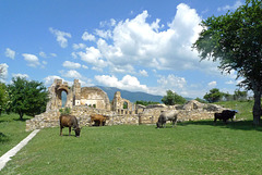
The most important church on Agios Achillios island (see: www.ipernity.com/doc/294067/47395972) was the Basilica of St. Achilles. The church was founded at the end of the 10th century by Tsar Samuel of Bulgaria. Initially it was the cathedral of the empire of Samuel and later - until the middle of the 15th century - a bishop's church.
In the basilica the mummified remains of Saint Achilles - a bishop from Larisa in Thessaly - were kept. These were brought to Agios Achillios after Tsar Samuel conquered Larisa in the 10th century. At the same time he commissioned craftsmen from Larisa to build the three-aisled basilica, which became the seat of the Bulgarian Patriarchate. The impressive church - (20 x 47 meters ) - was a cruciform basilica and among the ruins today one can see the famous sanctuary with three lobed windows, the pillars made of bricks and stones and a tomb on the south side.
After the reoccupation of the area by the Byzantines in 1018, the church became dependent on the archdiocese of Ohrid. In 1072 it was plundered by foreign invaders, but it continued to function until at least the middle of the 15th century. Over the years the church was abandoned, deserted and finally became a ruin.
Greece - Agios Achillios island
| |
|
|
|
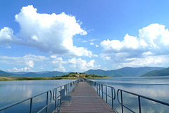
Agios Achillios is a small island in Small (Mikri) Prespa Lake. The name derives from the name of Saint Achilles, bishop of Larisa in the 4th century. The island was both a Roman and a Byzantine settlement and is known for its Byzantine ecclesiastical monuments.
On the island there are about ten houses, a guesthouse and a café/restaurant. It is with an island in Lake Pamvotis, nearby Ioannina, the only inhabited island in a lake in Greece. The main sight on the island is the ruin of the Saint Achilles Basilica (see: www.ipernity.com/doc/294067/47408324) . It is said that the island houses water buffalos, but the only animals we saw were some stray cats and ‘normal’ cows.
The Agios Achillios island and the Prespa Lakes (also known as Prespes) are located in Northwest Greece, at the tri-border point of Greece, Albania and FYR Macedonia/Republic of North Macedonia. Agios Achillios is connected to the mainland by a 650 m long floating pedestrian bridge.
Belgie - Brugge, Jan van Eyckplein
| |
|
|
|
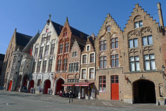
The Jan van Eyckplein is a square - named after the famous painter - located a little bit further away from the other touristic highlights of Bruges. As a result, it is not flooded with hordes of tourists and one can quietly enjoy the beautiful architecture of the typical brick houses with their stepped gables and quaint facades.
The square - constructed in 1787 - is located on the beginning of the Spiegelrei , which once was once was the old harbour of Bruges, where ships loaded and unloaded their goods.
Switzerland - Saint-Ursanne
| |
|
|
|
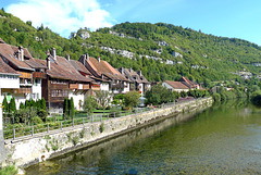
Saint-Ursanne is one of the jewels of the Swiss Jura. The medieval town is situated on the banks of the river Doubs at the foot of a rocky mountain ridge.
According to legend, the little town of St-Ursanne was founded at the end of the 6th century by the Irish monk Ursicinus, who lived as a hermit on this isolated spot. His hermitage within a cave can be reached by climbing 180 steep steps. Between 623 and 635 a first monastery community was founded. Around 1100 it was converted into a canons chapter.
Saint-Ursanne has conserved its medieval character (PiP1). Among the most important buildings in the centre are the collegiate church and its cloister (PiP4) built in the 12th and 13th centuries. Other parts of the old town contain heritage buildings dating from the 17th and 18th centuries. Even today, the town can only be accessed through one of the three historic gates. The ‘Porte Saint-Pierre’ is decorated with ‘La Berbatte’ (PiP3), a clock installed early in the 18th century.
The four-arched stone bridge (PiP2) over the river, built in 1728, awards a particularly splendid view of the picturesque town and its environs. A sandstone statue made in 1729 of St. John of Nepomuk, a protector against floods, stands on the bridge.
Nederland - Texel, Eierland Vuurtoren
| |
|
|
|
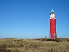
The lighthouse on Texel - officially Eierland Vuurtoren (Lighthouse Eierland) - is named after the island of Eierland, on of the two former islands, which were merged together to present island of Texel. The lighthouse is surrounded by a vast dune area, called Eierlandse Duinen and is located on the most northern point of Texel.
The lighthouse was built in 1864 after some civilians of Texel attended on the dangers of the waters between Texel and the island of Vlieland (72 ships had wrecked between 1848 and 1860). The tower itself is 37,4 metres high.
During the uprising of the Georgians in World War II - they barricaded themselves in the tower - the lighthouse was heavily damaged and had to be ‘rebuilt’. In 1950 it was lighted again.
As said the tower is surrounded by a scenic dune area on the mainland side and a very wide beach (especially at low tide). It is a very pleasant walking clockwise ‘around’ the tower from the car park at the end of the ‘Vuurtorenweg’. After finishing your walk have a drink or snack in ‘Torenrestaurant' with great views of the beach and ‘of course’ the sturdy bright red lighthouse. The lighthouse can be visited; from the top one has spectacular views of the North - and Wadden Sea and the nearby island of Vlieland.
Nederland - Dwarsgracht
| |
|
|
|
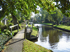
The main ‘street’ (canal) in Dwarsgracht, a hamlet nearby more well known Giethoorn in the Dutch province of Overijssel. The place was founded before 1800 at the time of peat extraction in the area.
Dwarsgracht is a real alternative for the famous, but very touristy, town of Giethoorn. Although just 3 km's away it is a completely different world: the same canal(s), small bridges, boats and thatched roof houses, but without the crowds and hustle and bustle of Giethoorn.
Dwarsgracht has just one café restaurant ( De Otterskooi ) and this is an ideal starting point for either a boat trip with a so called 'whispering boat' or for a bike tour along the canals and lakes. At De Otterskooi you can rent them both. Or just walk along the main canal through the village and enjoy the views over the water, the houses, the flowers, the birds and further away waving reed.
Nederland - Brummen/Bronkhorst
| |
|
|
|
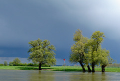
A thunderstorm above the IJssel River, nearby the ferry from Brummen to Bronkhorst (one of the smallest cities in the Netherlands).
(See for a picture and more information about Bronkhorst: www.ipernity.com/doc/294067/31724391/in/album/629489)
Nederland - Bergen op Zoom
| |
|
|
|
Bergen op Zoom was granted city status probably in 1212. In 1287 the city and its surroundings became a lordship as it was separated from the lordship of Breda. The lordship was elevated to a margraviate in 1559. Several noble families ruled Bergen op Zoom in succession until 1795.
The city was built on a place where two types of soil meet: sandy soil and marine clay. The sandy soil pushed against the marine clay, accumulating and forming hills over several centuries. Those ‘hills’ are called Brabantse Wal , literally meaning ‘ramparts of Brabant’; Bergen in Dutch means mountains or hills and Zoom refers to the border of these ramparts.
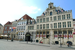
Bergen op Zoom became a trading city and merchants from all over Europe came to the city to sell their goods. The beautiful historical buildings on the Grote Markt (Market Square) reflect the wealth of the city.
The city hall (right) is a late Gothic building, dating back to the year of 1398; several fires put the building to ashes; the current building with its late-Gothic façade, dates from 1611. In front of the town hall stands a statue of ‘Anton van Duinkerken’, a local writer, poet and professor (PiP2). Hotel De Draak (left) is the oldest hotel in the Netherlands and is at least dating back to 1397, when a fire almost burnt down the entire city, but the inn was one of the few buildings which survived. City archives turned into ashes and smoke during this city fire, but experts say that Hotel de Draak was at least 100 years old when the city fire emerged.
Nederland - Hulshorst, De Maagd
| |
|
|
|
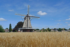
Windmill De Maagd (the Virgin) is a smock mill, which was built in 1894. The flour mill is located on the outskirts of the Dutch village and surrounded by wheat fields. After a first restoration in 1960 it fell back into disrepair. After a second restoration - 1988 - the mill is in working order again.
De Maagd has two flocks of millstones that are used to grind grain on a professional basis. One pair is driven by wind and the other has an alectric engine. The mill is quite unique as it used on a daily base. The flour of the mill is delivered to bakers and (pancake) restaurants, but also to other mill shops, hotels and hospitals.
Nederland - Staverden
| |
|
|
|
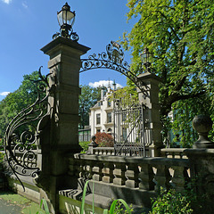
Around the year of 1300 Count Reinald van Gelre founded a settlement on the northern Veluwe. The ‘village’ was given city rights in 1298 as a form of encouragement and as a reward for his ambitions. But the development of Staverden never happened and there has never been any urban development since. It never came to anything more than the castle. Staverden Estate however does have 16 farms spread across its lands; a coach house, orangery, watermill, dovecot, workers' houses, a church and a cemetery, and is officially the smallest city in the Netherlands and the Benelux with its ca. 50 inhabitants (situation 2018).
The castle was frequently used as a hunting lodge by the Dukes of Gelre. Since 1400 there were feudal lords living at castle Staverden, who had to preserve and defend the castle. Around 1600 the castle was owned by the Van Haersoltes , who rebuilt it into a more habitable house.
Around 1840 the manor was rebuilt again; Staverden Castle got its current form in 1905, after the estate was purchased by Frederik Bernard s’Jacob , former mayor of Rotterdam. His heirs sold the house to the current owner, the foundation Geldersch Landschap en Kasteelen .
(Picture from another season: www.ipernity.com/doc/294067/21893815)
Nederland - Amsterdam, Hofje van Brienen
| |
|
|
|
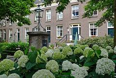
A Dutch hofje is a complex of almshouses around a central courtyard. They were built since the Middle Ages as a charity to house needy or elderly men and women. Amsterdam still has about 30 hofjes ; most of them can be found in or around the Jordaan neighbourhood.
Hofje van Brienen - or officially Het Brienens Gesticht de Star , was founded by Arnoud Jan van Brienen and his wife Sophia Maria Half-Wassenaar . In 1797 they commissioned the city architect of Amsterdam to design this hofje and to build it on the former location of beer brewery De Star . The aim was to provide housing for impoverished Roman Catholic men. Eventually the courtyard was built in 1803 and it was not until 1806 that the first inhabitants moved in.
Hofje van Brienen was completely renovated in 1997 and comprises 26 residential units. Nowadays they are inhabited by both married as unmarried, catholic and non-catholic inhabitants above the age of 45 years with a low income.
The hofje , being a hidden gem full with flowering and evergreen plants, can be visited for free.
Jump to top
- ipernity © 2007-2025
- Help & Contact
|
Club news
|
About ipernity
|
History |
ipernity Club & Prices |
Guide of good conduct
Donate | Group guidelines | Privacy policy | Terms of use | Statutes | In memoria -
Facebook
Twitter


