Jaap van 't Veen's photos
Switzerland - Muottas Muragl
| |
|
|
|
Muottas Muragl - on an altitude of 2.454 meters - is located high above the wide valley of the River Inn and the valley that leads to the Bernina Pass. It is without any doubt the most beautiful vantage point above the lakes, the villages of Upper Engadine and the surrounding mountains.
Between 1905 and 1907, the first funicular railway in Engadine was built here. Although modernised on many occasions, it has essentially remained the same to this day. The funicular railway takes over the 700-meter climb from Punt Muragl up to the Muottas Muragl in ten minutes. The upper section of the railway has sun collectors that cover the energy requirements of the mountain hotel/restaurant.
The mountain station is starting point of many hikes/walks. Among them is the well known Panorama Trail to Alp Languard, where one can take a chairlift to descend to the valley (PiP 2).
(The PiP was taken some minutes after the main picture.)
Switzerland - Bernina Pass
| |
|
|
|
The main picture is showing the Lago Bianco (see also PiP) and the road across the Bernina Pass before reaching the highest point. I took this picture from the Diavolezza cable car.
The Bernina Pass (2.328 m) is a mountain pass in the Bernina Range of the Alps. It connects the famous resort town of St. Moritz in the Upper Engadin valley with the Italian-speaking Val Poschiavo, which ends in the Italian town. Old paths crossed the Bernina Alps for hundred of years from Grisons to Valtellina in Italy. Back in 1865 a modern road replaced the old paths, which has been widened a number of times and has been open 365 days a year since 1965.
The Bernina Pass is also crossed by rail. The world famous Bernina Express has been travelling over the pass in summer since 1910 and since 1913 this popular tourist train is operating year-round between Chur and Tirano. It is the highest adhesion railway route in Europe. Energy source for the train line is the Lago Bianco, a hydro storage lake.
Apeldoorn - De Freule
| |
|
|
|
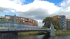
‘De Freule’ is not just one of the more than sixty bridges that cross the ‘Apeldoorns Kanaal’. It is a special bridge for two reasons: firstly it is only a pedestrian/bicycle bridge and secondly it is as a matter of fact also an art work. The 90 meter long bridge - made of iron and bronze - was designed by Tirza Verrips, an artist living in Apledoorn. It was built and opened in the year of 2000.
The bridge connects the city centre of Apeldoorn with a new built neighbourhood called ‘Welgelegen’ on the eastern bank of the canal. More than 200 years ago an estate with the same name was located in that area. It was owned by the famous Dutch admiral ‘J.H. van Kinsbergen’, where he was taken care of for many years by three ‘freules’ (dames/peeress). Many years later the bridge was named after the ‘freules’.
Wales - Beddgelert
| |
|
|
|
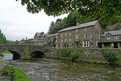
At first glance - certainly on a somewhat rainy gray day - the hard gray stone houses of Beddgelert do not look too inviting. But walking around and seeing all the blooming flowers the village became more and more picturesque.
Beddgelert (meaning “the grave of Gelert”) is probably named after an early christian missionary and leader called Celert (or Cilert), who settled here early in the 8th century. The earliest record of Beddgelert appears on a document dated 1258 (the name recorded is "Bekelert"); eleven years later it is recorded as "Bedkelerd".
Beddgelert lies in a valley at the confluence of the River Glaslyn and River Colwyn. Just above the confluence of the rivers, in the centre of the village, is the old stone bridge with two arches. It is hard to imagine, but the village once was a busy port, when the river was tidal and ships sailed all the way to the centre of Beddgelert.
Switzerland - Abbey Cathedral of St. Gallen
| |
|
|
|
The history of the monastery of St. Gallen (St. Gall) is dating back to the year 612, when an Irish monk named Gallus was on a preaching pilgrimage through Europe. He stumbled on a stone and dropped to a knee at the edge of the Steinach River, where he spotted a hungry bear. He gave the bear some of his bread, perhaps a bribe as not to eat him, but purportedly an offering to help him build a shelter. After Gallus' death, the spot grew in importance as a place of worship and a Benedictine monastery was founded in 747 by St Otmar and named after Gallus.
The Abbey of St Gallen and its monastery grew in stature and wealth, becoming a religious principality, ruled by Prince-Bishops. The Abbey Cathedral at St Gallen survived both the reformation and French Revolution, but under the influence of Napoleon in 1805, when the Canton of St Gallen was established, both the monastery and its political rule were dissolved.
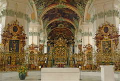
The current cathedral was built between 1755 and 1767 and is one of the last monumental baroque monastic constructions in Europe. A white interior is adorned with malachite green stucco-work, rose marble altars and a gilded altar fence (main picture). The opulently ceiling frescoes (PiP 2) depict biblical characters. The interior is decorated with numerous carvings; among them a wonderful pulpit (PiP 3), several confessionals and eighty four choir seats (PiP 4).
Several of the buildings of the former monastery now house municipal offices. The Abbey Cathedral of St Gallen (PiP 1), the abbey library and the surrounding monastery buildings – (the St. Gallen Abbey District) - was declared a UNESCO World Heritage Site in 1983.
Greece - Crete, Chania
| |
|
|
|
The old harbour of Chania - situated next to the old city - was built in the mid 14th century by the Venetians during their occupation of Crete. It was an important center, serving the Venetian military ships, as well as one of the most important commercial ports of the Eastern Mediterranean Sea.
In the 16th century the harbour was included to the new fortification plans of the city of Chania. During the period of the Turkish rule, the port continued to be a trade center.
Much later, in the19th - early 20th century, the largest ships at that time, had to anchor outside the harbor and reach the pier by boat. The port gradually abandoned and today the Venetian harbour offers moorage for fishing boats and other small boats and yachts.
The promenade along the water is lined with cafes, restaurants, bars and tavernas (PiP). A little bit further away you will find the (former) Turkish Küçük Hasan Pasha Mosque (PiP) and the Venetian shipyards and arsenals (PiP). Another landmark is the lighthouse, built at the harbour entrance by the Venetians and restored between 1830 and 1840 in its present form by the Egyptians.
(Four images stitched together for the main image)
Switzerland - Säntis
| |
|
|
|
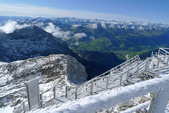
The Sántis is with a height of 2.502 metres the highest peak in the Alpstein massif in northeastern Switzerland. It is a natural landmark in the region between Lake Walen and Lake Constance. The mountain towers above one of the most beautiful landscapes of Europe and can be seen from miles away. .
The name Säntis dates back to the 9th century. It is an abbreviation of the Romansh language for Sambatinus (The one born on Saturday), which was thought to be the name of a nearby area. The name was later used to refer to the summit. In the German language it was originally called Semptis or Sämptis.
We were quite lucky with the weather during our visit. We took the aerial cable car at 9.30 am from Schwägalp, right at the foot of the Säntis At the peak we had a breathtaking clear 360-degree view, although it was freezing cold. It is said that one can see six Alpine countries: Switzerland, Germany, Austria, Liechtenstein, Italy and France. To be honest I can not tell if I saw all these countries. When back - just more than an hour later - the peak was already surrounded by clouds !!
Main picture: Swiss Alps with the Churfirsten in the ‘foreground’.
PiP 1: panorama (three pictures stitched together) looking north (Germany and Lake Constance) and northeast (Austria).
PiP 2 and 3: freezing and ‘hoarfrosting’ cold.
Italy - Brixen Cathedral
| |
|
|
|
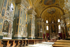
The ‘Dom Mariae Aufnahme in den Himmel und St. Kassian’ (Cathedral of Santa Maria Assunta and San Cassiano) is the largest church in Brixen, once belonging to the powerful Principality of Brixen, nowadays the diocese of Bolzano-Brixen. Although Bolzano is currently the city of residence of the bishop, the most important church in South Tyrol is still the cathedral in Brixen.
The cathedral is dating back to the late 10th century when the main building and its annexes were erected. A fire destroyed the church in 1174. The new romanesque-gothic building was rebuilt in the baroque style during the period of 1745 to 1755.
The cathedral’s two towers (PiP 1) are the landmark of the city of Brixen. The interior of the cathedral is a masterpiece of historical and artistic value. Its wide domed nave is decorated with rich marble and stucco (PiP 2). The main altar has a very striking altarpiece (PiP 3), but the decorative highlight is the fresco on the ceiling.
Wales - Caernarfon Castle
| |
|
|
|
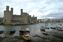
Caernarfon Castle is probably the most impressive and famous of the many Welsh castles. The site of the castle wasn’t chosen by accident. It had previously been the location of a Norman motte and bailey castle and before that a Roman fort stood nearby.
King Edward I started the construction of the castle in 1283, being part of city walls of medieval Caernarfon. It was not only a military stronghold, but also a seat of government and a royal palace. Standing at the mouth of the Seiont river, the fortress with its towers, battlements and colour banded masonry still dominates the walled town, also founded by Edward I.
Edwards son was born in Caernarfon Castle. In 1301 he became the recreated title of Prince of Wales and it was the first time the eldest son of the King of England was invested as Prince of Wales.
In 1969 the castle gained worldwide fame as the setting for the investiture of Prince Charles as Prince of Wales.
In 1986, Caernarfon was added to the UNESCO list of World Heritage Sites as part of the "Castles and Town Walls of King Edward in Gwynedd
USA - Arizona, Petrified Forest National Park
| |
|
|
|
Petrified Forest National Park is well known for its abundant number of fossils, especially fallen trees that lived in the Late Triassic Period, about 225 million years ago. The park is home to some of the most impressive fossils ever found and more are being discovered each year as erosion exposes new evidence. Fossils found here show the forest was once a tropical region, filled with towering trees; more than 150 different species of fossilized plants have been discovered.
When trees were toppled by volcanic eruptions, they were swept away by flowing water and deposited in marshes and covered with mud and volcanic ash. Buried under layers of sediment, the logs remained buried for millions and millions of years undergoing an extremely slow process of petrification, which essentially turned the logs to colourful stone. Much of the park’s petrified wood is from Araucarioxylon arizonicum trees (an extinct species of conifer).
The beautiful colours in the petrified wood come mainly from three minerals: pure quartz is white; manganese oxides form blue, purple, black and brown; and iron oxides provide hues from yellow through red to brown.
Theodore Roosevelt created Petrified Forest National Monument on December 8, 1906. Petrified Forest was designated as a national park on December 9, 1962.
(Main picture was taken along the Giant Logs Trail, behind the rainbow Forest Museum. The colourful collared lizard is quite common in the park during summer months.)
Greece - Crete, Aptera
| |
|
|
|
Aptera (literally meaning "without wings") is a lesser known archeological site not too far away from Chania. It was the most powerful city of western Crete from Minoan through Hellenistic times. The earliest mention of the Aptera is found as “A-pa-ta-wa” on the Linear B tablets of Knossos, dating back to the 14th-13th centuries BC. The currently findings of the excavations indicate that the place was inhabited from the 8th century BC until the 7th century AD, when abandoned due to a strong earthquake and attacks by the Saracen Arab pirates.
Archaeologists finished in 2009 the first face of the excavation at the carved-in-ground amphitheater of Aptera. Originally it was thought to be a Roman theater but actually it dates back to the Hellenistic times and was rebuilt during the Roman occupation of Crete. More recently the theater was restored.
Morocco - Merzouga, Erg Chebbi
| |
|
|
|
Erg Chebbi is one of Morocco's two Saharan ergs (large seas of dunes formed by wind-blown sand). The dunes stretch about 30 kilometers from north to south and are between 5 ands 10 kilometers wide. They rise dramatically from a surrounding pancake flat of black hamada (a barren hard rocky plateau) up to a height of more than 100 meters.
We visited Erg Chebbi during a camel ride (PiP 1) from our hotel to one of the dunes (PiP 2), where we were waiting in the descending sun on the play of light and shadow (PiP 3) and the constantly changing colours of the Sahara sand into a warm orange colour (main picture), which is one of the features of Erg Chebbi.
Nederland - ‘t Harde, Ampies Berg
| |
|
|
|
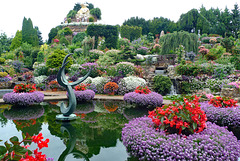
I don’t know if Ampies Berg (Ampies Mountain) is the most beautiful garden, but for sure it is the most remarkable one I have ever seen. As soon as I entered the garden I was overwhelmed by the explosion of colours of hundreds and hundreds of different flowers and plants.
It is a long time ago when Ampie and Batje Bouw during a holiday were inspired by the Austrian landscape. At home he decided to make a piece of Austria is his own garden with waterfall, a pond, beautiful flowers and a mountain with a height of fifteen meters. They have been working for more than fifty years creating their own floral paradise.
Germany - Ansbach, Orangery
| |
|
|
|
The Ansbach Residence (Residenz Ansbach or Markgrafenschloß) was the government seat of the Margrave of Brandenburg-Ansbach. The palace (PiP 3) has its own court garden with an orangery, although it has always been separated from the palace by other buildings and nowadays by a busy road.
A garden was first mentioned in the 16th century. The construction of the orangery started in 1726 under Margravine Christiane Charlotte. The garden was designed as a baroque garden. Severely damaged during World War II, it was reconstructed after the war, including an herb garden with many medicinal plants and a house to keep potted plants in winter.
In the garden one can find some statues and commemorative plaques. Today the orangery - the architectonic heart of the garden - is a café/restaurant and also used as a venue for concerts and conferences.
Denmark - Vallø Slot
| |
|
|
|
The beautiful and majestic Vallø Slot(Vallø Castle) traces its history back to the 14th century. The building of the castle was finished in 1586 by Mette Rosenkrantz - one of the richest women of Denmark - with the addition of a west and south wing and the two characteristic towers. The other wings were built in the 17th and 18th century. The castle was devastated by fire in 1893 but restored largely to its old design between 1893 and 1904.
The estate was owned by well known noble families until 1708. In that year it was bought by King Frederik IV, who gave it to his mistress, later Queen Anne Sophie Reventlow. After his death the new King Christian VI gave Vallø Estate to his wife Sophie Magdalene. On her birthday in 1737 she established a foundation (‘Noble Vallø Foundation for Unmarried Daughters’), which turned the castle into a home for ‘spinsters of noble birth’. Unmarried daughters of Danish royalty, unable to live in their own castles, were allowed to live at Vallø, supported by the foundation and government social programs.
The castle still provides housing for women of the Danish nobility but since 1976 admission to the residences is not restricted to unmarried women but now also cover widows and divorced women.
Wales: Borth-Y-Gest
| |
|
|
|
Borth-Y-Gest wit hits Victorian houses is built in a shallow bowl around a sheltered bay on the edge of the River Glaslyn with a horseshoe shaped promenade. The village is dominated by the harbour, where a number of small boats are moored.
The village was a busy shipbuilding centre before Porthmadog was established. The so called ‘pilot houses’ were built at the mouth of the harbour, so pilots could keep a watch for ships needing them. In the past Bort-Y-Gest was starting point for the crossing over the dangerous Glaslyn estuary.
Nederland - Vlissingen
| |
|
|
|
Statue of Michiel Adriaenszoon de Ruyter was unveiled by King William II on 25 August 1841. The cast iron statue was designed by sculptor Louis Royer. He based the statue on a painting by Ferdinand Bol. In 1894 the statue was give its current location on the ‘Keizersbolwerk’, where it is overlooking the mouth of the river Scheldt. Since 1905 the statue is flanked by two cannons recovered from the Sea of Messina. After a massive restoration the statue was unveiled again on 5 July 2011.
Michiel de Ruyter - the Netherland’s best known admiral - was born in Vlissingen (Flushing) on 24 March 1607. He went to sea as a young boy and would rise from cabin boy lieutenant admiral general, after he had been a mate on a whaler and worked for the Lampsins mercantile house in Vlissingen.
During the second half of the 17th century the Dutch Republic waged wars to protect the trade. These wars were mainly fought at sea. In the period 1666 - 1676 De Ruyter showed his skills as a commander-in-chief. He died in harness 29 April 1676 in a battle with the French in the Sea of Messina. His remains were interred in the ‘Nieuwe Kerk’ in Amsterdam.
(For more info about De Ruyter: nl.wikipedia.org/wiki/Michiel_de_Ruyter)
New Zealand - Muriwai
| |
|
|
|
Muriwai's gannet colony at Otakamiro Point is a one of the three colonies on the mainland of New Zealand, although out to sea, the colony continues on two vertical-sided islands (Oaia - where the colony first established - and Motutara). About 1.200 pairs of Australasian gannets nest here from August to March each year. The birds return from Australia to establish contact again with their lifelong mates.
The nests of the breeding colony are just centimetres apart. Each pair lays one egg and the parents take turns on the nest and strive for food by diving into the sea at up to 145 km per hour.
The chicks hatch naked, but within a week they're covered with fluffy down. As they mature, they grow juvenile feathers and begin to exercise their wings in preparation for the one-shot jump off the cliff. Once airborne, the young gannets leave the colony and cross the Tasman Sea to Australia. A few years later, surviving birds return to secure a nest site at the colony.
Jump to top
- ipernity © 2007-2025
- Help & Contact
|
Club news
|
About ipernity
|
History |
ipernity Club & Prices |
Guide of good conduct
Donate | Group guidelines | Privacy policy | Terms of use | Statutes | In memoria -
Facebook
Twitter


