Rules of Engagement
You Can't Get There From Here
You're Only as Old as You Feel, I Guess
Gare de Massy.
Empty Track
Tunnelblick zwischen Auf und Ab
HFF
29.01.2021 HFF
Nottingham Nottinghamshire 4th October 2020
Stadtkirche St. Wilhadi in Stade
Avenue des Champs-Élysées 1
Stara Motlawa
Glendalough 26
Marcher ou rouler........
HFF - kommt nicht vom rechten Weg ab!
Die Bank und der Zaun auf Coney Island
Kirschblüte
Pont de Normandie
Stichkanal
in the middle of the road
HFF
no honey
HFF
Like There's No Tomorrow
Ig Nobel Prize
The Wreckage of Humanity
road work
Long Road
my cottage
the professionals
bad seed
freedom of choice
Looking eastwards
rust belt
Road to Pempwell
Der Herbst zeigt seine Farben
Bogengang
Vanishing point
Neulich im Treppenhaus
machine intelligence
Hier wächst unser Brot
Fender Bender
Tenma-01
Madeira Funchal May 2016 X100T Fortress Santiago 5
life, or something like it
Location
Lat, Lng:
You can copy the above to your favourite mapping app.
Address: unknown
You can copy the above to your favourite mapping app.
Address: unknown
See also...
See more...Keywords
Authorizations, license
-
Visible by: Everyone -
All rights reserved
-
718 visits
Pony Express route


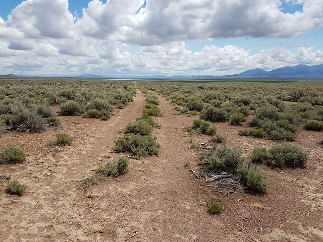
The Pony Express was a short-lived (1860-61) express mail route to California that used relays of horses between stations about 10 miles apart all across the West. It became highly romanticized, and is still remembered today, because one of the young riders was William ("Buffalo Bill") Cody, who decades later dramatized the operation in his Wild West Show. The service, which never made money, was rendered obsolete by the completion of the transcontinental telegraph in October 1861. This section is by Dry Creek in Lander County, central Nevada. View is looking east back across Bean Flat. There was supposed to be one of the stations near here, and we were looking to see if we could find a foundation, or something, but evidently the site is now on private land. The stations were, for obvious reasons, located at water sources, and so it probably was in the drainage of (not completely) Dry Creek, now the location of an active ranch. Interpretive signs (inset) here and there mark the route. Modern US 50 ("The Loneliest Road") parallels the route a couple of miles to the south (off to the right of the picture).
Rrrolf, Smiley Derleth, Ruebenkraut and 2 other people have particularly liked this photo
- Keyboard shortcuts:
Jump to top
RSS feed- Latest comments - Subscribe to the comment feeds of this photo
- ipernity © 2007-2025
- Help & Contact
|
Club news
|
About ipernity
|
History |
ipernity Club & Prices |
Guide of good conduct
Donate | Group guidelines | Privacy policy | Terms of use | Statutes | In memoria -
Facebook
Twitter

Admired in:
www.ipernity.com/group/tolerance
Sign-in to write a comment.