Location
Lat, Lng: 57.685733, -5.608127
You can copy the above to your favourite mapping app.
Address: A832, Ross-Shire, Scotland, IV22 2
You can copy the above to your favourite mapping app.
Address: A832, Ross-Shire, Scotland, IV22 2
See also...
Keywords
Authorizations, license
-
Visible by: Everyone -
All rights reserved
-
350 visits
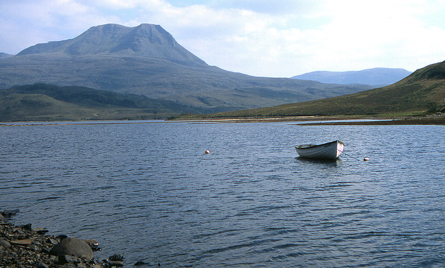
Loch Bad an Sgalaig and Baosbheinn(Wizard`s Hill)


Loch Bad an Sgalaig is a small, irregular shaped, freshwater loch and reservoir lying 5 mi (8.0 km) south of the small village of Poolewe, in Wester Ross, Scotland.
The north west end of the loch, where it outflows to the Eas na Laimh stream,was dammed in 1949 to power the Kerry Falls hydroelectric power station.
The loch was surveyed on 30 July 1902 by T.N. Johnston and John Hewitt and as part of the Sir John Murray's Bathymetrical Survey of Fresh-Water Lochs of Scotland 1897-1909.
Andy Rodker, Ste, Doug Shepherd, autofantasia have particularly liked this photo
- Keyboard shortcuts:
Jump to top
RSS feed- Latest comments - Subscribe to the comment feeds of this photo
- ipernity © 2007-2025
- Help & Contact
|
Club news
|
About ipernity
|
History |
ipernity Club & Prices |
Guide of good conduct
Donate | Group guidelines | Privacy policy | Terms of use | Statutes | In memoria -
Facebook
Twitter


Best regards, Doug
Alan Drury club has replied to Doug Shepherd clubBest wishes ... Steve
Alan Drury club has replied to SteBest wishes, Andy
Sign-in to write a comment.