Gudrun's photos with the keyword: Katla
Road to Þórsmörk
| 15 Aug 2022 |
|
|
|
Road (F)249 branches off from the ring road and runs between the river Markarfljót and the slopes of Eyjafjallajökull. There are numerous river and stream crossings and especially some of the glacial rivers are notoriously unpredictable. Most of the streams are constantly changing their course so no reliable fords can be marked. We saw several exhaust pipes and number plates which careless motorists had lost in crossings;-)
www.dangerousroads.org/europe/iceland/9850-f249-%C3%BE%C3%B3rsmerkurvegur.html
The mountain/ glacier in the background is Mýrdalsjökull with Katla volcano underneath.
www.katlageopark.com/about-katla
Katla from Mýrdalssandur
| 29 Jul 2017 |
|
|
|
Last night (28.07.17) a jökulhlaup (glacial outburst flood) has started from Mýrdalsjökull. Two days earlier a 4,5 earthquake in Katla caldera was felt in Vík, a strong smell of sulphur followed and conductivity measurements in Múlakvísl river showed an increased thermal flow into the river. Due to the ongoing flood and seismic tremor in nearby stations the colour code for Katla was changed to yellow. The flood peaked on Saturday, 29.07., the yellow alert was lifted on 31.07.
futurevolc.vedur.is/?volcano=KAT
en.vedur.is/about-imo/news/glacial-outburst-flood-in-mulakvisl
Gestern abend (28.07.17) hat ein Gletscherlauf aus dem Mýrdalsjökull begonnen. Zwei Tage zuvor war ein 4,5er Erdbeben in der Katla Caldera auch in Vík zu spüren, gefolgt von starkem Schwefelgeruch und erhöhter Leitfähigkeit im Fluss Múlakvisl. Wegen des Gletscherlaufs und vulkanischem Tremor in umliegenden Messstationen wurde die Warnstufe für Katla auf Gelb gesetzt. Am Samstag, 29.07. war der Scheitelpunkt der Flut erreicht, die Warnstufe wurde am 31.07. aufgehoben.
de.wikipedia.org/wiki/Katla .
Wet, wetter, Skógafoss
| 26 Jul 2017 |
|
|
|
Skógafoss is a 15m wide and 62m high waterfall where the Skógá river tumbles down the cliffs of the former coastline. It lies in Katla geopark between Eyafjallajökull and Katla volcanoes. Also see inset photos.
en.wikipedia.org/wiki/Sk%C3%B3gafoss
www.katlageopark.com/geosites/skogarfoss
Skógafoss ist ein 15m breiter und 62m hoher Wasserfall des Flusses Skógá, der hier über die Klippen der eiszeitlichen Küstenlinie fällt. Skógafoss liegt zwischen den Vulkanen Eyfjallajökull im Westen und Katla im Osten und ist Teil des Katla Geoparks.
Mýrdalssandur
| 04 Nov 2016 |
|
|
|
Fence in morning sunlight near the bridge over Kúðafljót on Mýrdalssandur.
HFF everybody! I'm back but will need lots of time to catch up.
Kúðafljót bridge
| 05 Nov 2016 |
|
|
|
Kúðafljót is one of the largest glacial rivers in Iceland. It originates in Mýrdalsjökull and is monitored closely because changes in conductivity can be warning signs of an impending jökulhlaup from Katla volcano.
Kúðafljót ist einer der größten Gletscherflüsse Islands. Er entspringt unter dem Mýrdalsjökull und wird genau überwacht, weil Änderungen in der elektrischen Leitfähigkeit auf erhöhte Aktivität des Vulkans Katla und drohende Gletscherläufe hinweisen können.
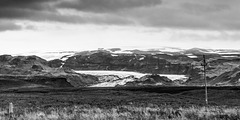
Dark clouds over Katla
| 01 Oct 2016 |
|
|
|
Mýrdalsjökull and outlet glacier Sólheimajökull seen from the ring road. Because of an unusually high level of seismic unrest in Katla caldera the aviation colour code was raised to yellow and civil protection declared a state of uncertainty. For the moment the activity has gone down again but the volcano continues to be monitored closely.
futurevolc.vedur.is/?volcano=KAT
Mýrdalsjökull und Auslassgletscher Sólheimajökull von der Ringstrasse. Wegen eines ungewöhnlich starken seismischen Schwarms wurde die Warnstufe für den Flugverkehr auf Gelb gesetzt und der Katastrophenschutz hat einen Status erhöhter Wachsamkeit ausgerufen. Momentan ist die Aktivität wieder zurückgegangen, aber der Vulkan wird weiterhin engmaschig überwacht.
de.wikipedia.org/wiki/Katla
Jump to top
RSS feed- Gudrun's latest photos with "Katla" - Photos
- ipernity © 2007-2025
- Help & Contact
|
Club news
|
About ipernity
|
History |
ipernity Club & Prices |
Guide of good conduct
Donate | Group guidelines | Privacy policy | Terms of use | Statutes | In memoria -
Facebook
Twitter


