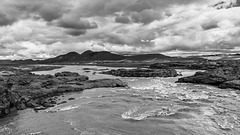
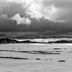
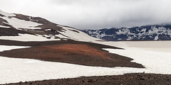
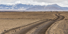
Gudrun's photos with the keyword: Askja
Signposts
| 02 Oct 2022 |
|
|
|
Near Dreki hut at the foot of Askja volcano in the middle of the Icelandic highland desert (the light coloured stuff is pumice from the 1875 Askja eruption). It's always fun to come across such signposts seemingly in the middle of nowhere!
For the 125km to Nýidalur you would probably need at least 6-7 hours in a 4x4 with high clearance as this F-road goes through lava fields and various fords. We only did the "easier" eastern part to Askja and that took us 5 hours for 100km. www.dangerousroads.org/europe/iceland/9864-f-roads-in-iceland.html
Original photo
Kreppá Bridge
Víti and Öskjuvatn
| 23 Aug 2022 |
|
|
|
Panorama stitched from 4 photos
EXIF: 1/1000 • f/5.6 • 28.0 mm • ISO 100/ LEICA CAMERA AG LEICA Q2/ SUMMILUX 1:1.7/28 ASPH.
Askja is a big central volcano in the middle of the Icelandic highlands, consisting of 3 nested calderas. Öskjuvatn (in the background) is Iceland's 2nd deepest lake (220m) and developed in the years/decades after the 1875 eruption when the magma chamber had emptied and the caldera slowly collapsed and filled with groundwater. Viti (Icelandic for hell) in the foreground is a maar, an explosion crater from a phreatic explosion which also happend in 1875. The water is sulphurous and people used to bathe in it. At the moment this is forbidden, as Askja seems to be slowly warming up towards another eruption. There has been an uplift of 35cm in recent times and the alert level has been raised to yellow.
Snowfall when we arrived
Swiss National Day is celebrated on 01.08, even in Askja;-)
Highland desert
| 24 Jul 2022 |
|
|
|
River Kreppá in the Icelandic highlands, a desert of lava and pumice created by various volcanic eruptions, most notably from Askja. www.vatnajokulsthjodgardur.is/en/areas/odadahraun/interpretation-and-knowledge/about-askja
Road F910 (4x4 only) crosses the river on one of the very few bridges in the area. Note how high the bridge is, fording would often be impossible.
www.vatnajokulsthjodgardur.is/en/areas/odadahraun
I'm off to Iceland again, see you in August!
Askja
| 30 Nov 2017 |
|
|
|
Inside Askja Caldera, still covered with snow in mid July. Askja /DyngjufjöllI is a central volcano in the Icelandic highlands and part of Vatnajökull National Park. futurevolc.vedur.is/?volcano=ASK
In der Askja-Caldera, die Mitte Juli noch immer mit Schnee bedeckt war. Askja/ Dyngjufjöll ist ein Zentralvulkan im isländischen Hochland und Teil des Vatnajökull Nationalparks. de.wikipedia.org/wiki/Askja
Askja Caldera
| 04 Aug 2015 |
|
|
|
In Askja Caldera - to the right is the snow covered track to Öskjuvatn, to the left one of the craters of Vikruborgir, eruption site of 1961.
Mordor
| 02 Aug 2015 |
|
|
|
Highland road F 910 traversing an area of pumice from the 1875 VEI 5 eruption of Askja central volcano. The northern part of the caldera can be seen in the background.
Upptyppingar
| 06 Nov 2014 |
|
|
|
Upptyppingar is a móberg ridge in the Askja fissure swarm. In the foreground lava and pumice from Askja eruptions can be seen.
Jökulsá a Fjöllum and Upptyppingar
| 06 Nov 2014 |
|
|
|
Jökulsá a Fjöllum, originating from Vatnajökull, is Iceland's second longest river (206km) and the one with the largest drainage basin. During holocene eruptions of Bárðarbunga jökulhlaups with a peak discharge of 900,000 m³ per second have occured along the river.
Jökulsá a Fjöllum and Askja
| 06 Nov 2014 |
|
|
The photo was taken from the bridge over Jökulsá a Fjöllum, where mountain road F910 crosses the river. Askja can be seen in the background.
River Kreppá and Austurleið
| 29 Oct 2014 |
|
|
|
Highland Road F910 and river Kreppá, the major tributary of Jökulsá a Fjöllum. A jökulhlaup (glacier outburst flood) from Vatnajökull would reach this area in less than 3 hours: avd.is/is/wp-content/uploads/2014/10/Jokulhlaup_kort_Holuhraun_20141017.png
On Highland Road F910-Austurleið
| 29 Oct 2014 |
|
|
|
After the Kreppá bridge F910 meanders through Krepputunga before doubling back to cross Jökulsá a Fjöllum. Móberg ridge Herðubreiðartögl and table volcano Herðubreið can be seen in the background, the foreground is filled with lava and pumice from Askja eruption.
Version with selective colouring added!
Herðubreið, the queen of Icelandic mountains
| 29 Oct 2014 |
|
|
|
Herðubreið (1682m) is a classic tuya (subglacial volcano) topped by a 300m thick subaerial lava shield. The photo was taken near the bridge over River Kreppá, the lava and pumice in the foreground stem from Askja eruptions.
Jump to top
RSS feed- Gudrun's latest photos with "Askja" - Photos
- ipernity © 2007-2025
- Help & Contact
|
Club news
|
About ipernity
|
History |
ipernity Club & Prices |
Guide of good conduct
Donate | Group guidelines | Privacy policy | Terms of use | Statutes | In memoria -
Facebook
Twitter


