RHH's photos with the keyword: viewpoint
White Rim from Green River Overlook
White Rim from Grandview Point
| 05 Oct 2023 |
|
|
|
Taken from Grandview Point in the Island of the Sky District of Canyonlands National Park.
Island in the Sky Sunset
| 23 May 2023 |
|
|
|
The mountains in the background are the La Sal Mountains on the Colorado border. The photo was taken from the Shafer Canyon overlook in the Island in the Sky District of Canyonlands National Park.
Dead Horse Point State Park
| 12 May 2022 |
|
|
|
This was taken with my phone at sunrise in Dead Horse Point State Park in Utah. We had been in the Island in the Sky area of Canyonlands National Park the previous day and got up early to catch the sunrise here, just a few miles outside of that part of Canyonlands. We went on from here, after having our breakfast, to the Needles district of Canyonlands.
Otter Crest, Oregon
| 13 Jun 2021 |
|
|
|
Taken from Otter Crest on the Oregon coast while traveling down the coast with family from Tillamook to Yaquina Head.
Grand Canyon
| 29 Feb 2020 |
|
|
|
Almost our last stop before heading home was the Grand Canyon. We only saw the South Rim of the Canyon. The north rim was still closed for the winter. At 7000 feet (2100 m) elevation it was still winter at the canyon, very cold and snow still on the ground. In spite of that it was very busy. This photo was taken from the Hermit's Point Road on the west side of the south rim, a road that tomorrow will be closed to cars. It was taken at one of the viewpoints along the road at a spot known as The Abyss and shows the Colorado River at the bottom of the canyon on the right. I had not seen the canyon since I was 13 years old and my wife had never seen it, so it was great to have been there, though our stay was only two days and two nights.
Cape Foulweather
| 29 Jul 2019 |
|
|
|
Continuing a second day of wandering down the Oregon coast, we drove the Otter Crest Loop between Depoe Bay and Newport. The weather which had been foggy soon cleared and the views along the coast were magnificent, this from the Otter Crest viewpoint at Cape Foulweather.
Zabriskie Point
| 30 Apr 2018 |
|
|
|
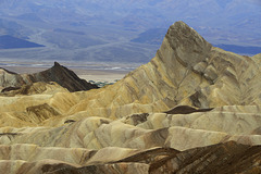
This was taken from the viewing area at Zabriskie Point and looks west over the valley, some of which is visible in the distance with its salt pans and greenery at Furnace Creek. We were waiting for the sunset when this was snapped and I went on from here to hike up a small nearby peak looking for a better view.
Zabriskie Point
| 29 Apr 2018 |
|
|
|
Driving south on the Scotty's Castle Road from Ubehebe Crater we spent a good part of the day photographing wildflowers and cactus and then went on to Dante's View on the east side of the park only to discover to our dismay that the road was closed (through May). We went back to Zabriskie Point, also on the east side and spent some time there before heading to Furnace Creek to get water and our evening meal. After eating we returned to Zabriskie Point for the sunset.
Viewpoint with No View
| 07 May 2013 |
|
|
|
There is a side trail from the trail to Fragrance Lake that takes you to a viewpoint from which the Straits of San Juan and the San Juan Islands can be seen. This was the view the day we hiked to the viewpoint. The tree in front is a Pacific Madrone.
ronaldhanko-orchidhunter.blogspot.com/2013/04/a-wet-walk-...
Jump to top
RSS feed- RHH's latest photos with "viewpoint" - Photos
- ipernity © 2007-2025
- Help & Contact
|
Club news
|
About ipernity
|
History |
ipernity Club & Prices |
Guide of good conduct
Donate | Group guidelines | Privacy policy | Terms of use | Statutes | In memoria -
Facebook
Twitter


