Herb Riddle's photos with the keyword: Lynmouth
Breath in….1….2…..3….out
| 15 Jan 2024 |
|
|
|
Take in the sea air here on Porlock hill, overlooking Lynton and Lynmouth.
Another from my recent Somerset trip, that I just had to share. See below for another shared bench with the same view a little lower down the hill.
Enjoy full screen.
Porlock Hill looking down to Lynton and Lynmouth
| 11 Dec 2023 |
|
|
|
After spending time in both Lynmouth and its upper Valley of the Rocks we head back to the village of Porlock over its famous hill. As we do, we take time on our way up to take a walk around here. As can be seen, a splendid place to rest a while too. In the distance we see Lynmouth at the water’s edge with its sister village of Lynton above and the Valley of The Rocks hidden behind the wooded bowl-shaped hill
Enjoy full screen.
Have a great day.
Lynmouth: the Rhenish Tower
| 22 Nov 2023 |
|
|
|
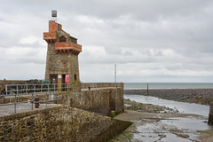
On the quay at the end of the harbour is the Rhenish Tower. This was built in the 1860s to store saltwater for indoor baths but later fitted with a light to act as a beacon. It was badly damaged in the devastating floods of 1952 but rebuilt to its original form. It acquired its name after it was said to resemble a tower on the River Rhine.
HWW, have a great day.
Old harbour and steps at Lynmouth
| 18 Oct 2023 |
|
|
|
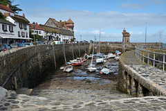
Another capture of the village of Lynmouth showing the harbour walls and old tower. The PiP (last photo) shows one of a number of flights of steps here that, allow boat and fishermen to access their craft. The harbour has been here a long time, in fact since Medieval days. It has been altered by floods, in particularly the 1952 one but there has floods here that devastated the village in 1607 too. In fact the word Lyn comes from the Old English ‘hlynn’ meaning ‘torrent’
HWW, have a great day.
Ye olde steps
| 18 Oct 2023 |
|
|
|
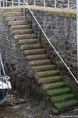
One of a number of flights of steps that, allow boat and fishermen to access their craft here in Lynmouth
A Post Card from Lynmouth
| 13 Oct 2023 |
|
|
|
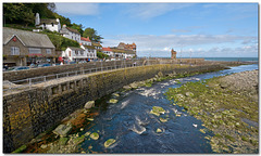
A view of part of this popular old village with its river and beacon tower.
It’s difficult to imagine that this was the scene for one of our worst flood disasters (see below).
Essential full screen. Enjoy the weekend.
“ON FRIDAY 15 AUGUST 1952, THE TINY VILLAGE OF LYNMOUTH SUFFERED WHAT COULD BE DESCRIBED AS THE WORST RIVER FLOOD IN ENGLISH HISTORY.
On the day itself, just over 9 inches (230mm) of rain fell, 6 inches (150mm) of which fell in a few short hours in the afternoon/early evening. Add in the 6 inches (150mm) of rain that had already fallen in the first two weeks of August, then it is no surprise that the top of Exmoor was unable to absorb the rainfall and was totally overwhelmed.
A noted author, S H Burton, recorded that water stood 18 inches (450mm) deep in the area of the moor around the Chains – indeed, the road between Lynmouth and Simonsbath, ironically at a place called Dry Bridges, was reported to the Devon Constabulary in the early evening as being washed away and impassable. The road here is half a mile above Farley Water, the nearest river. It was estimated that 90 million tons of rain fell in North Devon and West Somerset on that day.
This rainfall flooded into the many tributaries of the East and West Lyn rivers and, consequently, many tons of water, soil, boulders and vegetation descended through the narrow valleys (or coombes) of Exmoor from 500 metres up on the moor to meet at sea level in Lynmouth itself. On its way, various bridges blocked the flow until they collapsed and subsequently a wall of water and rubble hit Lynmouth in the late evening.
Effectively, Lynmouth was destroyed during that night.
The statistics make incredible reading. The West Lyn river rose 60 feet (18.25 meters) above the normal level at its highest point; 34 people in the wider area lost their lives – 28 in the Lynmouth/Barbrook area alone.
In 1953, the “58th report of Scientific Memoranda of the Devonshire Association“, prepared by specialist Mr C H Dobbie, concluded amongst other points that “the flow (of water) in the tributaries and branches exceeded the ‘acute catastrophic flood’ definition for England. As assessed by a preliminary investigation, the flow could be included in the list of extreme flood discharges of the world. The tiny catchment area of 39 square miles yielded a flow that has only been exceeded twice by the River Thames with all its 3812 square miles since measurements started in 1883.“
Further, Mr Dobbie calculated that the water that fell in that one day would supply the water needs of Lynmouth’s total population for 108 years.
Following the devastation, 114,000 tons of rubble was cleared from the village, some of it being used to extend the Esplanade Car Park, but most of it being dumped into the channel and dispersed by tidal motion. "
visitlyntonandlynmouth.com/history-heritage/the-1952-lynmouth-flood-disaster
The East Lyn River at Lynmouth
| 11 Oct 2023 |
|
|
|
As the A39 road trundles over the river here in this steep valley at Lynmouth, I look back with some pleasure up the river where a pleasant walk through the woods on the left climbs up to a place called ‘WatersMeet. Here also, seen just before this bridge on the right hand side is the confluence of the West Lyn River. The two rivers have caused devastation to the village in the recent past.
HWW, have a great day.
The Lynton & Lynmouth Cliff Railway
| 10 Oct 2023 |
|
|
|
A look at this lift that quickly transports you to the top of this high cliff to the village of Lynton. Taken from the sister village Lynmouth harbour area itself, the LLCR is in fact the highest and steepest totally water powered railway (funicular) in the world. It was opened in 1890, rises 500ft (152 m) and is 862ft (262.7 m) long. - No, we did not go on it this time but we have done so in the past.
See PiP for entrance view
More info: en.wikipedia.org/wiki/Lynton_and_Lynmouth_Cliff_Railway
Enjoy full screen.
Valley of the Rocks bench
| 09 Oct 2023 |
|
|
|
This capture belies the beauty of this place. The views beyond the trees and behind this hill to the right are breath-taking but that is for another day.
‘The Valley of the Rocks, is a dry valley that runs parallel to the coast in north Devon, England, about 1 kilometre to the west of the village of Lynton. It is a popular tourist destination, noted for its herd of feral goats, and for its landscape and geology.’ Wiki.
Enjoy full screen.
Have a great day.
Lynmouth: frontage.
| 08 Oct 2023 |
|
|
|
We see here the end journey of the river Lynn. It rises in Somerset and flows through the Devonshire countryside before reaching the Bristol Channel at Lynmouth. Sitting in the distance is The Rhenish Tower that was used as a beacon for shipping for many years before its almost complete destruction in the 1952 floods. It was rebuilt two years later but the only original part here is the 'fire basket' sat on its roof. The harbour is to the left of the wall .
Enjoy the day.
Waiting for dinner!
| 07 Oct 2023 |
|
|
|
A young crow here, I think, of the genus Corvus. (Ravens are a larger species)
Seen on the wall of Lynmouth harbour pier, by the lobster pots.
'The all-black carrion crow is one of the cleverest, most adaptable of our birds. It is often quite fearless, although it can be wary of man. They are fairly solitary, usually found alone or in pairs, although they may form occasional flocks. The closely related hooded crow has recently been split as a separate species.' RSPB
Enjoy full screen.
Jump to top
RSS feed- Herb Riddle's latest photos with "Lynmouth" - Photos
- ipernity © 2007-2025
- Help & Contact
|
Club news
|
About ipernity
|
History |
ipernity Club & Prices |
Guide of good conduct
Donate | Group guidelines | Privacy policy | Terms of use | Statutes | In memoria -
Facebook
Twitter


