Berny's photos
Red Canyon Arch - 1986
Red Canyon - Hoodoos - 1986
Red Canyon - 1986
Red Canyon - 1986
| |
|
|
|
Entering Bryce Canyon National Park from the Northwest on "Utah State Route 12", you first pass Red Canyon, which is a perfect attunement for the larger Bryce Canyon.
scanned slide, Minolta X700
Red Canyon - Hoodoos - 1986
| |
|
|
|
Hoodoos along the Pink Ledge Trail in Red Canyon, Dixie National Forest, Utah. It's near the Bryce Canyon NP. - scanned slide, Minolta X700
Bryce Canyon - 1986 - HFF!
| |
|
|
|
The next series will be about Bryce Canyon in Utah. This sign, which looks quite different today, is located at Highway 63, the Bryce Canyon National Park Scenic Drive.
scanned slides, Minolta X700
HFF and a sunny and happy weekend!
Stay safe and take care, my friends!
Est Fork Virgin River - 1986
| |
|
|
|
on the way from Zion NP to Bryce NP, near U.S. Highway 89
scanned slide, Minolta X700
Checkerboard Mesa - 1986
| |
|
|
|
Checkerboard Mesa is an iconic Navajo Sandstone summit located in Zion National Park. The PiP shows the same location 10 years later in 1996. - End of Zion NP
Zion NP - Sandstone Wonders - 1986
| |
|
|
|
Zion NP - Red Asphalt - 1986
The Great White Throne - 1986
| |
|
|
|
The Great White Throne (2056 m) is a rock tower, composed of white Navajo Sandstone in Zion National Park in Utah The north face rises 720 m from the floor of Zion Canyon near Angels Landing (to the right). It is often used as a symbol of Zion National Park.
scanned slide, Minolta X700
Zion NP - Angel's Landing - 1986
Zion NP - 1986
| |
|
|
|
Abraham Peak and Isaac Peak, seen from Sand Bench Trailhead
scanned slide, Minolta X700
Zion NP - 1986
| |
|
|
|
"Mountain of the Sun", "Twin Brothers" and "East Temple", seen from the begin of "Zion Mount Carmel Highway" (see notes) - scanned slide, Minolta X700
Zion NP - 1986
| |
|
|
|
some strange rock formations near "Pine Creek Canyon Overlook"
scanned slide, Minolta X700
Zion NP - The Great Arch - 1986
| |
|
|
|
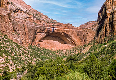
The "Great Arch" and the "Canyon Overlook" above, seen from Pine Creek Canyon. See note and PiP for viewpoint.
Zion NP - Canyon Overlook Trail - 1986
Zion NP - Canyon Overlook Trail - 1986
| |
|


