Rhyolite Ghost Town - 1986
Unnamed
Death Valley - Zabriskie Point - 1986
HBM in old town of Albuquerque
Death Valley - Badwater - 1986
Hoover Dam - 1986
Hoover Dam - 1986
45th floor = dangerous job
Intake Towers - 1986
Zabriskie Point
These boots are made for walking
Zion National Park - 1986
Pine Creek Canyon Overlook - 1986
Las Vegas - Fremont Street Experience - Neon Museu…
The color tax sign lady
Lake Tahoe, USA
Der Zaun im Monument Valley, USA
Monterey Aquarium
Apollo 13
HBM on the way to Death Valley
Pine Creek Canyon Overlook - 1996
Phoenix
Zion NP - 1986
Mariposa Grove - Bachelor and Three Graces - 1986
Owens Valley - lonesome tree 1986 - HFF!
speedway of Daytona
After the Storm
Sky, Land, Water
Manhattan by night
Yosemite - North Dome - 1986
Sunset Over Daugherty Creek Canal
Watchers
Californian Hydrant
Nevada Fall and Liberty Cap - 1986
Technology
Tamarack Lake, Nevada
Yosemite - Nevada Fall - 1986
Just another grocery pick-up
Boston's waterfront by night
Niagara Falls - 1986
29.01.2021 HFF
readin', ritin',and ruin....
Yosemite Falls - 1986
Yosemite Falls - 1986
Concentrating mill, Nightingale Mine
Location
Lat, Lng:
You can copy the above to your favourite mapping app.
Address: unknown
You can copy the above to your favourite mapping app.
Address: unknown
See also...
Keywords
Authorizations, license
-
Visible by: Everyone -
All rights reserved
-
178 visits
PCT and Spire off Arnot Peak


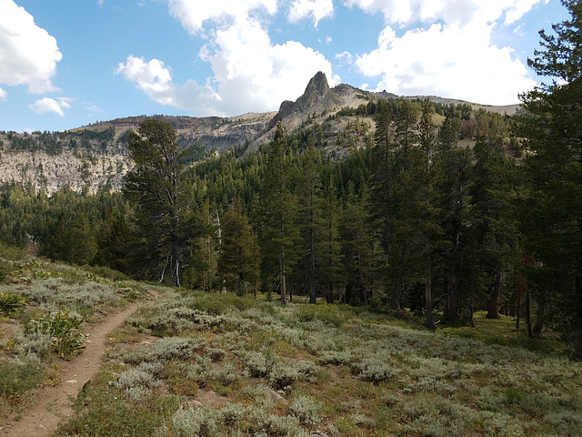
Carson-Iceberg Wilderness, Sierra Nevada, California, looking south. The Pacific Crest Trail (PCT) is on the left; the obvious saddle below is Wolf Creek Pass (not to be confused with the one in Colorado!) The prominent skylined spire evidently doesn't have a name but is at the end of a north-trending ridge off Arnot Peak (10,054 ft/3064 m). Judging by the topo map, the spire is around 9700 ft/2957 m. Elevation of the PCT here is about 8700 ft/2652 m.
LutzP, Pam J, Marie-claire Gallet and 2 other people have particularly liked this photo
- Keyboard shortcuts:
Jump to top
RSS feed- Latest comments - Subscribe to the comment feeds of this photo
- ipernity © 2007-2025
- Help & Contact
|
Club news
|
About ipernity
|
History |
ipernity Club & Prices |
Guide of good conduct
Donate | Group guidelines | Privacy policy | Terms of use | Statutes | In memoria -
Facebook
Twitter

Admired in:
www.ipernity.com/group/tolerance
Sign-in to write a comment.