Rock Ready To Roll.
Bayside Sunset
Busy Bee.
Herkules' Blick auf Kassel (PiP)
Under Puffy Clouds
New Use For A Tyre?
Valleys And Hills
HFF: Ein Plätzchen wär' noch frei ...
Waves Washing In
Roofs of Nafplio
From the Jetty At Lake Maraetai
Beside Hamilton Lake.
Die Jungfernbrücke im Bodetal (PiP)
a sunny HFF to all!
Green Valley
Plant Cart.
Picture Window.
Hanging Blossom.
Lakeside Leisure.
Despot's Palace - Mystras
under the bridge
Far Below The Road A Stream Flows.
Unendlicher Himmel über Eiderstedt (PiP)
A Glimpse Of The River.
Shadows On The Road.
Path through the Park
Spitzhacke
Calp, Spain
Near Whakamaru
Mirror Image
DSC 0676bc In Remembrance of WW1
Blick von der Seiser Alm
Holbeinsteg (PiP)
Just above Jones Landing.
Abends, wenn der Zinssatz festgelegt wird - oder l…
palms and houses
Green Beauty.
Machtdemonstration
Encroaching Clouds.
A Sheltered Place To Sit.
HFF and a sunny WE!
HFF: Kein Knusperhäuschen, sondern ...
Driving Through Huntly
Quedlinburg - Schloss in Kugel 2
Quedlinburg: Blick aus dem Schloss zum Münzenberg
Location
Lat, Lng:
You can copy the above to your favourite mapping app.
Address: unknown
You can copy the above to your favourite mapping app.
Address: unknown
See also...
Keywords
Authorizations, license
-
Visible by: Everyone -
All rights reserved
-
477 visits
Wallowa Mountains


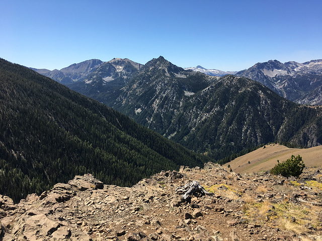
Looking slightly west of south from off Mt. Howard, accessed by the Mt. Howard tramway. The Wallowas (wuhl-OW-uh, btw, with "ow" as in "town") lie in northeastern Oregon and don't fit the usual image of Oregon mountains. They're a heavily glaciated range in granitic and high-grade metamorphic rock, in contrast to the young volcanics of the Cascades. There was hardrock mining activity here in the late 19th and early 20th centuries, primarily for gold, but since the 1930s the bulk of the area has been preserved in the Eagle Cap Wilderness (previously "primitive area"), with Eagle Cap (outlined; 9572 ft/2918 m)) as the centerpiece. The East Fork of the Wallowa River lies in the prominent canyon below; the side drainage directly below the viewpoint is Royal Purple Canyon.
The Mt. Howard tramway rises some 4000 ft from the village at the base, and when built in 1970 was claimed to be the steepest tram in North America. Without it, views like this are not available without a long and strenuous climb! The inset shows a view more to the right, with the highest peaks marked.
The Wallowas are well known in the Pacific Northwest, but they're not much of a Destination otherwise. You don't even see that many California license plates in the campground! ;)
Gudrun, Smiley Derleth, tiabunna and 2 other people have particularly liked this photo
- Keyboard shortcuts:
Jump to top
RSS feed- Latest comments - Subscribe to the comment feeds of this photo
- ipernity © 2007-2025
- Help & Contact
|
Club news
|
About ipernity
|
History |
ipernity Club & Prices |
Guide of good conduct
Donate | Group guidelines | Privacy policy | Terms of use | Statutes | In memoria -
Facebook
Twitter

Admired in:
www.ipernity.com/group/tolerance
I LOVE YOUR NARATIVES
Sign-in to write a comment.