Reflection
Im Central Park (PiP)
Nanu? Ich hatte gar keinen Besuch erwartet?
Quiet Countryside.
World Super Falls 2
Ein Winterspaziergang
Snowy path
Sonnenuntergang bei Alishan
Im Fischleintal
Elder Sister Pond - HFF (PiP)
Elder Sister Pond - HFF (PiP)
Auf dem Weg zur Klammbachhütte - HFF
Alishan Shouzhen Temple (3*PiP)
Kaohsiung bei Nacht (PiP)
Ruins of Saint Paul's - Macau
Golden Gate Bridge
On The Slea Head Drive - HFF
Im Alishan-Gebirge: die Sonne kommt über den Bergk…
Fort Charlotte
Hong Kong
View through a Henry Moore sculpture
Coastal fortifications at The Presidio
Silver Lake
Mt. Elwell (7818 ft/2383 m) and Lakes Basin
Ausgang zum "Central Park"
Park Sunset
Path at Sandy Bay.
Sonnenuntergang in Kaohsiung
Nicely Covered
Dubai
Mount Titiraupenga
Our back Fence.
HFF, und nicht Endstation!
the lighthouse on the St.Lawrence River - Canada
Last man standing
Langkofelgruppe
Blossoming.
Entrance path to the Natural Bridge.
Cloud Sheep
View Across The Lake
P9264129ac Snowing Gold
P9264090ac Laon Cathedral North Silhouette
117 1746bc Arrival in Laon and Its Top Ill ex Cath…
Hong Kong Skyline
Under Cool Trees,
Location
Lat, Lng:
You can copy the above to your favourite mapping app.
Address: unknown
You can copy the above to your favourite mapping app.
Address: unknown
See also...
Keywords
Authorizations, license
-
Visible by: Everyone -
All rights reserved
-
542 visits
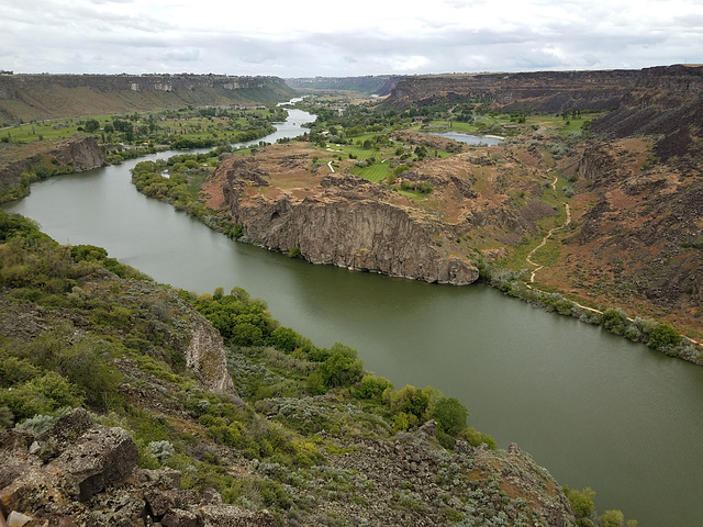
Snake River Canyon


Twin Falls, Idaho. Looking downstream (west) from near the southern end of the I.G. Perrine (US Highway 93) bridge. I thought the golf course nestled improbably amongst the craggy outcrops was an interesting touch! As I've noted elsewhere, this canyon was scoured and deepened about 18K years ago by the so-called Bonneville Flood, when Pleistocene Lake Bonneville overtopped a drainage divide into the Snake's drainage basin. The resulting rapid downcutting led to the natural equivalent of a dam failure. Lake Bonneville covered much of western Utah (the Great Salt Lake is a highly shrunken remnant), and it suddenly lost the top few hundred feet of water depth as a result of the flood. Geomorphological evidence indicates that at peak flow this canyon was filled brim to brim.
Gudrun, Tractacus, Pam J, William Sutherland have particularly liked this photo
- Keyboard shortcuts:
Jump to top
RSS feed- Latest comments - Subscribe to the comment feeds of this photo
- ipernity © 2007-2025
- Help & Contact
|
Club news
|
About ipernity
|
History |
ipernity Club & Prices |
Guide of good conduct
Donate | Group guidelines | Privacy policy | Terms of use | Statutes | In memoria -
Facebook
Twitter

Admired in:
www.ipernity.com/group/tolerance
Sign-in to write a comment.