Godber Mine
Distance
Sinking Behind a Cloud
Grand Prismatic Hot Spring - Yellowstone National…
The Trail Ahead
Relaxed ?
Fourth of July Lake
Lower Blue Lake
US - Huntingdon, OR. - Farewell Bend State Park
US - Huntingdon, OR. - Farewell Bend State Park
US - Huntingdon, OR. - Farewell Bend State Park
US - Boise, ID.
US - Boise, ID. - US Bank Plaza
US - Boise, ID. - Idaho State Capitol
US - Boise, ID. - Basque Center
US - Boise, ID. - Basque Block
US - Chicago, IL. - O'Hare Airport
Vista
US - Twin Falls, ID. - Shoshone Falls
US - Twin Falls, ID. - Shoshone Falls Park
US - Twin Falls, ID. - Perrine Bridge
US - Twin Falls, ID. - Snake River Canyon
US - Twin Falls, ID. - Snake River Canyon
Woods Lake
Pacific Crest Trail
Tenacity
Cole
Death Valley Sunset
Rhyolite Train Station
Last Chance Creek
Mail-order car
Erosion!
Mustangs!
Frenchman Creek/Lake
Wedge Overlook
1957 Ford
Pacific Crest Trail
The three-eyed monster
1958 Edsel
Buckhorn Wash
Road locomotive?
Zabriskie Point
Buckhorn Reservoir
Salina Creek
Topped off!
Location
Lat, Lng:
You can copy the above to your favourite mapping app.
Address: unknown
You can copy the above to your favourite mapping app.
Address: unknown
See also...
See more...Keywords
Authorizations, license
-
Visible by: Everyone -
All rights reserved
-
706 visits
Pony Express route


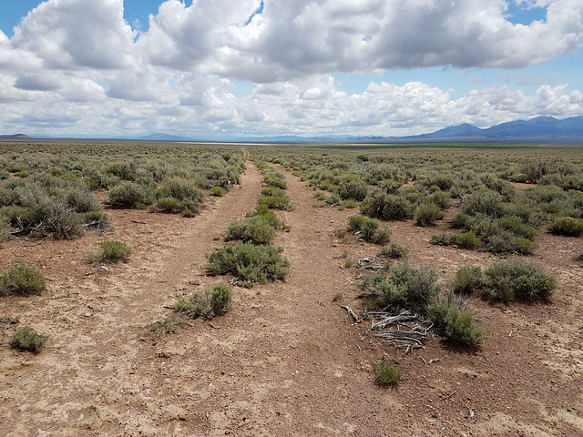
The Pony Express was a short-lived (1860-61) express mail route to California that used relays of horses between stations about 10 miles apart all across the West. It became highly romanticized, and is still remembered today, because one of the young riders was William ("Buffalo Bill") Cody, who decades later dramatized the operation in his Wild West Show. The service, which never made money, was rendered obsolete by the completion of the transcontinental telegraph in October 1861. This section is by Dry Creek in Lander County, central Nevada. View is looking east back across Bean Flat. There was supposed to be one of the stations near here, and we were looking to see if we could find a foundation, or something, but evidently the site is now on private land. The stations were, for obvious reasons, located at water sources, and so it probably was in the drainage of (not completely) Dry Creek, now the location of an active ranch. Interpretive signs (inset) here and there mark the route. Modern US 50 ("The Loneliest Road") parallels the route a couple of miles to the south (off to the right of the picture).
Rrrolf, Smiley Derleth, Ruebenkraut and 2 other people have particularly liked this photo
- Keyboard shortcuts:
Jump to top
RSS feed- Latest comments - Subscribe to the comment feeds of this photo
- ipernity © 2007-2025
- Help & Contact
|
Club news
|
About ipernity
|
History |
ipernity Club & Prices |
Guide of good conduct
Donate | Group guidelines | Privacy policy | Terms of use | Statutes | In memoria -
Facebook
Twitter

Admired in:
www.ipernity.com/group/tolerance
Sign-in to write a comment.