Alan Drury's photos
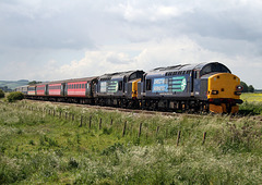
47583 COUNTY OF HERTFORDSHIRE crossing Ais Gill Vi…
| |
|
|
|
37412 LOCH LOMMOND approaching Tynedrum Lower Stat…
| |
|
92037 SULLIVAN working 4S43 Daventry - Mossend `Te…
| |
|
|
37606+37611 on 1Z47 Cardiff - York & Scarborough a…
| |
|
|
|
SS SIR WALTER SCOTT at Stronachlachar Pier.Loch Ka…
| |
|
|
|
SS Sir Walter Scott is a small steamship that has provided pleasure cruises and a ferry service on Loch Katrine in the scenic Trossachs of Scotland for more than a century, and is the only surviving screw steamer in regular passenger service in Scotland. It is named after the writer Walter Scott, who set his 1810 poem Lady of the Lake, and his 1818 novel Rob Roy around Loch Katrine.
In 1859 Loch Katrine became Glasgow's main water supply, connected by aqueducts and tunnels to the city more than 30 miles (48 km) away through a hilly landscape. The Trossachs became very popular in the Victorian era, and there were early steamship services on the loch. The Loch is surrounded by wooded mountains, and has romantic historical connections including the birthplace of the outlaw Rob Roy MacGregor. Queen Victoria had a holiday house built overlooking the loch.
William Denny and Brothers built Sir Walter Scott as a "knock-down" ship; that is, it was assembled with bolts and nuts at Denny's shipyard at Dumbarton on the River Leven, the pieces numbered and dismantled again, transported in pieces by barge up Loch Lomond and overland by horse-drawn cart to Stronachlachar pier on Loch Katrine and there rebuilt with rivets and launched. Denny's assembled Sir Walter Scott at their yard in 1899 and completed its reassembly and launch on the loch in 1900.
All ships in the UK must record a measured mile for seaworthiness. Sir Walter Scott completed its measured mile on the Firth of Clyde when bolted together, before being disassembled, transported to Loch Katrine and riveted together again.
Its original cost was £4,269, which included a delivery charge of £2,028.
Sir Walter Scott weighs 115 tons, is 110 feet (34 m) long and has a 19 feet (5.8 m) beam. It is powered by its original three-cylinder triple-expansion steam engine and has two locomotive-type boilers[clarification needed] which until the end of 2007 were fired by solid fuel fed into the firebox by a stoker. At a time when most steamers changed to oil-fired boilers, the Sir Walter Scott kept using solid fuel to meet the requirement of ensuring that Glasgow's water supply is not polluted, changing from coal to coke to reduce air pollution. In a refit at the end of the 2007 season the boilers were altered to run on biofuel. During this refit, the superstructure was rebuilt and a forward deck cabin was added. Some consider the modified superstructure an abomination, destroying the classic lines of this Victorian era steamer. The vessel has a crew of five.
Sir Walter Scott sails from Trossachs pier at the east end of the loch, 7 miles (11 km) north of Aberfoyle) and runs a ferry service 8 miles (13 km) west along the loch to Stronachlachar pier, in the morning and afternoon in spring and summer, taking walkers and cyclists who return by land, then takes those embarking at the pier and those doing the round trip back to Trosachs pier. In the afternoon it also does one or more shorter scenic cruises. In the winter it is taken up on a slipway for maintenance work.
Memorial Marker on Last Stand Hill,Little Bighorn…
| |
|
|
This Marker Stone is at the front of the Main 7th Cavalry Memorial on Last Stand Hill
Indian Combatant Marker Stone,Little Bighorn Battl…
| |
|
|
|
US Soldier 7th Cavalry Marker Stone,Little Bighorn…
| |
|
|
US Army Memorial on Last Stand Hill,Little Bighorn…
| |
|
|
|
The Battle of the Little Bighorn, known to the Lakota and other Plains Indians as the Battle of the Greasy Grass and commonly referred to as Custer's Last Stand, was an armed engagement between combined forces of the Lakota, Northern Cheyenne, and Arapaho tribes and the 7th Cavalry Regiment of the United States Army. The battle, which occurred June 25–26, 1876, near the Little Bighorn River in eastern Montana Territory, was the most prominent action of the Great Sioux War of 1876.
The fight was an overwhelming victory for the Lakota, Northern Cheyenne, and Arapaho, led by several major war leaders, including Crazy Horse and Chief Gall, inspired by the visions of Sitting Bull (Tȟatȟáŋka Íyotake). The U.S. 7th Cavalry, including the Custer Battalion, a force of 700 men led by George Armstrong Custer, suffered a major defeat. Five of the 7th Cavalry's twelve companies were annihilated; Custer was killed, as were two of his brothers, a nephew, and a brother-in-law. The total U.S. casualty count included 268 dead and 55 severely wounded (six died from their injuries later),including four Crow Indian scouts and two Pawnee Indian scouts.
Public response to the Great Sioux War varied in the immediate aftermath of the battle, but over the next years and decades Custer and his troops became iconic, heroic figures in American history, a status that lasted into the 1960s. The battle, and Custer's actions in particular, have been studied extensively by historians.
Old Faithful Geyser,Yellowstone National Park,Wyom…
| |
|
|
|
Old Faithful is a cone geyser located in Yellowstone National Park in Wyoming, United States. Old Faithful was named in 1870 during the Washburn-Langford-Doane Expedition and was the first geyser in the park to receive a name. It is a highly predictable geothermal feature; since 2000, it has erupted every 44 to 125 minutes.The geyser, as well as the nearby Old Faithful Inn, is part of the Old Faithful Historic District.
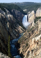
Yellowstone Lower Falls 308ft from Artist Point,Ye…
| |
|
|
|
Yellowstone Falls consist of two major waterfalls on the Yellowstone River, within Yellowstone National Park, Wyoming, United States. As the Yellowstone river flows north from Yellowstone Lake, it leaves the Hayden Valley and plunges first over Upper Yellowstone Falls and then a quarter mile (400 m) downstream over Lower Yellowstone Falls, at which point it then enters the Grand Canyon of the Yellowstone, which is up to 1,000 feet (304 m) deep.
Cascading from the 590,000 year old Canyon Rhyolite lava flow, Lower Yellowstone Falls is the largest volume waterfall in the Rocky Mountains of the United States.These falls (44°43′05″N 110°29′46″W) are 308 feet (94 m) high, or nearly twice as high as Niagara Falls. The volume of water flowing over Lower Yellowstone Falls can vary from 680 cu ft/s (19 m3/s) in the autumn, to 8,400 cu ft/s (240 m3/s) at peak runoff in late springtime.[citation needed] The flow rate of Lower Yellowstone Falls is much less than that of Niagara Falls, as the Yellowstone River is only 70 feet (21 m) at the point at which it goes over the lower falls, whereas the Niagara River is 2,600 feet (790 m) in width as it approaches the crest line of Horseshoe Falls.
Grand Teton Peak from Jenny Lake,Grand Teton Natio…
| |
|
|
Jenny Lake is located in Grand Teton National Park in the U.S. state of Wyoming. The lake was formed approximately 12,000 years ago by glaciers pushing rock debris which carved Cascade Canyon during the last glacial maximum, forming a terminal moraine which now impounds the lake. The lake is estimated to be 423 feet (129 m) deep and encompasses 1,191 acres (482 ha). Jenny Lake is considered to be a major focal point in Grand Teton National Park, with many hiking trails, scenic boat rides, and quick access to the major climbing routes onto the tallest peaks of the Teton Range.
Grand Teton Peak from The Snake River,Teton Nation…
| |
|
|
|
Grand Teton is the highest mountain in Grand Teton National Park, in Northwest Wyoming, and a classic destination in American mountaineering.
Grand Teton, at 13,775 feet (4,199 m), is the highest point of the Teton Range, and the second highest peak in the U.S. state of Wyoming after Gannett Peak. The mountain is entirely within the Snake River drainage basin, which it feeds by several local creeks and glaciers.The Teton Range is a subrange of the Rocky Mountains, which extend from southern Alaska to northern New Mexico.
Bryce Amphitheater from Bryce Point,Bryce Canyon N…
| |
|
|
|
Bryce Canyon National Park /ˈbraɪs/ is a National Park located in southwestern Utah in the United States. The major feature of the park is Bryce Canyon, which despite its name, is not a canyon, but a collection of giant natural amphitheaters along the eastern side of the Paunsaugunt Plateau. Bryce is distinctive due to geological structures called hoodoos, formed by frost weathering and stream erosion of the river and lake bed sedimentary rocks. The red, orange, and white colors of the rocks provide spectacular views for park visitors. Bryce sits at a much higher elevation than nearby Zion National Park. The rim at Bryce varies from 8,000 to 9,000 feet (2,400 to 2,700 m).
The Bryce Canyon area was settled by Mormon pioneers in the 1850s and was named after Ebenezer Bryce, who homesteaded in the area in 1874. The area around Bryce Canyon became a National Monument in 1923 and was designated as a National Park in 1928. The park covers 35,835 acres (55.992 sq mi; 14,502 ha; 145.02 km2) and receives relatively few visitors compared to Zion National Park and the Grand Canyon, largely due to its remote location.
Grand Canyon from Mather Point,Arizona,USA 19th Se…
| |
|
|
|
The Grand Canyon (Hopi: Ongtupqa; Yavapai: Wi:kaʼi:la, Navajo: Tsékooh Hatsoh, Spanish: Gran Cañón) is a steep-sided canyon carved by the Colorado River in the state of Arizona in the United States. It is contained within and managed by Grand Canyon National Park, the Kaibab National Forest, Grand Canyon-Parashant National Monument, the Hualapai Tribal Nation, the Havasupai people and the Navajo Nation. President Theodore Roosevelt was a major proponent of preservation of the Grand Canyon area, and visited it on numerous occasions to hunt and enjoy the scenery.
The Grand Canyon is 277 miles (446 km) long, up to 18 miles (29 km) wide and attains a depth of over a mile (6,093 feet or 1,857 meters).Nearly two billion years of Earth's geological history have been exposed as the Colorado River and its tributaries cut their channels through layer after layer of rock while the Colorado Plateau was uplifted.While some aspects about the history of incision of the canyon are debated by geologists, several recent studies support the hypothesis that the Colorado River established its course through the area about 5 to 6 million years ago. Since that time, the Colorado River has driven the down-cutting of the tributaries and retreat of the cliffs, simultaneously deepening and widening the canyon.
For thousands of years, the area has been continuously inhabited by Native Americans, who built settlements within the canyon and its many caves. The Pueblo people considered the Grand Canyon a holy site, and made pilgrimages to it.The first European known to have viewed the Grand Canyon was García López de Cárdenas from Spain, who arrived in 1540.
46233 DUCHESS of SUTHERLAND at Beckfoot on 1Z23 Ca…
| |
|
|
|
70013 + 48151 on 1Z27 York - Lancaster Help for He…
| |
|
|
|
GNR Class N.2 on 2P13 15.30 Grosmont - Pickering n…
| |
|
|
|


