Earthwatcher's photos with the keyword: ripples
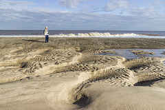
Spurn east beach bank, swales and ripples 2
| 01 Oct 2020 |
|
|
|
A visit to Spurn Point 25
Sand and gravel bars (possibly with a foundation of the Wolstonian age Basement Till) parallel to the coast allow the formation of elongate tidal pools, which become completely flooded by the incoming tide.
In this view the darker clayey gravel bar is in the middle distance on the left. In the foreground are large, metre-scale linguoid ripples: 'swales'. These are highly asymmetrical, with the steep lee sides facing south, indicating a predominant current direction from north to south (left to right). This is consistent with the southward longshore drift along the east of England coast
The linguoid swales in turn display centimetre-scale sand ripples on the stoss slopes. The ripples tend to be more symmetrical, indicating a current direction alternating between northward (to the left) flow on the flooding tide and southward flow (to the right) when the tide is ebbing.
In this photo the incoming tide is just beginning to flood the low swale zone.
Spurn east beach bank, swales and ripples 1
| 01 Oct 2020 |
|
|
|
A visit to Spurn Point 24
Sand and gravel bars (possibly with a foundation of the Wolstonian age Basement Till) parallel to the coast allow the formation of elongate tidal pools, which become completely flooded by the incoming tide.
In this view the darker clayey gravel bar is in the middle distance. In the foreground are large, metre-scale linguoid ripples: 'swales'. These are highly asymmetrical, with the steep lee sides facing south, indicating a predominant current direction from north to south (left to right). This is consistent with the southward longshore drift along the east of England coast
The linguoid swales in turn display centimetre-scale sand ripples on the stoss slopes. The ripples tend to be more symmetrical, indicating a current direction alternating between northward (to the left) flow on the flooding tide and southward flow (to the right) when the tide is ebbing.
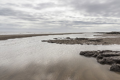
Spurn Neck view south
| 01 Oct 2020 |
|
A visit to Spurn Point 6
Looking southwards from Spurn Neck at low tide. Sand and clayey gravel bars parallel to the coast allow the formation of elongate tidal pools, which become completely flooded by the incoming tide.
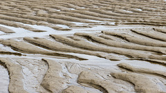
Spurn Neck sand ripples 2
| 01 Oct 2020 |
|
|
A visit to Spurn Point 4
Spurn Neck eastern low tide zone.
Asymmetric ripples in beach sand, presumably formed by the previous flood tide(s). The steeper, lee, side of the ripples face west (left); the gentle, stoss, sides face east (right). This indicates that these ripples were formed by water flow moving from right to left, i.e. by the incoming tide. They have clearly survived the previous ebbing tide, suggesting that the incoming tide flows faster than the ebb.
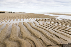
Spurn Neck sand ripples 1
| 01 Oct 2020 |
|
|
|
A visit to Spurn Point 3
Spurn Neck eastern low tide zone.
Asymmetric ripples in beach sand, presumably formed by the previous flood tide(s). The steeper, lee, side of the ripples face west (left); the gentle, stoss, sides face east (right). This indicates that these ripples were formed by water flow moving from right to left, i.e. by the incoming tide. They have clearly survived the previous ebbing tide, suggesting that the incoming tide flows faster than the ebb.
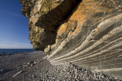
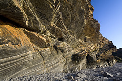
Upside-down rocks at Millook Haven, Cornwall
| 30 Sep 2009 |
|
|
|
The is an unusual detail view of the rocks at Millook Haven, north Cornwall.
The striped rocks are turbidites belonging to the Crackington Formation (upper Carboniferous). Way-up structures in the sandstone bands such as fining-up sequences, small-scale slump structures, ripple marks and grooves, etc, demonstrate that these northward dipping rocks (part of the famous chevron fold sequence) have been inverted and are upside-down.
Folded and inverted turbidites at Millook Haven, C…
| 01 Oct 2009 |
|
An unusual view of the intensely folded turbidite sequence in the Crackington Formation (upper Carboniferous) at Millook Haven, north Cornwall.
The northward-dipping limbs of the folds e.g. the striped sequence in the lower left quadrant are the inverted (upside-down) limbs.
Millook Haven cliff detail 6
| 01 Oct 2009 |
|
Detail of part of the turbidite sequence of the Crackington Formation (upper Carboniferous) at Millook Haven, north Cornwall, lit by the late afternoon sun.
This photo shows alternating sandstone (pale) and shale bands on the inverted limb of one of the recumbent chevron folds. The compass-clinometer is located on the stratigraphic base of one of the sandstone bands, which displays a fining-up sequence (in this case downwards, since it is inverted). Just to the left of the compass-clinometer, the coarser sandstone base has slumped stratigraphically down (in this case appearing up) into the underlying muddy layer (now grey shale).
This shows how you can use sedimentary structures to deduce whether the rocks are the right way up, or whether as in this case, they have been subsequently turned upside-down.
Jump to top
RSS feed- Earthwatcher's latest photos with "ripples" - Photos
- ipernity © 2007-2025
- Help & Contact
|
Club news
|
About ipernity
|
History |
ipernity Club & Prices |
Guide of good conduct
Donate | Group guidelines | Privacy policy | Terms of use | Statutes | In memoria -
Facebook
Twitter

