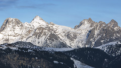
Bergfex's photos with the keyword: Karst
Summit Cross 'Upgrade' (see PiP)
| 22 Aug 2020 |
|
|
|
The old summit cross (see PiP) was replaced on September 1, 2019 by a new one, which was made by a local company using all the finesse of modern metalworking. It was donated by MICRO-EPSILON MESSTECHNIK GmbH & Co. KG from Ortenburg (district of Passau, Germany)
~~~~~
Das alte Gipfelkreuz (siehe PiP) wurde am 1. September 2019 durch ein neues ersetzt, das unter Anwendung aller Rafinessen moderner Metallbearbeiteung von einer heimischen Firma angefertigt wurde. Gestiftet wurde es von der MICRO-EPSILON MESSTECHNIK GmbH & Co. KG aus Ortenburg (Landkreis Passau, Deutschland)
~~~~~
Within the Lofer Mountains
| 17 Aug 2020 |
|
|
|
The "path" from the Schmidt Zabierow Hut (1,966 m) over the karstified high plateau to the Wehrgrubenjoch (2,218 m, Lofer Mountains, Austria).
~~~~~
Der "Weg" von der Schmidt-Zabierow-Hütte (1.966 m) über das verkarstete Hochplateau zum Wehrgrubenjoch (2.218 m, Loferer Steinberge, Österreich).
~~~~~
Der PoV ist hier eingetragen:
The Nuarach Trail
| 03 Dec 2016 |
|
|
|
Directly underneath the summit of the Mitterhorn the Nuarach Tail takes course. It's one of the most beautiful trails within the Tyrolese Limestone Alps. Here the descent to the valley begins. Four hours later you'll be in St. Ulrich at Pillersee. A taxi takes you back to your car.
~~~~~
Direkt unterhalb des Mitterhorn-Gipfels verläuft der Nuaracher Höhenweg - einer der schönsten Höhenwanderwege der nördlichen Kalkalpen. Von hier aus steigt man in rund vier Stunden wieder talwärts ab und gelangt nach St. Ulrich am Pillersee. Mit dem Taxi kommt man zurück zu seinem Auto im Loferer Hochtal.
You're Never Alone
| 03 Dec 2016 |
|
|
|
On top of Mitterhorn (2.506m, Tyrol, Austria), eight and a half hours after starting.
(NO, it's not me!)
~~~~~
Auf dem Gipel des Mitterhorn (2.506m, Loferer Steinberge, Tirol), achteinhalb Stunden nach dem Aufbruch im Tal.
(NEIN, das bin nicht ich!)
Dizzy Height
| 22 Aug 2020 |
|
|
|
In the Via Ferrata 'Naked Dog' in the Lofer Stone Mountains (provinces of Salzburg and Tyrol, Austria). It's a little 'breezy' up there.
(Captured by my wife)
~~~~~
Im Klettersteig 'Nackter Hund' in den Loferer Steinbergen (Bundesländer Salzburg und Tirol, Österreich). Es ist etwas 'luftig' dort oben.
(Aufgenommen von meiner Frau.)
~~~~~
Alongside the Abyss
| 02 Dec 2016 |
|
|
|
Sometimes the fixed rope route to the Mitterhorn seems to be a trail within the Dolomites.
~~~~~
Streckenweise ähnelt der Klettersteig auf das Mitterhorn einer Route in den Dolomiten.
To the Mitterhorn via "Naked Dog"
| 01 Dec 2016 |
|
|
|
From the 'Wehrgrubenjoch' the trail leads northwards. Here at 2.300 meters of altitude it is noticable cooler. Some people realize first symptoms of mountain sickness by tackling more than 1.500 meters within a single day. They are getting a little bit breathless, the alertness declines, a daze feeling may raise. Therefore it's advisable to be double alert within this karst landscape and to go consciouly slow.
(7 hours after the start - photo stops and a little rest included)
~~~~~
Vom Wehrgrubenjoch geht es nordwärts. Hier auf 2.300 Metern Höhe ist es deutlich kälter als unten im Tal. Und manch eine (r) spürt bei mehr als 1.500 Metern Aufstieg an einem einzigen Tag auch leichte Symptome der Höhenkrankheit: Man wird kurzatmiger, die Konzentration lässt nach, leichte Benommenheit stellt sich ein. Dann heißt es doppelt aufzupassen in diesem karstigen Gelände und bewusst langsam zu gehen.
(7 Stunden nach dem Start, incl. Fotostopps und Frühstückspause)
Mitterhorn, 2.506m
| 01 Dec 2016 |
|
|
|
The Mitterhorn within the Lofer Mountains, Tyrol (Austria).
(Captured from Hochkogel (1.066m), near Fieberbrunn (Austria) via a distance of 16 kilometers.)
~~~~~
Das Mitterhorn in den Loferer Steinbergen (Tirol).
(Aufgenommen aus 16 km Entfernung vom Hochkogel (1.066m) in der Nähe von Fieberbrunn (Tirol).)
Lofer Mountains from the West
| 01 Dec 2016 |
|
|
|
Long distance view (~30 km) to the Lofer Mountains from the West. (Captured in the late afternoon from a mountain called "Astberg", situated near Oberndorf in Tyrol, Austria. Cutout of the original capture. Effective focal length = 310mm.) The prominent summit left-hand, which looks like a pyramid, is the Mitterhorn (2.506m). See PiP to identify the other summits.)
~~~~~
Blick auf die Loferer Steinberge aus großer Ferne (~30km) von Westen her. (Aufgenommen vom Astberg, Nähe Oberndorf in Tirol, an einem späten Nachmittag. Effektive Brennweite 310mm (Ausschnitt + Crop-Faktor). Der markante pyramidenförmige Gipfel links ist das Mitterhorn (2.506m). Übrige Gipfel siehe PiP.)
~~~~~
Ein Bild von der anderen Seite zeigt volker_hmbg :
www.ipernity.com/doc/564349/43946930
Mountaineers Dreams
| 30 Nov 2016 |
|
|
|
"Don't think you're poor, because dreams didn't become reality.
Really poor is only, who didn't have dreams." (Marie von Ebner-Eschenbach, written on the summit cross of the 'Kreuzreifhorn' at the very left in the picture.)
View from Wehrgrubenjoch (2.218 m, Lofer Mountains, Austria) to the southwest. Directly behind the rock edge in the foreground, the path goes steeply down to the Ulricher Grube, which leads to the Pillerseetal . The summits opposite belong to the >Reifhorn .
~~~~
"Nenne Dich nicht arm, weil Träume nicht in Erfüllung gegangen sind.
Wirklich arm ist nur der, der nie geträumt hat." (Marie von Ebner-Eschenbach, Inschrift auf dem Gipfelkreuz des Kreuzreifhorn, ganz links im Bild.)
Blick vom Wehrgrubenjoch (2.218 m, Loferer Steinberge, Österreich) nach Südwesten. Direkt hinter der Felskante im Vordergrund geht es steil abwärts in die Ulricher Grube, die ins Pillerseetal führt. Die Gipfel gegenüber gehören zum Reifhorn .
~~~~~
Jump to top
RSS feed- Bergfex's latest photos with "Karst" - Photos
- ipernity © 2007-2025
- Help & Contact
|
Club news
|
About ipernity
|
History |
ipernity Club & Prices |
Guide of good conduct
Donate | Group guidelines | Privacy policy | Terms of use | Statutes | In memoria -
Facebook
Twitter


