Bergfex's photos with the keyword: Hintersee
Schärtenspitze
| 08 Oct 2018 |
|
|
|
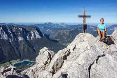
Rest at the summit of the Schärtenspitze (2.153m) after 1.200 meters ascent from the bike depot. On the lower left side of the valley you can see the starting point of the tour, the lake Hintersee near Ramsau (Bavaria, Germany). (In the background the Chiemgau Alps.)
~~~~~
Gipfelrast auf der Schärtenspitze (2.153m) nach 1.200 Metern Aufstieg vom Bike-Abstellplatz. Links unten im Tal ist der Ausgangspunkt der Tour, der Hintersee bei Ramsau (Bayern) zu sehen. (Im Hintergrund die Chiemgauer Alpen.)
Bike & Hike
| 06 Oct 2018 |
|
|
|
In terms of altitude, the savings are often not great. Here it was only 160 meters (from 790 to 950) until the forest road was closed for mountain bikers. But for the 6 km distance to the car park the bike was a huge relief, especially on the way back. (Captured at lake Hintersee near Ramsau (Bavaria, Gemany).
~~~~~
Bei den Höhenmetern ist die Ersparnis oft nicht groß. Hier waren es nur 160 Höhenmeter (von 790 auf 950), bis der Forstweg für Mountainbiker gesperrt war. Danach ging es nur noch zu Fuß weiter. Aber für die 6 km Entfernung zum PKW-Parkplatz war das Rad vor allem beim Rückweg eine riesige Erleichterung. (Aufgenommen am Hintersee bei Ramsau (Bayern).
~~~~~
Our goal / unser Ziel:
(Der Blaueis-Gletscher)
Dead Ice (2)
| 06 Oct 2018 |
|
|
|
The Blue Ice Glacier in the Berchtesgaden Alps (Bavaria, Germany), captured from the lower end of the dead ice field at about 1,900 m above sea level.
~~~~~
Der Blaueis-Gletscher in den Berchtesgadener Alpen (Bayern), aufgenommen vom unteren Ende des Toteis-Feldes auf ca. 1.900 m Seehöhe.
~~~~~
(4 Stunden zuvor vom Tal her aufgenommen)
Dead Ice (1)
| 06 Oct 2018 |
|
|
|
The Blue Ice Glacier in the Berchtesgaden Alps (Bavaria, Germany), captured from the lower end of the dead ice field at about 1,900 m above sea level.
~~~~~
Der Blaueis-Gletscher in den Berchtesgadener Alpen (Bayern), aufgenommen vom unteren Ende des Toteis-Feldes auf ca. 1.900 m Seehöhe.
~~~~~
A "Standard Path"
| 07 Oct 2018 |
|
|
|
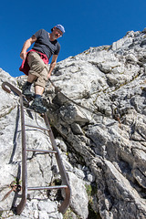
While the Blaueisspitze and the Hochkalter require mountaineering skills, the neighbouring Schärtenspitze (2.153m) is relatively easily accessible. Here we just met a descending hiker.
~~~~~
Während die Blaueisspitze und der Hochkalter bergsteigerisches Können erfordern, ist die benachbarte Schärtenspitze (2.153m) relativ leicht zugänglich. Hier begegnete uns gerade ein absteigender Wanderer.
www.outdooractive.com/de/bergtour/berchtesgadener-land/schaertenspitze-aufstieg-ueber-blaueishuette-abstieg-ueber-hochalm-/9173531
Blaueis Hut
| 07 Oct 2018 |
|
|
|
View back into the valley when climbing the Schärtenspitze (2.153m). On the lower right in the picture the famous Blaueis-Hütte (1.651m) with the beautiful sun terrace. Here one should absolutely stop and treat oneself to a piece of homemade cake.
~~~~~
Blick zurück ins Tal beim Aufstieg auf die Schärtenspitze (2.153m). Rechts unten im Bild die berühmte Blaueis-Hütte (1.651m) mit der schönen Sonnenterrasse. Hier sollte man unbedingt einkehren und sich ein Stück hausgemachten Kuchen gönnen.
~~~~~
Hüttenportrait von SERVUS TV (4:46 min):
www.servus.com/at/p/Blaueish%C3%BCtte/1343227636231-2071391747
~~~~~
(The Way up)
Twice Two
| 06 Oct 2018 |
|
|
|
Yesterday morning at the western shore of lake Hintersee near Ramsau (Bavaria, Germany).
~~~~~
Gestern morgen am Westufer des Hintersees bei Ramsau (Bayern).
~~~~~
(Der See etwas später von oben aufgenommen)
H.A.N.W.E. at Hintersee (Bavaria)
| 06 Oct 2018 |
|
|
|
Yesterday morning on the way to the glacier Blaueis above the lake Hintersee near Ramsau (Bavaria, Germany).
~~~~~
Gestern morgen auf dem Weg zum Blaueisgletscher oberhalb des Hintersees bei Ramsau (Bayern).
~~~~~
(Beginn der Tour)
Jump to top
RSS feed- Bergfex's latest photos with "Hintersee" - Photos
- ipernity © 2007-2025
- Help & Contact
|
Club news
|
About ipernity
|
History |
ipernity Club & Prices |
Guide of good conduct
Donate | Group guidelines | Privacy policy | Terms of use | Statutes | In memoria -
Facebook
Twitter


