Bergfex's photos with the keyword: valley
Today's Winter Solstice
| 21 Dec 2024 |
|
|
|
Sunset this afternoon at 16:21.
From tomorrow the days will get longer again.
~~~~~
Sonnenuntergang heute Nachmittag um 16:21 Uhr.
An morgen werden die Tage wieder länger.
~~~~~
Eine halbe Stunde später: Blick auf meinen Heimatort St. Johann in Tirol
Goodbye, Plitvice!
| 27 Oct 2024 |
|
|
|
View down from the hiking trail that leads to the exit of the Plitvice Lakes National Park . And so ends my series of images of the beautiful national park..
~~~~~
Blick hinunter vom Wanderweg, der zum Ausgang des Nationalparks Plitvicer Seen führt. Und damit endet meine Bilderserie von dem wunderschönen Nationalpark.
~~~~~
Martin Busch Hut
| 10 Feb 2023 |
|
|
|
The Martin Busch Hut in the Ötztal Alps at 2,501 metres above sea level.
~~~~~
Die Martin-Busch-Hütte in den Ötztaler Alpen auf 2.501 Metern Seehöhe.
~~~~~
Next Goal: Ötzi Discovery Site (3,210 m)
| 30 Jan 2023 |
|
|
|
The Ötzi site itself is still in the distance (top right). First you walk about 5 kilometres through the valley to the Similaun Hut (535 metres altitude). There you can have a coffee and leave your large luggage there.
~~~~~
Die Ötzi Fundstelle selbst liegt noch in der Ferne (rechts oben). Zunächst geht man knapp 5 Kilometer durch das Tal zur Similaun-Hütte (535 Höhenmeter). Dort gibt es einen Kaffee, und man das das große Gepäck deponieren.
~~~~~
Mill Village of Gschnitz (1)
| 02 Sep 2022 |
|
|
View of the Mill Village Gschnitz during the ascent to the Innsbruck Hut (Gschitztal, Tyrol, Austria)
~~~~~
Blick auf das Mühlendorf Gschnitz beim Aufstieg zur Innsbrucker Hütte (Gschitztal, Tirol, Österreich)
~~~~~
The Mill Village of Gschnitz
| 02 Sep 2022 |
|
|
|
View of the Mill Village Gschnitz during the ascent to the Innsbruck Hut (Gschitztal, Tyrol, Austria)
~~~~~
Blick auf das Mühlendorf Gschnitz beim Aufstieg zur Innsbrucker Hütte (Gschitztal, Tirol, Österreich)
~~~~~
Climbing the 'Habicht' (3,277 m) (1)
| 28 Aug 2022 |
|
|
|
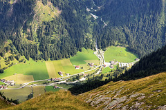
View of the Gschnitztal, a side valley of the Wipptal through which the Brenner motorway runs. You can see the small mountaineering village of Gschnitz (population 427), and at the bottom right the hikers' car park (PiP) at 1,244 metres above sea level. There is no mountain railway. The only way to climb the mountains here is under your own feet. It is accordingly quiet here.
~~~~~
Blick in das Gschnitztal , einem Seitental des Wipptals, durch das die Bernnerautobahn führt. Man sieht das kleine Bergsteigerdorf Gschnitz (427 Einwohner/innen), und ganz unten rechts den Wanderparkplatz (PiP) auf 1.244 Metern Seehöhe. Eine Bergbahn gibt es nicht. Hier kann man die Berge nur mit eigener Kraft erklimmen. Dementsprechend still geht es hier zu.
~~~~~
Via Ferrata dell' Amicizia (17) (with PiP)
| 24 May 2022 |
|
|
|
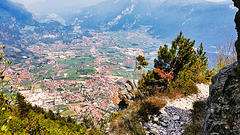
View from the normal path on Cima SAT , which also serves as a descent from the summit, to the north. (For the names of the localities, see PiP).
~~~~~
Blick vom Normalweg auf den Cima SAT , der auch als Abstieg vom Gipfel dient, nach Norden. (Benennung der Ortschaften siehe PiP).
~~~~~
Way Down
| 05 Jun 2020 |
|
|
|
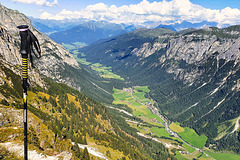
"A mountain is only considered to be climbed if you get back to the valley under your own feet." View from above on the way there, which is also the way back.
~~~~~
"Ein Berg gilt nur dann als bestiegen, wenn man auf eigenen Füßen wieder ins Tal gelangt." Blick von oben auf den Hinweg, der auch der Rückweg ist.
Weißbach bei Lofer
| 30 Jun 2019 |
|
|
|
From this perspective one sees the Saalach Valley with the small village Weißbach near Lofer (Federal State of Salzburg, Austria) descending from the Leoganger mountains.
~~~~~
Aus dieser Perspektive sieht man das Saalachtal mit dem kleinen Ort Weißbach bei Lofer (Bundesland Salzburg, Österreich) beim Abstieg von den Leoganger Bergen.
Val Gardena
| 05 Sep 2018 |
|
|
|
Descent from Cirjoch (2.469m, Group Puez) into Val Gardena . In the valley floor the winding Strada Statale 243 , which leads to the right to the Gardena Pass . Opposite the Sella massif (up to 3.152m altitude).
~~~~~
Abstieg vom Cirjoch (2.469m, Puez-Gruppe) ins Grödnertal . Im Talboden die verwundene Strada Statale 243 , die rechts zum Grödnerjoch führt. Gegenüber der Sellastock (bis 3.152m Höhe).
Preparing SPARTAN
| 04 Sep 2018 |
|
|
|
Training sessions in between, so that the holiday is not a training interruption and the arm strength is maintained. Because in 4 days STPARTAN RACE will be in the neighbouring village Oberndorf (Tirol, Österreich), and this year my wife will also be there. (Picture above taken near the Puez Hut (Dolomites, Italy))
~~~~~
Trainingseinheiten zwischendurch, damit der Urlaub keine Trainingsunterbrechung ist und die Armkraft erhalten bleibt. Denn in 4 Tagen ist das STPARTAN RACE im Nachbarort Oberndorf (Tyrol, Austia), und dieses Jahr ist meine Frau auch dabei. (Bild oben aufgenommen in der Nähe der Puez-Hütte (Dolomiten, Italien))
~~~~~
SPARTAN RACE (own album):
www.ipernity.com/doc/2218680/album/1012426
www.kitzbueheler-alpen.com/de/st-johann/sommer/spartan-race-oberndorf-worlds-best-obstacle-race.html
"She" at the finish line
Thunderstorm Coming
| 02 Sep 2018 |
|
|
|
At the edge of the Langental , near the alpine hut Puezhütte (Dolomites, South Tirol, Italy). In the background the Sass da Ciampac (2.667m).
~~~~~
Am Rand des Langentals , in der Nähe der Puezhütte (Dolomiten, Südtitol, Italien). Im Hintergund der Sass da Ciampac (2.667m).
~~~~~
Blick ins Tal:
Rifugio Puez (Ütia de Puez)
| 02 Sep 2018 |
|
|
|
The alpine hut Puezhütte at 2,475m altitude in the Dolomites (South Tyrol, Italy).
~~~~~
Die Puezhütte auf 2.475m Höhe in den Dolomiten (Südtirol, Italien).
Langental (Dolomites)
| 01 Sep 2018 |
|
|
|
Panoramic view from the Puez Plateau (Dolomites, South Tyrol, Italy) in southwest direction into the Langental . Far in the background the small town of Wolkenstein (Selva Gardena).
~~~~~
Blick vom Puez Plateau (Dolomiten, Südtirol, Italien) Richtung Südwesten ins Langental . Weit im Hintergrund das Städtchen Wolkenstein .
Spring is Near
| 17 Mar 2017 |
|
|
|
Only 3 days until first day of spring. Snow is melting now within the valleys of Tyrol (Austria). What you see here is the Nockeralm in the valley of Vals (1.400 meters of altitude). The gras begins to grow on sunny hillsides. On the second view you'll notice, that it grows better on those areas, which have been cleaned from rotten vegetation.
~~~~~
Noch 3 Tage, dann ist Frühlingsanfang. In den Tiroler Tälern schmilzt jetzt der Altschnee. Hier im Bild zu sehen die Nockeralm im Valser Tal (1.400 m ü.A.). An den sonnigen Hängen kriecht allmählich das Grün bergauf. Wenn man genau hinschaut, sieht man, wie das Gras auch abhängig von der Bearbeitung durch die Bergbauern sprießt. Dort, wo das Altgras weggeharkt wurde, ist das frische Gras schon weiter.
~~~~~
To the other direction:
Early Spring Flowers
| 05 Mar 2017 |
|
|
|
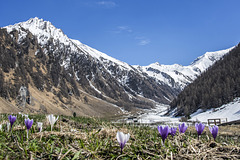
View into the valley Valser Tal (North Tyrol, Austria, aprox. 1.400 m of altitude at the fotopoint). Left-hand in the background the Hohe Wand (Croda Alta, 3.289m). Right-hand the Kraxenträger (La Geria, 2.988m). The ridge, which interlinks the two summits, is the borderline between Italy and Austria.
Mountaineers might treat a pass right-hand from Kraxenträger. The oddity of this tour is the alpine hut Landshuter Europahütte , situated on top of the alpine pass - exactly on the border. (The borderline runs midst through the guest room. You may choose to take your meal on Austrian territory or on Italian, but in the same room.) It takes approximately five hours to arrive it from the fotopoint.
Under botanical aspects the shown crocusses ( Alpenkrokus ,Crocus vernus) are unique, as they bloom out of the melting snow.
~~~~~
Blick in den Talschluss des Valser Tals (Nordtirol, an dieser Stelle ca. 1.400 m ü.A.). Im Hintergrund links die Hohe Wand (Croda Alta, 3.289m) und rechts der Kraxentrager (La Geria, 2.988m). Auf dem Grat, der die beiden Gipfel verbindet, verläuft die Grenze zwischen Italien und Österreich. Er ist zeimlich unüberwindbar.
Für Wanderer gibt es allerdings rechts am Kraxenträger vorbei einen Weg. Die Tour ist insofern erwähnenswert und kurios, weil oben auf der Passhöhe (Friedrichshöhe) die Landshuter Europahütte steht. Wanderer mit guter Kondition erreichen sie vom Fotopoint aus in etwa 5 Stunden - und stehen dann in einem Gastraum, durch dessen Mitte die Ländergrenze verläuft. Je nachdem, für welchen Tisch man sich entscheidet, speist man also entweder in Italien oder in Österreich.
Botanisch faszinieren mich die abgebildeten Alpenkrokusse (Crocus vernus) vor allem deshalb, weil sie praktisch aus dem Schnee heraus erblühen. Mit den Knollen noch im frostkalten Schmelzwasser, bilden sie bei den ersten Sonnenstrahlen diese wunderschönen Blüten.
Nothing for Half-Hearted
| 18 Nov 2016 |
|
|
|
Because the difference of altitude from the foto point down to the gravel pit is aproxx. 700 meters.
(Stitched from 4 captures 11mm)
~~~~~
Kein guter Platz für Ängstliche. Denn hier geht es 700 Meter senkrecht in die Tiefe.
(Bild zusammengesetzt aus 4 Aufnahmen mit 11mm Weitwinkel)
~~~~~
View from the opposite:
upload.wikimedia.org/wikipedia/commons/a/a8/Haltstock_von_osten_mit_kopft%C3%B6rlgrat.jpg
or:
www.stadler-markus.de/alpinklettern/wilder-kaiser/kletterrouten/gamshalt.html
Jump to top
RSS feed- Bergfex's latest photos with "valley" - Photos
- ipernity © 2007-2025
- Help & Contact
|
Club news
|
About ipernity
|
History |
ipernity Club & Prices |
Guide of good conduct
Donate | Group guidelines | Privacy policy | Terms of use | Statutes | In memoria -
Facebook
Twitter


