Bergfex's photos with the keyword: landscape
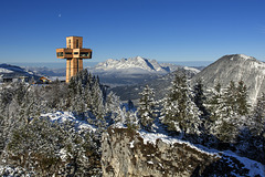
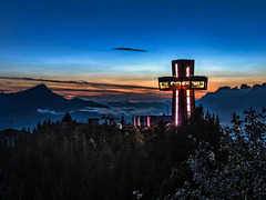
Jakob's Cross in Tyrol (Austria) - Original Photo
Jakob's Cross in Tyrol (Austria) - With Cloudy Sky
| 05 Dec 2020 |
|
|
|
All Sky Replacement with LUMINAR
Don't miss this video. This software is really impressing!
Forget PicMonkey . . .
~~~~~
Original Dramatic
Millions of Fallen Trees
| 11 Oct 2019 |
|
|
|
View from the via ferrata Rotwand down to the Karerpass and Karersee , where almost all trees fell victim to a terrible autumn storm in November 2018.
article: When millions of trees fall down
~~~~~
Blick vom Rotwand-Klettersteig hinab auf der Karerpass und Karersee , wo im November 2018 fast alle Bäume einem furchtbaren Herbtststurm zum Opfer fielen.
Artikel: Wenn Millionen Bäume fallen
On Top of the "Rose Garden"
| 11 Oct 2019 |
|
|
|
On top of the Rotwandspitze (Roda di Vael, 2,806 m, Dolomites, South Tyrol, Italy).
~~~~~
Auf der Rotwandspitze (Roda di Vael, 2.806 m, Dolomiten, Südtirol, Italien).
~~~~~
Kaiser Mountains Tyrol
| 21 Jan 2019 |
|
|
|
View from Brandstadl (1650m) at Scheffau (Tyrol, Austria) to the Wilden Kaiser.
~~~~~
Blick vom Brandstadl (1650m) bei Scheffau (Tirol, Österreich) auf den Wilden Kaiser.
~~~~~
(from far away)
Kaiser Mountains (Tyrol)
| 25 Feb 2017 |
|
|
|
Break of dawn over the Kaiser Mountains in Tyrol (Austria), captured from the summit of the Buchensteinwand (1.456m). Lefthand in the foreground is the new Cross of Saint James (established in 2014).
~~~~~
Mörgendämmerung über dem Kaisergebirge (Tirol), aufgenommen vom Gipfel der Buchensteinwand (1.456m, Tirol, Österreich). Links im Vordergrund das im Juli 2014 neu errichtete Jakobskreuz.
~~~~~
20 minutes later:
H.F.F. - Cross of Saint James
| 24 Feb 2017 |
|
|
|
Sunrise on summit of the Buchensteinwand (St. Jakob, Tyrol, Austria) with the cross of Saint James on its top.
~~~~~
Sonnenaufgang auf der Buchensteinwand (St. Jakob i.H., Tirol) mit dem Jakobskreuz auf dem Gipfel.
~~~~~
The Cross of Saint James
| 07 Dec 2016 |
|
|
|
The highest accessible summit cross of the world - the Jakobskreuz in St. Jakob (Tyrol, Austria). It was established on top of the Buchensteinwand (1.456m) in 2014. In the background you see the Kaiser Mountains .
~~~~~
Das höchste begehbare Gipfelkreuz der Welt - das Jakobskreuz in St. Jakob (Tirol, Österreich). Es wurde 2014 auf dem Gipfel der Buchensteinwand (1.456m) errichtet. Im Hintergrund das Kaisergebirge.
~~~~~
At sunrise:
It's Wintertime!
| 13 Dec 2016 |
|
|
|
Tonight is snowed in Tyrol!
(Here you see the "Hinterkaiser" in North Tyrol, Austria)
~~~~~
Freude über Freude: Gestern und heut Nacht hat's in Tirol endlich geschneit!
(Hier im Bild der Hinterkaiser in Nordtirol vor einem Jahr.)
~~~~~
Webcam:
www.bergfex.at/sommer/wilder-kaiser/webcams/c114
Alongside the Road
| 26 Dec 2016 |
|
|
|
Launch sites are not easily to be found in wintertime.
~~~~~
Startplätze sind rar im Winter.
~~~~~
Aerial photo while ballooning near Walchsee (Tyrol, Austria), January 2016.
View across the whole valley:
The blower:
Continuing . . .
Up and Away
| 26 Dec 2016 |
|
|
|
A little bit later.
~~~~~
Kurz nach dem Start.
~~~~~
Kaiserwinkl Ballooning near Walchsee (Tyrol, Austria), January 2016.
* Ascension *
| 26 Dec 2016 |
|
|
|
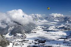
Ballooning across the lake 'Walchsee', which is situated between the 'Kaiser Mountains' (right-hand) and the 'Chiemgau Alps' (left-hand). Viewe from west to east. Left-hand in the foreground the village Walchsee . In the middle of the background, below the yellow-green balloon, the village of Kössen .
Have a nice Boxing Day!
~~~~~
Ballonfahrt über den Walchsee, der zwischen dem Kaisergebirge (rechts) und den Chiemgauer Alpen (links) liegt. Blick von Westen nach Osten. Im Vordergrund links unten die Gemeinde Walchsee . In der Bildmitte hinten - unter dem grüngelben Ballon - die Gemeinde Kössen .
Einen wunderschönen 2. Weihnachtstag wünsch ich euch!
~~~~~
Kaiserwinkl Ballooning near Walchsee (Tyrol, Austria), January 2016.
Closer to the lake:
Ice Circles
| 27 Dec 2016 |
|
|
|
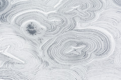
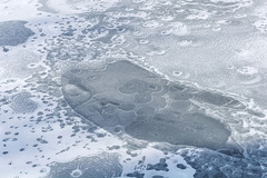
I never saw those structures before.
The reason is exciting:
3. With regard to the lake Walchsee it means: The water of this lake is heavily contaminated with dead organic particles, which are washed in by the tributary waters. As time goes by they sink to the bottom of the lake, forming a layer of dead organic material there. Step by step this material decomposites and forms marsh gas. (This phenomenon is well known. You may watch it at lakes or pools in forests.) The gas rises in bubbles. But within the Walchsee they only have 21 meters of altitude to ascend. Therefore they stay less than bubbles within the lake Baikal, which has a depth of 1.600 meterns. That's the reason why the ice circles on the Walchsee are smaller.
~~~~~
Ich hab nie zuvor solche Eisstrukturen gesehen.
Die Erklärung ist erstaunlich:
3. übertragen auf den Walchsee bedeutet das: Das Wasser des Walchsees ist stark mit toten organischen Partikeln belastet, welche durch die Zuflüsse eingetragen werden und im See allmählich auf den Grund sinken. Dort bildet sich eine Schicht aus totem organischen Material, dass sich allmählich zersetzt. (Dieses Phänomen ist bekannt und weit verbreitet. Man kann es in vielen kleinen Waldtümpeln beobachten.) Dabei entsteht sog. Sumpfgas, das in Blasen aufsteigt. Die Gasblasen haben im Walchsee allerdings nur bis zu 21m Aufstiegshöhe. Deshalb bleiben sie kleiner als im Baikalsee mit seinen 1.600 Metern Wassertiefe, wo sich die kleinen Bläschen beim Aufsteigen zu großen Blasen vereinigen können. Die Eiskreise auf dem Walchsee sind deshalb kleiner.
~~~~~~
Aerial photo while ballooning near Walchsee (Tyrol, Austria), January 2016.
Disclosing the secret, part 1:
Disclosing the secret, part 2:
Amazing Structures
| 27 Dec 2016 |
|
|
|
I never saw those structures before.
The reason is exciting.
2. This phenomenon is known from elsewhere: The phenomenon of ice circles has bee described in 1882. But it didn't evoke interest of scientists before 1995, when very large ice circles were seen on satellite photographs of lake Baikal with diameters of some kilometers. As recently as 2009 those ice circles were explored. Measurements of temperature and flow underneath the frozen surface uncovered the mystery.
Beneath the ice circles large vortices are stirring. Those circulating waters cause the dark ringlike structures. The vortices originate from ascending methane bubbles, which are developping by decomposing of organic materials at the bottom of the lake. The bubbles take warm waters on their way up. A vertical flow results, which is circling under the influence of the Coriolis force - in the same manner as waters do within the plug hole of an wash-bowl, but reverse.
www.spiegel.de/wissenschaft/natur/a-674932.html
If you know, what you have to be looking for, you'll find some more interesting pictures within the worldwide web:
www.leidorf.de/images/dzoom/grafik/1Ds38720_Eis.jpg
~~~~~
Ich hab nie zuvor solche Eisstrukturen gesehen.
Die Erklärung ist erstaunlich:
2. ist das Phänomen von anderswo bekannt: Das Phänomen der Eiskreise wurde schon 1882 beschrieben, erweckte aber erst 1995 wissenschaftliches Interesse, weil auf Satellitenaufnahmen kilometergroße Eiskreise auf dem Baikalsee entdeckt wurden. Erst 2009 wurden diese Eiskreise genauer erforscht. Temperatur- und Strömungsmessungen unter der Eisoberfläche brachten die Erklärung.
Unter den Eiskreisen bewegen sich Strudel. Das kreisförmig zirkulierende Wasser verursacht die dunklen Ringstrukturen im Eis. Ursache für die Strudel ist aufsteigendes Methangas aus sich zersetzendem Pflanzenmaterial am Boden des Sees. Die Gasblasen nehmen wärmeres Wasser mit hoch. Es entsteht eine Aufwärtsströmung, die sich unter dem Einfluss der Corioliskraft zu drehen beginnt - wie das Wasser im Abfluss eines jeden Waschbeckens, nur umgekehrt herum.
www.spiegel.de/wissenschaft/natur/a-674932.html
Wenn man weiß, wonach man suchen soll, findet man übrigens weitere interessante Aufnahmen:
www.leidorf.de/images/dzoom/grafik/1Ds38720_Eis.jpg
~~~~~
Aerial photo while ballooning near Walchsee (Tyrol, Austria), January 2016.
Disclosing the secret, part 1:
Disclosing the secret, part 3:
Patterns of Nature
| 27 Dec 2016 |
|
|
|
I never saw those structures before.
The reason is exciting:
1. some background: The lake 'Walchsee' is of natural origin with a depth of approximately 21 meters. Two thirds of his waters come from forests and from nature, one third comes from agricultural land. Therefore the water has a hight concentration of organic particles (no chlorellas, but died off plant materials). The visibility is only 3,5 meters on average. In summertime the temperature of water rises up until 23 degrees centigrade. Therefore this lake is very popular for swimming.
de.wikipedia.org/wiki/Walchsee_%28See%29
~~~~~
Ich hab nie zuvor solche Eisstrukturen gesehen.
Die Erklärung ist erstaunlich:
1. muss man dazu wissen: Der Walchsee ist ein bis zu 21m tiefer Trogsee natürlichen Ursprungs. Zwei Drittel seines Wassers stammt aus Wäldern und der Natur, ein Drittel von landwirtschaftlich genutzten Flächen. Das Wasser hat deshalb eine hohe Konzentration an organischen Partikeln (keine Algen, sondern abgestorbenes Pflanzenmaterial). Die mittlere Sicht beträgt nur 3,5 m. Im Sommer erreicht der See dadurch eine Wassertemperatur von 23 Grad, was ihn zu einem beliebten Badesee macht.
de.wikipedia.org/wiki/Walchsee_%28See%29
~~~~~
Aerial photo while ballooning near Walchsee (Tyrol, Austria), January 2016.
Disclosing the secret, part 2:
Lake WALCHSEE
| 27 Dec 2016 |
|
|
|
Seldom to be seen from that angel of view. Even more seldom with such a lack of snow on the surface of the frozen lake, because in last winter we had only few snowfalls in Tyrol until end of January.
(Aerial capture out of a hot-air balloon crossing the lake 'Walchsee' (Tyrol, Austria).)
~~~~~
Selten zu sehen aus dieser Perspektive - und noch seltener mit so wenig Schnee auf dem Eis. Denn es hatte im vergangenen Winter bis Ende Januar extrem wenig geschneit.
(Luftaufnahme aus einem Heißluftballon über dem Walchsee (Tirol, Österreich).)
~~~~~
Aerial photo while ballooning near Walchsee (Tyrol, Austria), January 2016.
From a greater distance:
Disclosing the secrets of the structures:
* Embossment *
| 25 Dec 2016 |
|
|
|
Mitterhorn , 2.506m, Lofer Mountains (Tyrol, Austria)
~~~~~
Was man kaum glauben mag: Vom Gipfel gibt es eine Abfahrmöglichkeit für Tourenskigeher, die Diagonalrinne , welche schräg nach rechts unten in die Schneegrube führt. (Das ist im Bild dort, wo der leichte Nebel liegt.) Von dort geht es dann - nur unwesentlich leichter - weiter nach unten, bis ins Lastal nach St. Ulrich am Pillersee. Einstufung "anspruchsvoll, felsdurchsetzt, Stellen bis 45Grad, Stürze nicht empfehlenswert, Nachahmung auf eigene Gefahr". Na denn, wer's braucht . . .
Tour Nr. 5 aus : www.schmidt-zabierow.at/media/Skitourenauswahl.jpg
~~~~~
The Lofer Mountains:
The Worlds Highest Accessible Summit Cross
| 07 Dec 2016 |
|
|
|
With an altitude of nearly 30 meters this summit cross is the highest accessible summit cross of the world. It's located in St. Jakob in Haus (Tyrol, Austria). Left-hand in the background you'll see the 'Kitzbüheler Horn.
~~~~~
Mit einer Höhe von fast 30 Metern ist das Jakobskreuz auf der Buchensteinwand in St. Jakob in Haus (Tirol) das größte begehbare Gipfelkreuz der Welt. Links im Hintergrund das Kitzbüheler Horn.
~~~~~
Further information:
de.wikipedia.org/wiki/Gipfelkreuz#Begehbares_Gipfelkreuz
~~~~~
Jump to top
RSS feed- Bergfex's latest photos with "landscape" - Photos
- ipernity © 2007-2025
- Help & Contact
|
Club news
|
About ipernity
|
History |
ipernity Club & Prices |
Guide of good conduct
Donate | Group guidelines | Privacy policy | Terms of use | Statutes | In memoria -
Facebook
Twitter


