Gudrun's photos with the keyword: Salar de Uyuni
Battered, but still running (PiP)
Veteran
Planet Incahuasi (PiP)
| 29 Jun 2017 |
|
|
|
My first try at a little planet, inset the panorama it was made from. Shot from the top of Isla Incahuasi, an island in the middle of Uyuni salt flats.
www.photographymad.com/pages/view/little-planet-photos-5-simple-steps-to-making-panorama-worlds
Mein erster "Planeten"-Versuch, das Ursprungs-Panorama ist im PiP. Aufgenommen vom höchsten Punkt der Isla Incahuasi im Uyuni-Salzsee.
Sunset on the Salar
| 25 Aug 2016 |
|
|
|
Sunset clouds over Salar de Uyuni with Volcán Tunapa in the distance. We had a toast with Bolivian wine for the occasion, but the first drop goes to Pachamama as an offering - the ritual is called ch'alla (see inset photo)
Isla Incahuasi (view full size!)
| 23 Aug 2016 |
|
|
|
View from the top of Isla Incahuasi over Salar de Uyuni. The distant mountain is Volcán Tunupa.
Salar de Uyuni lies at 3660m and is the world's largest salt flat at 10.582 km². 30.000-42.000 years ago Salar de Uyuni was part of prehistoric Lake Minchin which slowly evaporated and left the Salar along with Lake Titicaca, Lago Poopó and Salar de Coipasa. Salar de Uyuni is covered with a salt crust of up to 30m thickness, underneath is a brine saturated with sodium chloride, lithium chloride, and magnesium chloride. Salar de Uyuni holds 43% of the world's lithium reserves.
Isla Incahuasi and the other "islands" are the tops of ancient volcanoes submerged during the era of Lake Minchin. They are covered by fossilized coral and stromatolites, giant cacti (trichocereus pasacana) grow on the islands.
en.wikipedia.org/wiki/Salar_de_Uyuni
Salar de Uyuni liegt auf 3660m Höhe und ist mit 10.582 km² der weltgrößte Salzsee. Er entstand vor ca. 30.000-42.000 Jahren aus dem prähistorischen Minchin-See, der langsam verdunstete und den Titcacasee, den Lago Poopó sowie Salar de Coipasa und Salar de Uyuni zurückließ.
Der Salar ist mit einer bis zu 30m dicken Salzschicht bedeckt, unter der sich eine in Wasser gesättigte Lösung von Sodiumchlorid, Lithuíumchlorid und Magnesiumchlorid befindet. Unter dem Salar de Uyuni finden sich 43% der weltweiten Lithiumvorkommen.
Isla Incahuasi und die anderen "Inseln" im Salar sind die Gipfel alter Vulkane, die vom Minchin - See überflutet wurden. Sie sind mit versteinerten Korallen und Stromatoliten bedeckt und mit riesigen Kakteen (trichocereus pasacana) bewachsen.
de.wikipedia.org/wiki/Salar_de_Uyuni (der englische Wiki-Artikel ist deutlich besser)
Abandoned
| 04 Jun 2015 |
|
|
|
In the late 19th century Uyuni used to be a train hub with railway lines to ports on the pacific coast, mostly for freight trains carrying minerals. Construction was planned and supervised by British engineers invited by the Antofagasta and Bolivia Railway companies. In the 1940s the lines fell into disuse and after the valuable copper parts were removed the locomotives were left to rust.
Cementerio de Trenes
| 02 Jun 2015 |
|
|
|
In the late 19th century Uyuni used to be a train hub with railway lines to ports on the pacific coast, mostly for freight trains carrying minerals. Construction was planned and supervised by British engineers invited by the Antofagasta and Bolivia Railway companies. In the 1940s the lines fell into disuse and after the valuable copper parts were removed the locomotives were left to rust.
Washing day
| 27 May 2015 |
|
|
|
A newly built salt storehouse (still lacking the stairs to the door) and a veteran truck used for drying laundry. See inset photos!
Sky on fire
| 22 May 2015 |
|
|
|
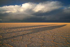
Stormclouds over Salar de Uyuni turning colourful at sunset
See inset photo www.ipernity.com/doc/523247/28834717
Salar de Uyuni
| 21 May 2015 |
|
|
|
The world's largest salt flat covers 10.582 km², is 3656m above sea level and contains approximately 50-70% of the world's lithium reserves in the brine under the salt crust.
en.wikipedia.org/wiki/Salar_de_Uyuni
Clickable note
After the storm
| 20 May 2015 |
|
|
|
Salar de Uyuni at the end of the dry season. In "Bolivian winter" (actually summer!) the Salar is covered by water which makes it dangerous to drive on.
en.wikipedia.org/wiki/Salar_de_Uyuni
Salar de Uyuni
Sunset on Salar de Uyuni
| 11 Dec 2013 |
|
|
|
Stormclouds make for a colourful sunset on the world's largest salt flat
Jump to top
RSS feed- Gudrun's latest photos with "Salar de Uyuni" - Photos
- ipernity © 2007-2025
- Help & Contact
|
Club news
|
About ipernity
|
History |
ipernity Club & Prices |
Guide of good conduct
Donate | Group guidelines | Privacy policy | Terms of use | Statutes | In memoria -
Facebook
Twitter


