Gudrun's photos with the keyword: South Island
Christchurch Cathedral- before the quake
| 22 Feb 2021 |
|
|
|
10 years ago, on 22.02.2011, the Christchurch quake killed 185 people and destroyed vast parts of the inner city including the Cathedral. Whereas most of the city has been rebuilt, the cathedral still isn't finished.
en.wikipedia.org/wiki/2011_Christchurch_earthquake
The main photo and 1st note show the cathedral in its original state, the 2nd and 3rd note were taken 9 months after the quake when the CBD still was a red zone.
Vor genau 10 Jahren, am 22.02.2011, kostete das Erdbeben von Christchurch 185 Menschenleben und zerstörte weite Teile der Innenstadt einschließlich der Kathedrale. Während das Stadtzentrum weitgehend wiederaufgebaut ist, ist die Kathedrale noch immer nicht ganz wiederhergestellt.
de.wikipedia.org/wiki/Christchurch-Erdbeben_vom_Februar_2011
Das Hauptfoto und 1.PiP zeigen die Kathedrale im früheren Zustand, 2. und 3. PiP sind 9 Monate nach dem Beben entstanden, als die Innenstadt noch als rote Zone abgesperrt war.
Stirling Falls
Bowen Falls
| 13 Dec 2018 |
|
|
|
At Milford Sound in NZ's Fiordland National Park, part of Te Wahipounamu World Heritage Area
whc.unesco.org/en/list/551
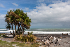
Tauranga Bay
| 19 Jan 2018 |
|
|
|
Hokitika fence
Remarkables
| 12 Jan 2018 |
|
|
|
The Remarkables are an over 2000m high mountain range on the southeastern shore of Lake Wakatipu, seen here from Queenstown.
Die Remarkables sind eine über 2000m hohe Bergkette, die sich am Südostufer des Lake Wakatipu erhebt. Hier von Queenstown aus aufgenommen.
Colour version:
Red Zone (2xPiP)
| 12 Jan 2018 |
|
|
|
The devastating Febr. 2011 quake and various aftershocks had flattened vast parts of Christchurch's City Centre. In late 2012 much of it was still in the Red Zone and fenced off. The collapsed spire of the Cathedral had been demolished and a debate about what to do with the church had started. Only in late 2017 a decision was reached to rebuild the Cathedral, with a narrow majority of 55%.
HFF, folks!
Queen Charlotte Sound
| 11 Jan 2018 |
|
|
|
View from Captain Cook's lookout on Motuara Island in Queen Charlotte Sound. The Sound is part of the Marlborough Sounds in the north of the South Island, a maze of submerged river valleys where only the tops of former mountain ranges remain above sea level forming peninsulas and islands.
Blick von Captain Cook's lookout über den Queen Charlotte Sound. Dieser ist ein Teil der Marlborough Sounds, einem Gewirr abgesoffener Flusstäler im Norden der Südinsel, aus dem nur noch die Bergrücken als Halbinseln und Insel herausschauen.
Link to larger size: www.ipernity.com/doc/523247/46122740/sizes/o
Panorama stitched from 15 verticals, EXIF: 1/80 • f/11.0 • 18.0 mm • ISO 100/ Canon EOS 350D DIGITAL/ 18.0-200.0 mm
Punakaiki beach
| 10 Jan 2018 |
|
|
|
South of Dolomite point there are also "Pancakes" to be seen on the beach.
Akaroa Lighthouse
| 30 Sep 2016 |
|
|
|
This historic wooden lighthouse used to be on Akaroa Head from 1880 to 1977. In 1980 it was moved to its present location in Akaroa township by the Akaroa Lighthouse Preservation Society.
www.doc.govt.nz/parks-and-recreation/places-to-go/canterbury/places/banks-peninsula-area/historic-akaroa-head
Deutsch: de.wikipedia.org/wiki/Akaroa_Lighthouse
HFF everybody!
Rorschach Pancakes (PiP)
| 09 Jan 2018 |
|
|
|
Original photo mirrored and turned by 90°, cropped square and a cross processing filter applied.
Pancake Rocks
| 09 Jan 2018 |
|
|
|
Pancake Rocks at Dolomite Point, Punakaiki, are one of the most famous features of Paparoa National Park on the West Coast of NZ's South Island.
A 50m thick sheet of Oligocene limestone is responsible for the distinctive topographic features in the park. The *Pancakes" are made up of resistant bands of limestone separated by thin, soft and mud-rich layers which have been eroded away by wind and water.
en.wikipedia.org/wiki/Paparoa_National_Park
Die Pancake Rocks am Dolomite Point in Punakaiki sind Teil des Paparoa Nationalparks an der Westküste der neuseeländischen Südinsel.
Eine 50m mächtige Kalksteinschicht aus dem Oligozän prägt die Landschaft des Nationalparks. Die "Pancakes" bestehen aus Schichten widerstandsfähigen Kalksteins, zwischen denen weicheres Material eingelagert ist, das von Wind und Wasser wegerodiert wurde.
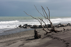
Tasman Sea
Driftwood
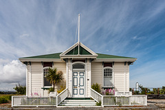
Hokitika Custom House
| 07 Aug 2015 |
|
|
|
The custom house was built in 1896/97 on the shore of Hokitika river. Hokitika used to be a busy port following the goldrush in the 1860s but went into decline in the 20th century.
HFF!
Jump to top
RSS feed- Gudrun's latest photos with "South Island" - Photos
- ipernity © 2007-2025
- Help & Contact
|
Club news
|
About ipernity
|
History |
ipernity Club & Prices |
Guide of good conduct
Donate | Group guidelines | Privacy policy | Terms of use | Statutes | In memoria -
Facebook
Twitter


