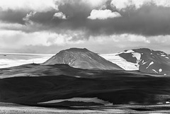
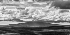
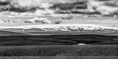
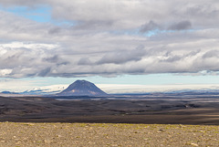
Gudrun's photos with the keyword: Sprengisandur
Nýidalur
| 14 Nov 2022 |
|
|
|
Nýidalur (830m) lies on highland road F26 with Tungnafellsjökull glacier nearby. There are huts with bunk/dorm accommodation run by the Icelandic touring club. We only had our lunch break there and thankfully could use the hut, on two former visits we were shivering on the benches outside...The water in the washrooms is the coldest I have ever experienced!
This part of Sprengisandur highland desert has permafrost, the 1st note shows the polygonal patterns made by ice wedges. en.wikipedia.org/wiki/Ice_wedge
Frostspalten: lineare Schrumpfrisse in gefrorenem Boden, die durch Kontraktion bei sehr tiefen Temperaturen gebildet werden, an der Bodenoberfläche bilden sie oft ein Polygonnetz. Durch Gefrieren von eindringendem Schmelzwasser werden Eiskeile gebildet.
Yet even in this harsh climate flowers grow:
Bartsia alpina (Alpenhelm)
Silene acaulis (Moss campion, Stängelloses Leimkraut, Lambagras)
Far Horizons
| 26 Sep 2022 |
|
|
|
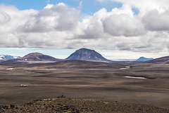
Southern Highlands seen from Kistualda (767m), a small hill near highland road F26 with a wide ranging view. The mountain in the distance is Hekla volcano (1491m).
A well deserved rest
| 02 Sep 2022 |
|
|
|
The horses had come all the way from the south over the feared Sprengisandur highland crossing. They get a well deserved one week's rest before making the return journey.
hFF folks!
Hofsjökull
| 31 Aug 2022 |
|
|
|
seen from Sprengisandur (highland road F26)
At 925 km² Hofsjökull is Iceland's 3rd largest glacier. It lies in the geographical middle of the country and covers a large shield volcano with a massive caldera.
Homebuilt trailer
| 12 Jan 2019 |
|
|
|
At Nýidalur hut in the Central Highlands we met 2 Icelanders who had built this trailer themselves. They proudly proclaimed they had comfortably spent many freezing nights in there;-)
An der Nýidalur-Hütte im zentralen Hochland trafen wir 2 Isländer, die diesen Anhänger selbst gebaut hatten. Sie erzählten stolz, dass auch sie da drin auch bei minus 10 Grad kuschelig warm übernachtet hätten;-)
Fjörðungsalda and Tungnafellsjökull
| 08 Dec 2018 |
|
|
|
Fjörðungsalda (the low hill with the mast) lies in the middle of the Icelandic highlands and demarcates the watershed between North and South. The taller hill in the background is Tungnafellsjökull, a 1523m high glaciated volcano west of Vatnajökull. icelandicvolcanos.is/?volcano=TUN
Fjörðungsalda (der niedrige Berg mit dem Mast) liegt in der Mitte des isländischen Hochlands und ist die Wasserscheide zwischen Nord und Süd. Der Berg im HIntergrund ist Tungnafellsjökull, ein 1523m hoher vergletscherter Vulkan westlich vom Vatnajökull.
I am back online but have a lot of catching up to do, so I probably won't be able to visit and comment all of your photos.
Ich bin wieder da und sehr im Rückstand, deswegen werde ich wohl in nächster Zeit nicht alle eure Fotos besuchen und kommentieren können.
Hofsjökull
| 10 Oct 2018 |
|
|
|
Hofsjökull is Iceland's 3rd largest glacier covering a roughly circular area of 925m". Like other Icelandic glacers it has a volcano with a huge caldera underneath and is retreating considerably.
Hofsjökull hat eine fast runde Form und ist mit 925m" Oberfläche Islands drittgrößter Gletscher. Wie bei anderen isländischen Gletschern liegt ein Vulkan mit einer riesigen Caldera unter dem Eis, das zunehmend abschmilzt.
Panorama taken from Sprengisandur looking SW, stitched from 4 photos,
EXIF:1/160• f/11.0 • 70.0 mm • ISO 100, Canon EOS 6D, EF24-70mm f/4L IS USM
Trölladyngja
| 09 Oct 2018 |
|
|
|
Trölladyngja (1468m) is Iceland's largest shield volcano with a 10km diameter and a 100m deep oblong crater. It lies in the wasteland north of Vatnajökull and is part of the National Park.
Trölladyngja (1468m) ist Islands größter Schildvulkan. Er hat einen Durchmesser von 10km und einen 100m tiefen ovalen Krater. Er liegt in der Vulkanwüste nördlich des Vatnajökull und ist Teil des gleichnamigen Nationalparks.
Highland desert Sprengisandur
| 04 Oct 2018 |
|
|
|
On Highland route F26, Sprengisandsleið, at 783m a.s.l., looking east towards Vatnajökull and Bárðarbunga.
Sprengisandur is the highest part of this ancient highland crossing and was much feared because it's exposed to the elements and has no water and grass for the horses. en.wikipedia.org/wiki/Sprengisandur
Auf der Hochlandpiste F26, Sprengisandsleið, auf einer Höhe von 783m. Blick nach Osten zum Vatnajökull und Bárðarbunga.
Sprengisandur ist der höchste Abschnitt dieser alten Hochlanddurchquerung und war gefürchtet, weil er so exponiert war und keinerlei Wasser oder Gras für die Pferde hatte. de.wikipedia.org/wiki/Sprengisandur
Bárðarbunga, 2010m high subglacial volcano
ICE-SAR at Nýidalur
| 01 Oct 2018 |
|
|
|
Icelandic search and rescue superjeeps at Nýidalur. Close by is a notorious ford on Sprengisandur highland road. The 4x4 hire car on the left would never have been able to cross if the water hadn't been very low that day and even so they needed one of the volonteers in superjeeps to guide them across. The people driving the car were in shorts and flip-flops and quickly hopped in again after realizing how cold it was;-)
en.wikipedia.org/wiki/Icelandic_Association_for_Search_and_Rescue
Superjeeps der isländischen Rettungsgesellschaft in Nýidalur. Ganz in der Nähe ist eine berüchtigte Furt auf der Sprengisandur-Hochlandpiste. Der 4x4 Mietwagen links wäre niemals drübergekommen, wenn der Wasserstand nicht so niedrig gewesen wäre und selbst da brauchten sie einen der Freiwilligen im Superjeep, der sie rüberlotste. Die Insassen des PKWs waren in kurzen Hosen und Flipflops und verschwanden wegen der Kälte des Hochlands schnell wieder ins Auto.
de.wikipedia.org/wiki/ICE-SAR
Bárðarbunga
| 27 Jul 2016 |
|
|
|
Bárðarbunga is a 2009m high central volcano under Vatnajökull with a 65km² large ice filled caldera and a 190 km long and up to 25 km wide fissure swarm. The most recent eruption was the 2014/15 Holuhraun fissure eruption, the largest in Iceland since Laki. Excellent detailed info: futurevolc.vedur.is/?volcano=BAR
This photo was taken from Highland road F26, Sprengisandur, about 6 weeks before the start of Holuhraun. See inset photos for the state of the road after a long winter.
Infos about the caldera collapse: en.vedur.is/about-imo/news/on-the-bardarbunga-gradual-caldera-collapse
Bárðarbunga ist ein 2009m hoher Zentralvulkan unter Vatnajökull. Er hat eine 65km² große eisgefüllte Caldera, das gesamte Vulkansystem erstreckt sich über 190km Länge und bis zu 25 km Breite. Bárðarbunga liegt über dem isländischen Hotspot und auf der Bruchzone. Die letzte Eruption 2014/15 im Holuhraun war die größte in Island seit Laki und förderte 1,6km³ Basaltlava.
Das Foto zeigt den Vulkan 6 Wochen vor Holuhraun von der Hochlandpiste Sprengisandur (F26) im Westen. Die Piste war noch nicht lange geöffnet und war noch sehr nass
Stóraverslón and Hofsjökull
| 13 Oct 2014 |
|
|
|
Looking NW from Sprengisandur (F26) highland road to Stóraverslón lakes and Hofsjökull glacier
Bárðarbunga and Háganga
| 13 Oct 2014 |
|
|
|
Looking NE from Sprengisandur to Bárðarbunga (left under Vatnajökull glacier) and Háganga rhyolithic cone
Syðri Háganga
| 13 Oct 2014 |
|
|
|
Syðri Háganga rhyolithic cone seen from the viewpoint on Kistualda, Vatnajökull in the background
Panorama Hágöngur from Kistualda
Tungnafellsjökull from Nýidalur hut
| 13 Oct 2014 |
|
|
|
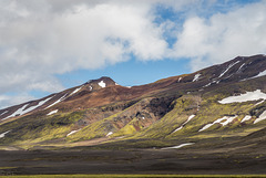
Tungnafellsjökull is a dormant palagonite volcano southwest of Bárðarbunga, near the centre of the hot spot and the triple junction. Repeated quakes in the fissure swarm so far have been merely tectonic.
Aldeyjarfoss Panorama
| 13 Oct 2014 |
|
|
|
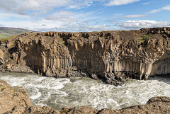
At Aldeyarfoss the river Skjálfandafljót drops 20m over the basalt colums of the Suðurárhraun lava field.
River Skjálfandafljót
| 13 Oct 2014 |
|
|
|
River Skjálfandafljót breaking through the basalt columns of Suðurárhraun lava field
Jump to top
RSS feed- Gudrun's latest photos with "Sprengisandur" - Photos
- ipernity © 2007-2025
- Help & Contact
|
Club news
|
About ipernity
|
History |
ipernity Club & Prices |
Guide of good conduct
Donate | Group guidelines | Privacy policy | Terms of use | Statutes | In memoria -
Facebook
Twitter


