tarboat's photos with the keyword: road
Lost road
| 11 Dec 2018 |
|
|
Mam Tor is a 517 m (1,696 ft) hill near Castleton in the High Peak of Derbyshire, England. Its name means "mother hill", so called because frequent landslips on its eastern face have resulted in a multitude of "mini-hills" beneath it. These landslips, which are caused by unstable lower layers of shale, also give the hill its alternative name of Shivering Mountain. In 1979, the continual battle to maintain the A625 road (Sheffield to Chapel en le Frith, seen running across this view) on the crumbling eastern side of the hill was lost when the road officially closed as a through-route.
A stitch of three images in Photoshop.
Teeth
| 21 Jun 2012 |
|
Cutters on a Wirtgen Milling Drum for planing concrete road surfaces. Seen at Hillhead quarry exhibition.
Dinosaur
| 27 Oct 2010 |
|
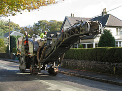
Heading back with the dogs into Buxton after a long walk through the woods we met this dinosaur heading up the road. It turned out to be harmless, and further research shows it to be a Wirtgen W-150 cold planer for milling up the old road surface before relaying.
Sunken way
| 20 Oct 2008 |
|
It's all Eagle1942's fault. Every time I go out and about in the hills I find myself looking for old routeways hiding in the landscape. This particular sunken way lies between Hacked Way Lane and Buxton Old Road and is seen looking northwards towards Lamaload reservoir which lies in the valley to the right of the distant woodlands. Although now boggy and filled with rushes this route must have seen the passage of thousands of feet and hooves to have created such a deep gulley. I wonder how old it is and where they were all going?
Jump to top
RSS feed- tarboat's latest photos with "road" - Photos
- ipernity © 2007-2025
- Help & Contact
|
Club news
|
About ipernity
|
History |
ipernity Club & Prices |
Guide of good conduct
Donate | Group guidelines | Privacy policy | Terms of use | Statutes | In memoria -
Facebook
Twitter


