Phil's photos with the keyword: AZ1
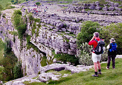
Limestone "Pavement", Malham Cove.
| 10 May 2014 |
|
|
|
A limestone pavement is a natural karst landform consisting of a flat, incised surface of exposed limestone that resembles an artificial pavement. The term is mainly used in the UK where many of these landforms have developed distinctive surface patterning resembling blocks of paving. Similar landforms in other parts of the world are known as alvars.
Conditions for limestone pavements are created when an advancing glacier scrapes away overburden and exposes horizontally-bedded limestone, with subsequent glacial retreat leaving behind a flat, bare surface. Limestone is slightly soluble in water and especially in acid rain, so corrosive drainage along joints and cracks in the limestone can produce slabs called "clints" isolated by deep fissures called "grikes" or "grykes" (terms derived from the North of England dialect). If the grykes are fairly straight and the clints are uniform in size, the resemblance to man-made paving stones is striking, but often they are less regular. Limestone pavements that develop beneath a mantle of topsoil usually exhibit more rounded forms.
Limestone pavements can be found in many previously-glaciated limestone environments around the world. Notable examples are found in the Yorkshire Dales in Northern England, such as those above Malham Cove and on the side of Ingleborough Hill. They are also found in the Stora Alvaret in Öland, Sweden; in the Burren, County Clare, Ireland and in the Désert de Platé in the French Alps.
(Wikipedia).
More Information here:
en.wikipedia.org/wiki/Malham_Cove
View from the top of Malham Cove.
| 16 Jun 2013 |
|
|
|
Malham Cove is a natural limestone formation in the Yorkshire Dales National Park, 1 km north of the village of Malham, North Yorkshire, England. A well-known beauty spot, it is a large, curved limestone cliff at the head of a valley, with a fine area of limestone pavement at the top. On the west side of the 80 metre / 260 feet high cliff face are about 400 irregular stone steps: these form part of the route of the "Pennine Way" long-distance (approx. 270 miles) footpath.
Camera: Olympus AZ1 (low resolution by today's standards...only 3 megapixels).
More Information here:
en.wikipedia.org/wiki/Malham_Cove
View from Pendle Hill, looking South-East.
| 14 Jun 2013 |
|
|
|
Photographed from near the top of Pendle Hill using an Olympus AZ1 camera. This was one of my first digital cameras and it only had 3.2 megapixels but the results were usually quite good, considering the low resolution.
SEE NOTES.
In 1652, during the early years of the Religious Society of Friends (Quakers), George Fox had a vision while on top of Pendle Hill.
"As we travelled, we came near a very great hill, called Pendle Hill, and I was moved of the Lord to go up to the top of it; which I did with difficulty, it was so very steep and high. When I was come to the top, I saw the sea bordering upon Lancashire. From the top of this hill the Lord let me see in what places he had a great people to be gathered."
Today Pendle remains strongly linked to the Quakers, giving its name to one of their centres for religious and spiritual study and contemplation in the United States.
(Wikipedia).
www.ipernity.com/group/england
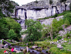
Malham Cove.
| 10 Jun 2013 |
|
|
|
Malham Cove in the Yorkshire Dales National Park, England.
Camera: Olympus AZ1.
Malham Cove is a natural limestone formation 1 km north of the village of Malham, North Yorkshire, England. A well-known beauty spot, it is a large, curved limestone cliff at the head of a valley, with a fine area of limestone pavement at the top.
On the west side of the 80 metre (260 foot) high cliff face are about 400 irregular stone steps: these form part of the route of the Pennine Way.
Originally, a large waterfall flowed over the cove as a glacier melted above it. The remnant of a stream which once fell over the cliff now flows out of the lake of Malham Tarn, on the moors 2 km north of the cove. That stream now disappears underground at the aptly named 'Water Sinks', 1.5 kilometres (one mile) before it's valley reaches the top of the cove. A stream of a similar size (Malham Beck) emerges from a cave at the bottom of the cove. It used to be assumed that the two streams were one and the same. However, experiments with dyes have now shown that two separate streams go underground at different locations, cross paths without mixing behind the cliff, and re-emerge a couple of kilometres apart. This shows the complexity of the system of caves behind the cliff, which is thought to be around 50,000 years old.
(Wikipedia).
www.ipernity.com/group/england
Jump to top
RSS feed- Phil's latest photos with "AZ1" - Photos
- ipernity © 2007-2025
- Help & Contact
|
Club news
|
About ipernity
|
History |
ipernity Club & Prices |
Guide of good conduct
Donate | Group guidelines | Privacy policy | Terms of use | Statutes | In memoria -
Facebook
Twitter


