Jaap van 't Veen's photos with the keyword: Brücke
Greece - Κleidonia Bridge
| 04 Oct 2023 |
|
|
|
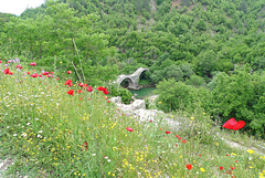
After an unsuccessful attempt in 1844, finally the Kleidonia (also Klidonia) Bridge was built in 1853. This one-arch bridge spans the Voidomatis river in a verdant valley. The construction was paid by Balkiz Hanum, spouse of the Turk Malik-pasha.
The elongated arch has a length of 20 meters and a height of 9.15 meters. The path over the bridge is 3,20 meters wide. The bridge is considered being the end of the Vikos Gorge .
The Kleidonia Bridge is not only known for its beautiful arch, its location among plane trees and scenic views, but also boasts of a history of a bloody feud between two families for reasons of honor.
Greece - Arta Bridge
| 29 Sep 2023 |
|
|
|
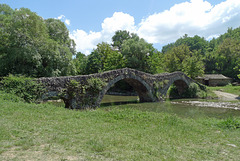
The Bridge of Arta is a stone footbridge crossing the Arachthos river on the outskirts of town. The current bridge is Ottoman and most probably built from 1602 till 1606. However the history of a bridge on that place goes even back to the Roman period.
From the annexation of Arta in 1881 to the outbreak of the First Balkan War in 1912, the highest point of the bridge was the border between the Ottoman Empire and the Kingdom of Greece.
The bridge has a length of 145 meters and the width is 3.75 meters. It has four semicircular arches with no symmetry. The Bridge of Arta received many restorations and additions throughout its history. A major restoration took place during the decade of 1980, after which the bridge got back its beauty.
A folk ballad tells a story of how builders were building the bridge, but its foundations would collapse each night. Finally a bird with a human voice informed the master builder that he should sacrifice his wife in order to complete the construction. She was buried alive in the foundations of the bridge. She first curses the bridge, but then turns the curse into a wish once she realizes her brother may cross the bridge. Thus the sacrifice is fulfilled and the spirits of the river all the bridge to be built successfully.
In 1931, during repairs, a small room was discovered in one of the bridge pillars: it is claimed that a skeleton was indeed found there.
Greece - Kipi, Lazaridis Bridge
| 04 Sep 2023 |
|
|
|
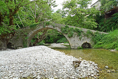
The one-arch stone Lazaridis Bridge (also known as Kontodimos Bridge) was built in 1753 and named after Kostas Lazaridis, an owner of a mill, located near the bridge. Mr. Tolis Kontodimos from the nearby village of Vradeto donated for the construction of the bridge. The watermill was used by the people of Kipi, Koukouli, Kapesovo and Vradeto in order to grind the wheat.
The bridge is located in the gorge of the river Vikos near the village of Kipi and connects the village of Kipi with Koukouli. The arch is 15 meters wide and has a height of 7,80 meters. The walkway has a length of 20 meters and is 2,90 meters wide. The bridge is also known as the “Venice Bridge”.
Greece - Koukouli, Noutsos Bridge
| 23 Aug 2023 |
|
|
|
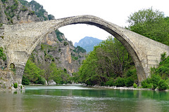
The Noutsos Bridge (Γεφύρι Νούτσο) - also called Kokkoros Bridge - is an impressive one-arched bridge located between the villages Koukouli, Dilofo and Kipi. The bridge spans the River Vikos at one of its impressive narrows. There is an inscription with the year of 1750 or 1752. The bridge was paid for by Mr. Noutsos Kontodimos and Mr. Noutsos Karamesinis. Mr. Kokkoros, owner of a nearby mill, donated a sum of money to correct the steep incline of the cobbled walkway in 1910.
The Noutsos Bridge is one of the best stone bridges in the area. It has an impressive arch spanning 24 meters and rising 11,60 meters above the river bed. The walkway has a length of 39 meters and is 2,50 meters wide.
The Noutsos Bridge, although very old, is still in good condition. In 1977, part of the cobbled path was destoyed by unknowns, but fortunately, the archaeological service repaired the damage and the historic bridge still stands there.
Greece - Kipi, Plakidas Bridge
| 09 Aug 2023 |
|
|
|
The Plakidas Bridge (Γεφύρι Πλακίδα) is crossing the Voidomatis River close to the village of Kipi on a site belonging to the village of Koukouli. The stone bridge has three semi-circular arches. The central arch has a span of 13,50 meters and a height of 7,60 meters. The bridge is 64 meters long and 3,20 meters wide.
Plakidas Bridge retained its original triple-arched form despite being almost completely reconstructed over the years.
The first bridge on this location was wooden and built in 1814. A short time later, but unknown when, an abbot from the nearby monastery in Vitsa paid 20.000 “piaster” for the bridge to be rebuilt in stone. The monastery of Profitis Ilias maintained a watermill at this point and the construction of the bridge was done to replace the older bridge, in order to make the passage safer.
Repairs were carried out in 1866 and were paid by Alexios Plakidas. This act is recorded in an old register of “contributors and benefactors to the community and church of Koukouli village”.
Alexios brother and nephew were also contributors. Since that time the Plakidas family has not stopped generous amounts of money to repair the bridge. This explains the bridge’s name, although its official name is Kalogeriko Bridge; which means “Bridge of the abbot”.
Greece - Kipi, Mylos Bridge
| 07 Aug 2023 |
|
|
|
The Mylos Bridge (Γεφύρι Μύλου) is located nearby the village of Kipi and crosses the River Bayiotiokos. The villagers used to cross this bridge to get to the local watermill (hence the name: mylos = mill in Greek) and their gardens on the opposite side of the river, or to travel to Ioannina.
Mylos Bridge has three arches. The two largest stand in the river bed and are almost equal in size; the smallest is a flood arch. Looking from left to right the dimensions of each arch are (span and height): 9.60/4.30 meters, 8.30/3,75 meters and 3.90/1.60 meters. The walkway is 41 meters long and 2.30 meters wide. It rises and falls twice, peaking in height over the keystones of the largest arches. The path is protected by vertical arcade stones.
A plaque built into the masonry over the central pier tells that the bridge was completed in June 1748.
Greece - Vrosina, bridge
| 02 Aug 2023 |
|
|
|
Some pictures of the stone single-arched stone bridge in Vrosina. Its construction was funded by the Makralexis Monastery The bridge crosses the river Zaloggitikos just before it flows into the Kalamas.
I estimate the bridge is dating back to the end of the 19th century, like a lot of other stone bridges in Epirus. But to be honest I couldn’t find much information about the bridge. Even two friendly and helpful Vrosina-women were not able to find important information about its history on the internet.
Greece - Konitsa Bridge
| 26 Jul 2023 |
|
|
|
The Konitsa or Aoos Bridge was built by architect and stone-master Zioga Frontzou. The construction – done by 80 craftsmen - was completed in 1870, after the first attempt collapsed a year earlier.. The bridge - built to replace an older wooden bridge that stoof on the same place - helped to improve communication and transport between the local population in the area. The construction of the bridge was a difficult and expensive undertaking and a miracle of its time. The bridge - professionally and aesthetically designed - was not only financed by the rich, but also by the ordinary people who shared the idea of the bridge.
The single-span stone arch bridge has a width of 36,80 meters and a height of almost 18 meters. The cobbled walkway - just 2,70 meters wide - has a length of 61,50 meters. The Konitsa Bridge is one of the largest stone bridges in Epirus (and even the Balkan).
It’s not only the bridge, but also the location with the Aoos river flowing under the arch and an incredible view into the Aoos Gorge with the natural beauty of the green mountains of the Northern Pindos National Park in the background.
Konitsa Bridge is built on the narrowest point of the Aoos gorge with some good rocks on both sides of the river. Therefore a one arch of big radius could steadily cover the distance, avoiding bigger and more expensive constructions. Under the arch hangs a little bell, which warned crossing people for strong winds. The bell was lost, but replaced in 1975.
Nederland - Schiedam, Appelmarktbrug
| 03 Mar 2023 |
|
|
|
The Appelmarktbrug is one of Schiedam's three cast-iron drawbridges, built around 1860. When a boat passes through the harbour, this bridge is pulled up by hand by two bridge keepers. The cast-iron drawbridges are the oldest examples in the Netherlands of double (cast-iron) drawbridges.
From the Appelmarktbrug , one has a great view of the Lange Haven and the Havenkerk (PiP1 and 2); originally a Roman Catholic parish church.
Nederland - Zwolle, brug Katerveersluizen
| 06 Oct 2021 |
|
|
|
The Katerveersluizen is a complex of two locks at the mouth of the Willemsvaart in the river IJssel. Their construction was made possible by a major financial contribution from King Willem I, to whom the canal owes its name. The complex of locks and drawbridges forms part of a sconce, which was part of Zwolle's defence line, constructed in 1598.
A small lock with a passage width of about 6 metres was built in 1818-1819. In the second half of the 19th century, this lock proved to be too small for the increasingly larger ships. Therefore, in 1873, a new larger lock was built with a width of 12 metres. At the same time the bridges - including the double iron drawbridge shown in the photo - were built over the locks. In 1964, the Zwolle-IJsselkanaal was opened, so the locks are no longer used for boating.
Nederland - Vreeland, Van Leerbrug
| 24 Sep 2021 |
|
|
|
As early as the 17th century, there was a wooden drawbridge across the Vecht. Later, it was replaced by an iron one. This iron bridge was blown up by the Germans at the beginning of May 1945, just before the end of World War II.
In 1949, a new bridge was opened: a second-hand double drawbridge dating from 1888, which was transported in sections over water from Weesperkarspel to Vreeland. The Vreeland barrel factory Van Leer financed a large part of the costs. That's why the bridge was named the Van Leerbrug . In 1986, the bridge was replaced by the current bridge, which retained its name.
Nederland - Amersfoort, Brug over ‘t Havik
| 23 Aug 2021 |
|
|
|
Amersfoort is an old medieval city. Around 1300 a first city wall was constructed. When the city grew strongly in the 14th century, more land was needed and between 1380 and 1450 a wider, second city wall and city canals were built. In particular, the Langegracht (see PiP2 and 3) and the Havik (main picture and PiP1) cross the city centre.
Around the Havik, the medieval harbour used to be located. The name Havik can therefore be translated as Havenwijk (Harbour area). The oldest mention is from 1390. Nowadays, it is a neighbourhood with beautiful façades and monuments.
One of them is the Havikbrug , which dates from the year 1642. The bridge is popularly called Heksenbrug (Witches’Bridge). The bridge owes its name to a story that tells that at this spot, women suspected of witchcraft had to proof if they were a witch or not.
Nederland - Delden, Kasteel Twickel/toegangsbrug
| 16 Jul 2021 |
|
|
|
Access bridge across the inner moat to Kasteel Twickel . This bridge was built in 1709 of sandstone blockwork with two round arches. The bridge forms the connection between the moated forecourt and the moated main building. The bridge has a simple wrought-iron railing. In 1987, the last restoration of this national monument took place.
Nederland - Veessen, Tolbrug
| 30 Oct 2020 |
|
|
|
The Tolbrug (Toll Bridge) near Veessen is part of a Dutch plan Ruimte voor de Rivier (Room for the River), intended to protect the areas surrounding the Dutch rivers for flooding.
Better drainage of river water reduces the chance of flooding. Between the villages of Veessen and Wapenveld a channel has been created between two dikes to give the river IJssel more room to flood safely. The bridge - connecting the areas on both sides of the dikes, even is the channel full of water - has 60 flaps, which will be opened during extremely high tide. The river water then flows into the area between the two dikes up to the outlet at Wapenveld. If the channel fills up, this temporarily lowers the level in the IJssel.
The Tolbrug - 800 meters long - is named after the Tolhuis (Tollhouse) that used to stand on the current spot of the driveway to the bridge.
Greece - Poseidonia, ‘sinking’ bridge
| 29 Jun 2020 |
|
|
|
When hearing or reading the words Corinth Canal, almost everyone has in front of them the image of the straight canal with its steep, almost perpendicular walls (PiP4) and the bridges connecting the two banks high above the water.
But at the western end of the canal close to Corinth it looks very different; no high cliffs and an almost flat landscape and a ‘sinking’ bridge, connecting Corinth/Poseidonia with Loutraki. The bridge - like the one at the other end of the canal near Isthmia - was constructed in 1988. The bridge lowers its deck 8 meters below water level, permitting waterborne traffic to use the waterway.
We had to wait some time, because ships can only pass through the canal on a one-way system. The waiting was rewarded with a spectacular view of the subducting and rising bridge. After that we could cross the bridge on our way to Loutraki (PiP3).
Greece - Konitsa bridge
| 24 Jan 2020 |
|
|
|
The Konitsa or Aoos bridge was built by architect and stone-master Zioga Frontzou. The work started in 1823 and was finished in 1870 (although it looks older). The bridge helped to improve communication and transport between the local population in the area. The construction of the bridge was a difficult and expensive undertaking and a miracle of its time. The bridge - professionally and aesthetically designed - was not only financed by the rich, but also by the ordinary people who shared the idea of the bridge.
The single-span stone arch bridge has a width of 35 meters and a height of 20 meters and is one of the largest stone bridges in Epirus (and even the Balkan). It’s not only the bridge, but also the location with the Aoos river flowing under the arch and an incredible view into the Aoos Gorge with the natural beauty of the green mountains of the Northern Pindos National Park in the background.
Konitsa bridge is built on the place where the Aoos is narrowing with also some good rocks on both sides of the river. Therefore an one and only arch of big radius could steadily cover the distance, avoiding bigger and more expensive constructions. Under the arch hangs a little bell, which warned crossing people for strong winds. The bell was lost, but replaced in 1975.
Slovenia - Ljubljana, Triple Bridge
| 10 Jan 2020 |
|
|
|
The Tromostovje (Triple Bridge) is a group of three bridges across the Ljubljanica River, connecting the historical center with the more modern parts of Ljubljana. The central bridge - then called Lower Bridge - was opened in 1842, replacing an old wooden medieval bridge, which was already mentioned in 1280. This Lower Bridge had two arches and a metal fence.
In order to prevent the ‘1842 bridge’ becoming a bottleneck the famous Slovene architect Joze Plečnik designed in 1929 the two side bridges for pedestrians. Construction started in 1931 and continued until spring 1932. Nowadays the Triple Bridge is part of the pedestrian zone of the city. From each of the side bridges, two stairways lead to terraces situated just above the river
The central bridge is partly built from limestone. Other parts are built from concrete. The ‘fences’ with 642 balusters are made of artificial concrete. The platform is covered with granite blocks laid in 2010. The bridge was renovated in 1992.
Switzerland - Thun
| 14 Jun 2019 |
|
|
|
Thun is a medieval city, located on the west end of Lake Thun. Already as early as 2.500 BC a first settlement arose on today's site of the city. The castle - towering above the old town - was built by the Dukes of Zähringen. It has a donjon (PiP 1), dating back between 1180 and 1190. One can enjoy wonderful views over the city (PiP 2) and the mighty mountains of the Bernese Highlands, with the Eiger, Mönch and Jungfrau in the far distance.
Five bridges connect the modern shopping area of Thun with the medieval city center. By far the most interesting is the wooden covered bridge Untere Schleuse (main picture), built in 1724. The flood gates regulate the water flow of the River Aare (PiP3).
Jump to top
RSS feed- Jaap van 't Veen's latest photos with "Brücke" - Photos
- ipernity © 2007-2025
- Help & Contact
|
Club news
|
About ipernity
|
History |
ipernity Club & Prices |
Guide of good conduct
Donate | Group guidelines | Privacy policy | Terms of use | Statutes | In memoria -
Facebook
Twitter


