slgwv's photos with the keyword: Banks Lake
The artificial river--
| 23 May 2014 |
|
|
|
The canal that fills Banks Lake. The water is pumped up from the Columbia River with hydropower from Grand Coulee Dam. Looking southwesterly (toward Banks Lake). Electric City, Washington state, USA. The photo is thru a chain-link fence!
Watch that first step...
| 22 May 2014 |
|
|
|
Banks Lake as seen looking north from the west side of Steamboat Rock. Steamboat Rock State Park, Washington state. For more about Banks Lake see the album notes.
Upper Grand Coulee and Banks Lake
| 22 May 2014 |
|
|
|
Looking east from the top of Steamboat Rock toward Northrup Point. Here the Grand Coulee is cut into the granite bedrock below the Columbia River basalts, which form the dark, flat caprock. See adjacent photo for more about Banks Lake. The highway running along the shore on the far side is Washington SR 155.
Banks Lake
| 22 May 2014 |
|
|
|
Looking south along the Grand Coulee from the top of Steamboat Rock. Steamboat Rock State Park, Washington state, USA. Banks Lake is doubly artificial: it's formed by dams at either end of the upper Grand Coulee (above Dry Falls and above Grand Coulee Dam), and is filled by water pumped up from the Columbia River by Grand Coulee Dam! "Coulee", btw, is a localism for a flat-bottomed canyon with steep sides.
Banks Lake
| 22 May 2014 |
|
|
|
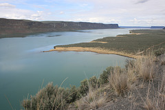
Filling the floor of the upper Grand Coulee, eastern Washington state, USA. Looking more or less north. Banks Lake is doubly artificial; it's held in the Grand Coulee by dams at either end, and filled by Columbia River water pumped up using hydropower from Grand Coulee Dam! So it's filled by an artificial river as well. It's the master holding pond for the Columbia Basin irrigation project, as all the irrigated lands lie downhill from here. It can also be used as a "peaking pond"--the pumps can be run in reverse as generators for when the electrical load peaks. In effect electricity can be stored by pumping water up into the lake.
This pic gives a better scale of the lake--and remember, every drop was pumped up from the Columbia! The prominent mesa just visible at upper right is Steamboat Rock, a state park near the north end of the lake. We hiked to the top of it, with lots of pix elsewhere in this collection.
Banks Lake
| 22 May 2014 |
|
|
|
Eastern Washington state, USA. Banks Lake is doubly artificial; it's held in the Grand Coulee by dams at either end, and filled by Columbia River water pumped up using hydropower from Grand Coulee Dam! So it's filled by an artificial river as well. It's the master holding pond for the Columbia Basin irrigation project, as all the irrigated lands lie downhill from here. It can also be used as a "peaking pond"--the pumps can be run in reverse as generators for when the electrical load peaks. In effect electricity can be stored by pumping water up into the lake.
Jump to top
RSS feed- slgwv's latest photos with "Banks Lake" - Photos
- ipernity © 2007-2025
- Help & Contact
|
Club news
|
About ipernity
|
History |
ipernity Club & Prices |
Guide of good conduct
Donate | Group guidelines | Privacy policy | Terms of use | Statutes | In memoria -
Facebook
Twitter


