slgwv's photos with the keyword: Saddlebag Lake
Saddlebag Lake
| 26 Mar 2011 |
|
|
|
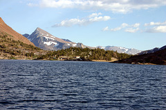
Another SoCalEd reservoir, off the Tioga Pass road (California State Route 120) just east of Yosemite National Park. Looking just east of south. The resort at the south end of the lake runs a water taxi (i.e., boat shuttle) across the lake to this point, so you can get a head start on the hike! It's the jump-off point for what's called 20 Lakes Basin, a popular hiking area in the Hoover Wilderness. Map location, again, is approximate.
Saddlebag Lake and Mt. Dana
| 08 Aug 2012 |
|
|
|
Sierra Nevada, California, USA, just north of Tioga Pass, the back way (i.e., from the east over the Sierra crest) into Yosemite. Looking south from the water taxi on the way back from the 20 Lakes Basin. Saddlebag Lake is another of SoCal Edison's reservoirs from the early 20th century. The main Sierra Crest runs up along the ridge to the summit of Mt. Dana (13057 ft/3980 m) and marks the boundary of Yosemite National Park (to the right/west). The small settlement ahead is Saddlebag Lake Resort. That's where the taxi docks. There's also a popular campground there.
Mt. Dana is named for James Dwight Dana, a pioneering American geologist and mineralogist. "Dana's Manual of Mineralogy" is published to this day, in an umpteenth edition. Quite a few of the peaks in this part of the Sierra Nevada are named for famous geologists or naturalists.
Jump to top
RSS feed- slgwv's latest photos with "Saddlebag Lake" - Photos
- ipernity © 2007-2025
- Help & Contact
|
Club news
|
About ipernity
|
History |
ipernity Club & Prices |
Guide of good conduct
Donate | Group guidelines | Privacy policy | Terms of use | Statutes | In memoria -
Facebook
Twitter


