slgwv's photos with the keyword: Santa Rosa Range
Quinn River Valley
| 01 Aug 2016 |
|
|
|
Looking west out the mouth of Horse Creek Canyon in the Santa Rosa Range, extreme northern Nevada. Yes, that's agriculture out there in the middle of the valley, mostly alfalfa from pumped groundwater I would guess. The Quinn River is another landlocked drainage, flowing from southern Oregon into the north end of the Black Rock Desert. Like most "rivers" in this area, it's really just a creek.
Abel Creek
| 03 Aug 2016 |
|
|
|
Santa Rosa Range, Nevada, looking slightly east of south down an unnamed side creek (which actually was running water!)
Flotsam
| 01 Aug 2016 |
|
|
|
Really. That is driftwood stuck up on the sides of this canyon, from an enormous flood back in the (IIRC) 80s. The water was running 30 feet or so deep thru here--and the speed of the current must have been enormous! Horse Creek Canyon, Santa Rosa Range, Nevada.
Lizard
| 01 Aug 2016 |
|
|
|
Sceloporus spp., either the western sagebrush lizard ( S. vanderburgiansis ) or the western fence lizard ( S. occidentalis ). Along the Horse Creek trail, Santa Rosa Range, Nevada.
Water!
| 01 Aug 2016 |
|
|
|
Horse Creek, flowing westward out of the Santa Rosa Range, in extreme northern Nevada. This drainage was dry when the satellite view was taken.
McConnell Creek
| 18 Sep 2015 |
|
|
|
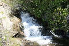
A nice small falls and pool--the dogs really appreciated it! Off the McConnell Creek trail, Santa Rosa Mountains, in extreme northern Nevada.
Santa Rosa range
Road to Hinkey Summit
Jump to top
RSS feed- slgwv's latest photos with "Santa Rosa Range" - Photos
- ipernity © 2007-2025
- Help & Contact
|
Club news
|
About ipernity
|
History |
ipernity Club & Prices |
Guide of good conduct
Donate | Group guidelines | Privacy policy | Terms of use | Statutes | In memoria -
Facebook
Twitter


