Leon_Vienna's photos with the keyword: Lake Nipissing
Lake Nipissing, Farewell Mood - 2007
Lake Nipissing, South Shore - 2007
| 07 Oct 2021 |
|
|
|
Lake Nipissing, Rock Gardens & Kalm's Lobelia (4xP…
| 06 Oct 2021 |
|
|
|
Kalm's Lobelia on wikipedia: en.wikipedia.org/wiki/Lobelia_kalmii
Northern White Cedar on wikipedia: en.wikipedia.org/wiki/Thuja_occidentalis
Abendländischer Lebensbaum auf wikipedia: de.wikipedia.org/wiki/Abendl%C3%A4ndischer_Lebensbaum
Lake Nipissing Cottage Again - 2007
| 01 Oct 2021 |
|
|
|
Lake Nipissing, Cottage Again - 2007 (2xPiP)
| 29 Sep 2021 |
|
|
|
Lake Nipissing, Water's Dance - 2007 (2xPiP)
| 25 Sep 2021 |
|
|
|
The sky was replaced. This time by On1 Photo Raw 2022. Prior development with Adobe Camera Raw & DxO Nik Collection (PiP2).
Original file see PiP1.
I'm still not sure how "legitimate" I should find such manipulations.
Nevertheless, I just like the main image better ;-)
Lake Nipissing, Rocky - 2007 (2x PiP)
Lake Nipissing, Blue Hour - 2007 (PiP)
| 14 Sep 2021 |
|
|
|
LutzP suggested a bettter crop - you'll find it as PiP.
And: LutzP is right.
Lake Nipissing, Golden Hour - 2007 (PiP)
| 13 Sep 2021 |
|
|
|
Back at "tiny" Lake Nipissing, South shore.
Lake Nipissing: 831 km²
Lake Huron: 59.586 km²
Lake Constance/Bodensee: 536 km² (PiP)
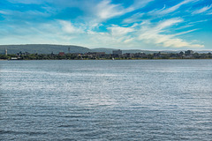
Lake Nipissing, North Bay Lakeside - 2007
| 28 Jul 2021 |
|
|
|
Die Hügel hinter der Stadt sind eher Stufe, denn Hügel. Eine Stufe auf den uralten Granit des kanadischen Schildes. Dort oben geht es mit nur flachem Relief eher eben weiter ( siehe hier ). Gleich hinter der Stadt liegt der Trout Lake, der über den Mattawa und Ottawa River nach Südosten zum Sankt Lorenz Strom entwässert, während der Nipissing über den French River nach Westen zu den Großen Seen eine Verbindung hat. Eigentlich liegt die Stadt selbst genau auf der Wasserscheide und auf der einzigen (von Stromschnellen abgesehen), nur wenige hundert Meter langen Portage-Strecke für Kanus zwischen Atlantik und Oberer See. Die Geländestufe im Bild zeigt in etwa den Beginn und Verlauf des Wasserweges Richtung Osten.
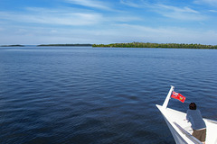
Lake Nipissing, Manitou Islands Cruise - 2007 (2x…
| 27 Jul 2021 |
|
|
|
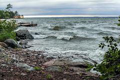
Lake Nipissing, Rough Waters - 2007
| 25 Jul 2021 |
|
|
|
Lake Nipissing, The Bay around the Corner - 2007 (…
| 24 Jul 2021 |
|
|
|
Exploring French River, Rocky - 2007 (7 PiPs)
| 18 Jul 2021 |
|
|
|
The French River (French: Rivière des Français, Ojibwe: Wemitigoj-Sibi) is a river in Central Ontario, Canada. It flows 110 kilometres (68 mi) from Lake Nipissing west to Georgian Bay ... The French River flows through typical Canadian Shield country, in many places exposing rugged glaciated rock but also through heavily forested areas on the upper portion. The mouth of the river contains countless islands and numerous channels which vary from narrow, enclosed steep-walled gorges, falls and rapids, to broad expanses of open water.
Together with the Ottawa and Mattawa Rivers, the French River formed part of the water highway from Montreal to Lake Superior in the days of the fur trade. It remained a major canoe route until about 1820. Around 1855, the Grand Trunk Railway of Canada provided newfound access to the area and the Georgian Bay. This led to increased exploration and interest for fishing and logging during the era of the Industrial Revolution. After the Great Chicago Fire in 1871, there was a boom in logging along with the creation of Lumber barons in the Great Lakes. The French River was "ripe for the picking with its seemingly inexhaustible supply of timber and proximity to the American markets".
en.wikipedia.org/wiki/French_River_(Ontario)
Lake Nipissing, Tranquillity - 2007
Lake Nipissing, Sunset Firework - 2007
| 10 Jul 2021 |
|
|
|
Lake Nipissing, Evening Mood - 2007
| 08 Jul 2021 |
|
|
|
Lake Nipissing - Granite vegetation (PiP)
| 05 Jul 2021 |
|
|
|
Jump to top
RSS feed- Leon_Vienna's latest photos with "Lake Nipissing" - Photos
- ipernity © 2007-2025
- Help & Contact
|
Club news
|
About ipernity
|
History |
ipernity Club & Prices |
Guide of good conduct
Donate | Group guidelines | Privacy policy | Terms of use | Statutes | In memoria -
Facebook
Twitter


