Leon_Vienna's photos with the keyword: Manitoulin Island
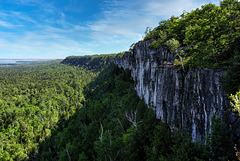
Manitoulin Island, View at 10 Mile Point - 2007
| 12 Sep 2021 |
|
|
|
So, das ist mein letztes Bild von Manitoulin Island. Die Koffer waren schon im Auto und wir auf dem Rückweg nach North Bay. Ein letzter Stopp gebührte diesem Aussichtspunkt, an der Kante eines zweiten, neben dem Niagara Escarpment geologisch älteren Steilhanges auf Manitoulin.
Besonders für die Betrachter aus (Mittel-)Europa möchte ich erwähnen, dass diese Wassermenge da unten, tja ... eigentlich nur die Bucht einer Bucht ist. Oder anders: es ist der Ostteil des North Channel, die schmale Wasserpassage, die Manitoulin Island vom Festland trennt. Wir sind weit davon entfernt, die Wasserfläche der Georgian Bay zu sehen, geschweige denn irgend etwas von der offenen Weite des Lake Huron. Es sind schon ungeheure Dimensionen - wenn ihr auf der Karte heraus zoomt, seht ihr, was ich meine .
Vom rechten Bildrand zieht sich eine flache Landfläche herein, das ist nicht Festland oder ferne Insel, es ist immer noch Manitoulin Island - die Nordspitze von Wiikwemkoong First Nation, etwa 14 km entfernt. Weiter zur Mitte hin sieht man am Horizont Bergspitzen der La Cloche Mountains, auf dem Festland etwa 24 km entfernt. Das kleine Inselchen heißt Loon Island, ansonsten sind noch Haywood -, Beaver - und Strawberry Island zu sehen - nicht dass ich das damals schon gewusst hätte.
Den Blickwinkel schätze ich auf max. 100°, ziemlich genau Richtung Nordost.
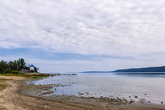
Manitoulin Island - Last View on Carter Bay - 2007…
| 10 Sep 2021 |
|
|
|
Manitoulin Island, Monarch Butterflies at Carter B…
| 09 Sep 2021 |
|
|
|
Out of many reasons I didn't really take photographs that time. I just was amazed and pleased about that new little "tin box" with its tiny sensor inside. There was nothing that could be done manuelly and the small lightcollector wasn't able to create a selective focus for a blurred background. So I rather snapshooted, than photographed and my images of that time offer more a documental value, than anything else. At least I think so. And of course, they keep memories. At least for me.
Well, meanwhile I am able to handle some image editing tools and again, I am amazed and pleased about what can be done with this old and small files - assumed you take the time it is needed.
The image up here is an example for such pictures. I wasn't statisfied at all with it, but some evening hours of editing made it at least respectable, I think.
A jumble however it remains ...
Manitoulin Island, Monarch Caterpillar - 2007 (2xP…
| 08 Sep 2021 |
|
|
|
Ein paar Zeilen über das Leben des Monarchfalters.
A few lines about monarch butterflys' life.
Manitoulin Island, Carter Bay Dunes - 2007 (PiP)
| 06 Sep 2021 |
|
|
|
Manitoulin Island, Old Farmland - 2007
| 04 Sep 2021 |
|
|
|
Manitoulin Island, Misery Bay & Carter Bay Plants…
| 03 Sep 2021 |
|
|
|
Main: Hooded Ladies' Tresses - Spiranthes romanzoffiana - Drehwurz
PiP1: Kalm's St. Johns Wort - Hypericum kalmianum - Kalms Johanniskraut
PiP2: Bladderwort - Urticularia sp. - Wasserschlauch
PiP3: Mountain Deathcamas - Anticlea elegans - Zierliche Jochlilie
Manitoulin Island, Misery Bay, Divided - 2007
Manitoulin Island, Misery Bay, Beach Community - 2…
Manitoulin Island, Pavement Alvar at Misery Bay -…
| 28 Aug 2021 |
|
|
|
Back to my my photo archive HDD - Canada 2007 series can go on.
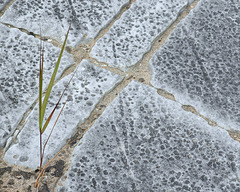
A closer look at the compact and leveled limestone on Manitoulin Island with its structural cracks and glacial scratches. Hard life there ...
More about Alvars:
english - en.wikipedia.org/wiki/Alvar
deutsch - de.wikipedia.org/wiki/Alvar_(Landform)
Two further sites about Canadian Alvars worth seeing, you'll find here - very nicely written and garnished with most beautiful images:
- floraofohio.blogspot.com/2017/04/the-bruce-peninsula-part-vi-alvar.html (all seven parts about Bruce Peninsula are worth to look at - in my opinion ... and not even mentioning the rest of this interesting site)
- www.meanderphotography.ca/Alvar
Manitoulin Island, Pavement Alvar with Glacial Str…
| 15 Aug 2021 |
|
|
|
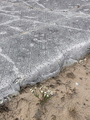
Alvar - leveled and massiv limestone, planed by ice age glacier. Non to little soil development during last few thousand years create an envirement for very specialized plant communities.
Those stronger cracks have to do with the structure of the limestone, the finer scratches origin from glacial movements during the last ice age.
More about Alvars:
english - en.wikipedia.org/wiki/Alvar
deutsch - de.wikipedia.org/wiki/Alvar_(Landform)
Two further sites about Canadian Alvars worth seeing, you'll find here - very nicely written and garnished with most beautiful images:
- floraofohio.blogspot.com/2017/04/the-bruce-peninsula-part-vi-alvar.html (all seven parts about Bruce Peninsula are worth to look at - in my opinion ... and not even mentioning the rest of this interesting site)
- www.meanderphotography.ca/Alvar
Manitoulin Island, Pavement Limestone, Misery Bay…
| 14 Aug 2021 |
|
|
|
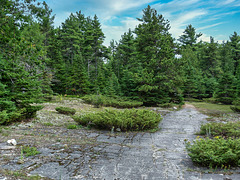
Compact and leveled limestone bedrock creats a biological environment known as Alvar. According german wikipedia one more criterion shall be that the limestone rock was more or less planed by the ice of the ice age. Often scratches of those glacier works can be seen on the surface of the "pavement".
More about Alvars:
english - en.wikipedia.org/wiki/Alvar
deutsch - de.wikipedia.org/wiki/Alvar_(Landform)
Two further sites about Canadian Alvars worth seeing, you'll find here - very nicely written and garnished with most beautiful images:
- floraofohio.blogspot.com/2017/04/the-bruce-peninsula-part-vi-alvar.html (all seven parts about Bruce Peninsula are worth to look at - in my opinion ... and not mentioning the rest of this interesting site)
- www.meanderphotography.ca/Alvar
Oh, and by the way: the sky was brought by Skylum's Luminar AI. On my original JPG it was dazzling white ... I experiment with it, but whenever skies or light mood is effected with it, I tag it with "Luminar AI".
Manitoulin Island, Misery Bay - 2007
| 12 Aug 2021 |
|
|
|
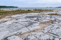
Compact and leveled limestone bedrock creats a biological environment known as Alvar. According german wikipedia one more criterion shall be that the limestone rock was more or less planed by the ice of the ice age. Often scratches of those glacier works can be seen on the surface of the "pavement".
More about Alvars:
english - en.wikipedia.org/wiki/Alvar
deutsch - de.wikipedia.org/wiki/Alvar_(Landform)
Manitoulin Island, West Bay, Lake Huron - 2007
Manitoulin Island, Niagara Escarpment-Panorama ca.…
| 08 Aug 2021 |
|
|
|
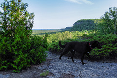
Almost the whole thing, without doggie or someone else.
Central direction should be almost north-east, toward the small town of Little Current which might be situated behind the slope in the centre of image - two hights of the eastern part of La Cloche Mountains are seen as well (pip3). In the left part North Channel of Lake Huron is visible (pip1), a bit further right the western part of La Cloche (pip2). The waters on the right half isn't any of the Great Lakes, but Lake Manitou (pip4), the world's largest freshwater lake on the world's largest island in the world's largest freshwater lake (taking Lake Huron and Lake Michigan as one, what they obviousely are) ... more about that here: en.wikipedia.org/wiki/Lake_Manitou and here: en.wikipedia.org/wiki/Manitoulin_Island
Manitoulin Island, In the Green - 2007
| 03 Aug 2021 |
|
|
|
Manitoulin Island, Niagara esc... someone always s…
Manitoulin Island, Niagara Escarpment (3xPiP)
| 30 Jul 2021 |
|
|
|
Jump to top
RSS feed- Leon_Vienna's latest photos with "Manitoulin Island" - Photos
- ipernity © 2007-2025
- Help & Contact
|
Club news
|
About ipernity
|
History |
ipernity Club & Prices |
Guide of good conduct
Donate | Group guidelines | Privacy policy | Terms of use | Statutes | In memoria -
Facebook
Twitter


