RHH's photos with the keyword: coleman glacier
Mount Baker
| 11 Oct 2014 |
|
|
|
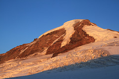
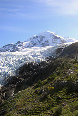
This will be the last photo from our Mount Baker climb, at least for now, and I thought it appropriate that I end the series with a photo of the mountain itself, taken from Coleman Glacier on the first day of our climb. Seeing Mount Baker now, either from a distance or up close, it is a little hard to believe that we were actually on its summit.
Sunrise over the North Cascades
| 10 Oct 2014 |
|
|
|
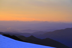
This is another photo of the sunrise taken on the second day of our Mount Baker climb. The sun was coming up behind Mount Baker as we climbed Coleman Glacier, but we could see the colors of the sunrise on the peaks to the north of Baker. Looking at this again, I'd probably crop it top and right
Coleman Glacier
| 08 Oct 2014 |
|
|
|
This was taken coming down from Mount Baker and down and across Coleman Glacier. What had taken us abnout twelve hours going up took us less than five hours coming down.
The Roman Slope
| 29 Sep 2014 |
|
|
|
This photo was taken as we climbed the Roman Slope, first on the snow and a little further up on the rocky ridge to our right. The photo was taken by son Edward who was second on the rope and shows our guide, Troy, who was leading the way. The photo gives some perspective to the climb but truthfully it did not feel as steep as it appears in this shot.
Near the Top of Coleman Glacier
| 24 Sep 2014 |
|
|
|
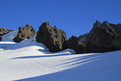
This was taken at about 8:30 in the morning at we neared the top of Coleman Glacier and an altitude of around 9000 feet (still around 1800 feet to go and over two hours of climbing). The photo looks back over the valley up which we had come. The boulders had fallen from the ridge above us, and though we were still in the shadow of Baker and of the Roman Slope, the sun was well up.
Sunrise from Coleman Glacier
| 23 Sep 2014 |
|
|
|
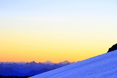
The last picture was taken from our camp on the glacier at sunset. This is sunrise the next morning. We had started our climb at 5:00 am while it was still dark. This was taken several hours later. We were in the shadow of Baker and the Roman Slope and could not see much to the east, but the colors of the sunrise to the north were spectacular and promised the best of days, which indeed we had.
Sunset from Coleman Glacier
| 22 Sep 2014 |
|
|
|
Camped on Coleman Glacier for the night we were behind a ridge that blocked out our view of the setting sun, but we were still able to see the colors of the sunset in the sky and mountains to the northwest. The mountains in the foreground are still the North Cascades, but those in the distance are the Canadian Coastal Range and in the morning we could see the lights of the city of Vancouver in the distance as well.
Evening Light on Baker
| 20 Sep 2014 |
|
|
|
After making camp on Coleman Glacier at 8000 feet of elevation we spent the evening watching the sunset and contemplating the fact that we still had the hardest 2800 feet of elevation to go to reach the top of Baker. The sun was setting behind a ridge, but we could see the sunset colors to the northwest and light of the setting sun on Baker. I was fascinated by the different colors including purple or pink in the snow as the sun went down.
Camping on the Glacier
| 20 Sep 2014 |
|
|
|
This was our overnight camp on the way up to the summit of Mount Baker. We were at about 8000 feet elevation on a relatively level area of Coleman Glacier known as the Football Field. We reached this point at about 4:00 in the afternoon, set up camp, cooked and ate our evening meal, watched the sunset and then turned in for the night. Edward (tan trousers) and I had a warm and comfortable night, but Nate and our guide, Troy (green jacket) were very cold and uncomfortable and did not sleep much. After waking at 4:00 am and making a quick breakfast we set off again at 5:00 am.
The Shadow of Baker
| 19 Sep 2014 |
|
|
|
This was taken early in the morning on the second day of our Mount Baker Climb. At this point we were still crossing and climbing Coleman Glacier and had been climbing for over an hour and half with the Black Buttes (see previous photo) on our right and Mount Baker ahead and to the east. When this picture was taken the sun was just coming up behind Mount Baker to the east (in the opposite direction from the picture). We were looking back west and taking pictures of the sunrise colors in the sky over Puget Sound and the San Juan Islands when this shot was taken. We did not recognize it at the time, but this is the shadow of Mount Baker being thrown many miles away on the western horizon by the rising sun. A friend who saw this picture pointed that out.
The Black Buttes
| 18 Sep 2014 |
|
|
|
We reached this point in our climb at about 4:00 pm. This relatively flat area of Coleman Glacier is known as the Football Field, and it was there we set up camp and spent the night in the shadow of the Black Buttes, a ragged ridge of crumbly rock that runs to the southwest from Mount Baker. The sun as it went down highlighted them and watching the light on them was part of a very enjoyable evening spent in expectation of next day's climbing.
Coming Down off the Glacier
| 17 Sep 2014 |
|
|
|
As we came to the top of the Hogsback near the side of Coleman Glacier, we saw a party coming down off the glacier. We did not have the opportunity to talk to them, so we do not know if they had made the summit of Mount Baker or not, but the picture puts some perspective into the photos I've posted and gives some idea of the distances we had to hike on the glacier. A little later we would be going up the same route.
Mount Baker and Coleman Glacier from the Hogsback
| 16 Sep 2014 |
|
|
|
The first part of our Mount Baker climb took us two miles and up 1000 feet of elevation along the Heliotrope Ridge trail which ends at the knob just visible in the center of the picture. We did not go quite that far, however, and took a side trail up the Hogsback and narrow, steep ridge (glacial moraine?) that took us to the side of the glacier and another 1000 feet higher where we began our trek across the glacier. This picture was taken from the Hogsback.
The part of the glacier that we crossed is not visible in this shot, nor the south slopes of Mount Baker where we climbed to the summit. This is the west face of the mountain, known as the Roman Wall, with the North Ridge, another route to the summit, running down from the peak. The top of the mountain as it appears here is known as the Dome, but is not the true summit. That is to the east of the Dome and is shown in the previous picture.
Mount Baker and Coleman Glacier
| 12 Sep 2014 |
|
|
|
This will be my last post for a few days. Edward and I leave early tomorrow morning for our Mount Baker climb. We’ll be meeting our guide and the rest of the group in Bellingham and will be heading from there to the Heliotrope Ridge trailhead in Mount Baker-Snoqualmie National Forest. Tomorrow we hike with packs two miles and 1000 feet of elevation to the end of the Heliotrope Ridge trail and then another mile and another 1000 feet of elevation to our campsite near Coleman Glacier. Saturday morning we start early (around 1:00 am) and hike another nine miles across Coleman Glacier and up another 5500 feet of elevation to the summit. After spending time at the summit we hike all the way back down (approx. 12 miles), retrieving our backpacks and camping gear on the way down. I’ve been training hard for this and am looking forward to it, but am also somewhat apprehensive, since besides a climb of Long’s Peak years ago this is something I’ve never done before.
This is the description of the climb on the website of the company providing our guide: Mount Baker, with its huge glaciers and lofty size dominate the landscape for over a hundred miles in all directions. This fire breathing mountain is home to the thickest sheets of ice in the contiguous 48 states making this climb one to remember. Our climb starts with full packs in temperate rain-forests. The hike then takes us up and up into gradually changing ecosystems until we reach the sub-alpine Hog’s Back. Here we bathe in views of the Coleman and Roosevelt glaciers with the Canadian Coast range to the North as we set camp. On summit day we rise early and rope up. From camp to the top the climb is spent entirely on glacier. We climb the Coleman glacier while traversing under the steep rock walls and ice cliffs of the Black-Buttes. This takes us to the Roman Slope where we gain big views to the south and climb the last 1,500 feet to the summit which is 10,770 feet of elevation.
Jump to top
RSS feed- RHH's latest photos with "coleman glacier" - Photos
- ipernity © 2007-2025
- Help & Contact
|
Club news
|
About ipernity
|
History |
ipernity Club & Prices |
Guide of good conduct
Donate | Group guidelines | Privacy policy | Terms of use | Statutes | In memoria -
Facebook
Twitter


