RHH's photos with the keyword: mount larrabee
Winchester Mountain and Mount Larrabee
| 22 Jan 2021 |
|
|
|
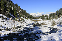
Returning from our hike up to Herman Saddle we followed the Chain Lakes trail around the west side of Lower Bagley Lake with (from the left) Winchester Mountain and Mount Larrabee in the distance.
Bagley Creek
| 22 Jan 2021 |
|
|
|
This Bagley Creek with Lower Begley Lake in the distance and Winchester Mountain and Mount Larrabee in the background.
Mount Larrabee and the Border Peaks
| 13 Nov 2016 |
|
|
|
This was taken on the way to hiking the Chain lakes trail. I make a quick visit to Artisit's Point , took a few photos from there and then headed back down to Austin Pass and the trail. The tallest peak in the photo is Mount Larrabee and the peaks at the left are the Border Peaks, so called because the Canadian-American border runs between them.
The View North from Artist's Point
| 19 Dec 2015 |
|
|
|
This is another photo from one of our 2014 snowshoeing excursions up to Artist's Point. The view is over the valley up which we had come and over the valley northward to the peaks near the Canadian border (the names of the peaks can be found in the notes).
Winter Sunrise
| 29 Jan 2015 |
|
|
|
The peaks in the background at from right to left, Mount Larrabee, Winchester Mountain and (behind the trees), American and Canadian Border Peaks. This is looking north from the snowshoe trail to artist's Point.
Mount Larrabee and the Border Peaks
| 24 Jan 2015 |
|
|
|
This view is from the area of Artist's Point and looks north. The peak just to the left of the trees in the foreground is Mount Larrabee with American Border Peak the jagged peak further to the left, and Canadian Border Peak partly obscured by a cloud. The American-Canadian border runs between these peaks and that area is an area in which we have often hiked.
Mount Larrabee
| 14 May 2014 |
|
|
|
This is Mount Larrabee, just south of the Canadian border and north of Mount Baker. It is 7861 ft / 2396 m in elevation and a favorite destination for climbers. The trail to the peak follow the ridge in the foreground and parts of the trail can be seen in the photo. For non-climbers the trail ends at the lower peak to the right of Larrabee known as the Pleiades Overlook, and over the ridge, known as High Pass, lies an old mine, the Gargett Mine, well worth exploring by taking a side trail down the other side of the ridge.
Mountain Morning
| 14 Feb 2014 |
|
|
|
Taken from the Mount Baker ski area as the sun rose. The highest peak is Mount Larrabee and the peaks to the right the Pleiades. Son Edward and I have been on top of the middle, rounded peak in the center of the Pleiades, though not in the winter. The photo below was taken from that peak looking back toward Mount Baker.
Sunrise in the North Cascades
| 30 Jan 2014 |
|
|
|
Taken at sunrise as I snowshoed up to Artist's Point near Mount Baker. The peaks to the left of the trees are Mount Larrabee and American Border Peak, with the top of Canadian Border Peak just visible at the far left. The photo below was taken in the autumn and shows the same three peaks from a different vantage point (more to the east).
Jump to top
RSS feed- RHH's latest photos with "mount larrabee" - Photos
- ipernity © 2007-2025
- Help & Contact
|
Club news
|
About ipernity
|
History |
ipernity Club & Prices |
Guide of good conduct
Donate | Group guidelines | Privacy policy | Terms of use | Statutes | In memoria -
Facebook
Twitter


