RHH's photos with the keyword: palouse river
Palouse Falls
| 20 Sep 2021 |
|
|
|
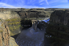
This panorama was taken in Palouse Falls State Park in eastern Washington. The Palouse is a large wheat growing area in eastern Washington and Oregon. The Palouse River flows through the area and here in the state park the river drops 200 feet (61 m) into a large bowl in the basalt formations before heading to its confluence with the Snake River.
Old Ferry
| 04 Aug 2018 |
|
|
|
This is one of the old ferry boats now abandoned at Lyon's Ferry State Park in Washington. I could find no information on the boat either at the park or on line.
Lyon's Ferry
| 04 Aug 2018 |
|
|
|
Lyon's Ferry is at the juncture of the Palouse and Snake Rivers and the site of an old ferry crossing, now replaced with a modern bridge. We visited the state park there with my daughter and her children. The inset photos show one of the old abandoned ferries and the railroad bridge, along with some of the Black Locust trees we found growing there.
Palouse River
| 23 Mar 2017 |
|
|
|
This is the Palouse River above Palouse Falls where it makes a sharp ninety degree bend around a granite monolith known as the Mohawk. The photo was taken on a recent visit when the river was running very high. I am posting this photo because both access to my photos and internet time are limited by my being in hospital for what appears to be appendicitis.
Palouse Falls
| 27 Feb 2017 |
|
|
|
This is Palouse Falls, designated the official waterfall of Washington State, whatever that means. The falls are the main feature of Palouse Falls State Park and are found on the Palouse River in the area of southeastern Washington known as the Palouse. The falls drop 198 feet (60 meters) in an even deeper canyon. We were there on February 17 after navigating a very muddy and slippery road into the park and not only saw the falls but hiked the cliffs above the falls and the upper canyon where another set of falls (more cascades than falls) are found. The main falls had more water coming over them than we have ever seen and the water was a very dirty brown, as is evident in the photo.
Lower Palouse Falls
| 06 Dec 2014 |
|
|
|
These are the Lower Palouse Falls once again, this time from one of the viewpoints on the buttes overlooking the falls. It is hard in a photo to give the scale here, but these falls drop 180 feet (55 m) and the canyon at that point is 377 feet deep (115 m). Nor is this a large volume of water for these falls. At certain times of the year the falls appear to have nearly twice as much water coming over and into the canyon below. I wish, too, that it had been a better day, but we take what we get when doing photography.
I've posted this in IMO, not because I think it such a great picture, but because I'm looking for suggestions as to how it might have been improved or might be improved through processing. I've tried a few things but nothing seems to give it the extra bit of pizzazz it needs. Suggestions?
Upper Palouse Falls and the Mohawk from Below
| 04 Dec 2014 |
|
|
|
Near the Upper Falls of the Palouse River it is possible to hike down into the canyon and see the falls and the canyon from this perspective. In fact it is possible to hike to the top of the Lower Falls from her following the river under the cliff on the right. The basalt formation around which the river runs is the Mohawk, seen now from below.
Eastern Washington Scablands
| 03 Dec 2014 |
|
|
|
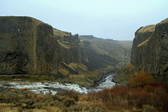
The view here is south from one of the overlooks at Palouse Falls State Park over the scablands of eastern Washington where the park and falls are located. The Palouse River flows through this canyon into the Snake River a few miles further south. It is possible to kayak up the river from its confluence with the Snake to the base of the falls.
Upper Palouse Falls
| 02 Dec 2014 |
|
|
|
The falls in the previous picture are just around the corner on the right from this viewpoint. Shown are the Upper Falls of the Palouse River, also know as Squaw Falls, really little more than a series of cascades that drop about 30 feet. The massive basalt formation around which the river runs is known as the Mohawk. These falls are a bit of a hike from the Lower Falls but it is well worth the time and effort.
Palouse Falls
| 01 Dec 2014 |
|
|
|
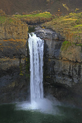
We were in eastern Washington over the weekend and on Friday visited Palouse Falls State Park. Palouse Falls is in the scablands of southeastern Washington near the town of Washtucna. The falls are on the Palouse River a few miles from its confluence with the Snake River. These, the lower falls, drop approximately 180 feet (55m) into a sheer basalt canyon that is 377 feet (115m) deep and into a huge bowl from which the river flows away south through the canyon. There is also an upper falls that drops 20 feet (6m) around the corner from the top of these falls. We were there last January but wanted to see the falls once again and wanted to show them to our youngest son, Edward, who was with us on the trip.
Upper Palouse Falls
| 03 Feb 2014 |
|
|
|
Another photo of Upper Palouse Falls. Along with the more spectacular Lower Falls they are on the Palouse River in eastern Washington and part of Palouse Falls State park. The Palouse is an fertile area of hills and plains in southeastern Washington north of the Snake River that is used primarily for growing wheat. The falls are in an area of scablands, not so fertile or amenable to farming, but still within the Palouse.
Upper Palouse Falls and the Mohawk
| 31 Jan 2014 |
|
|
|
This is another shot of Upper Palouse Falls, more of a cascade than a falls, but beautiful for all that. The more spectacular lower falls are just around the corner where the river disappears on the right. The formation looming above the falls isa called, I believe, the Mohawk, since from above it looks very much like a mohawk-style haircut.
Palouse Falls
| 22 Jan 2014 |
|
|
|
One more shot of the Lower Falls taken with a telephoto lens. The top of the falls can be reached by some rather dangerous hiking, but this is taken from the safety of the fenced viewing area near the car park. These falls drop 180 feet into a huge basalt bowl out of which the river flows on to its junction with the Snake River.
Upper Palouse Falls
| 21 Jan 2014 |
|
|
|
These are the same falls as in the previous photo, only taken from the trail down, the trail just visible in the bottom of the picture. The picture shows, too, what the scablands of eastern Washington are like, generally treeless, with lots of sagebrush, coulees, pinnacles, basalt, and sheer cliffs.
Palouse Falls
| 20 Jan 2014 |
|
|
|
This is where we were Saturday. Palouse Falls is in the scablands of southeastern Washington near the town of Washtucna. The falls are on the Palouse River a few miles from its confluence with the Snake River. These, the lower falls, drop approximately 180 feet (55m) into a sheer basalt canyon that is 377 feet (115m) deep and into a huge bowl from which the river flows away south through the canyon. There is also an upper falls that drops 20 feet (6m) around the corner from the top of these falls. We hiked to the upper falls and learned later that it is possible though somewhat difficult to hike down from where this photo was taken to the bottom of the canyon, but that was 13 miles and an estimated 5-6 hours and we did not have the time. The falls are part of a state park but are quite remote and there was no one around while we were there. The day was foggy and dull, but we enjoyed the opportunity to be out and to do a bit of hiking in spite of the weather.
Lots more photos and text here: ronaldhanko-orchidhunter.blogspot.com/2014/01/palouse-falls-state-park.html
Jump to top
RSS feed- RHH's latest photos with "palouse river" - Photos
- ipernity © 2007-2025
- Help & Contact
|
Club news
|
About ipernity
|
History |
ipernity Club & Prices |
Guide of good conduct
Donate | Group guidelines | Privacy policy | Terms of use | Statutes | In memoria -
Facebook
Twitter


