RHH's photos with the keyword: palouse falls
Palouse Falls
| 20 Sep 2021 |
|
|
|
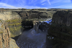
This panorama was taken in Palouse Falls State Park in eastern Washington. The Palouse is a large wheat growing area in eastern Washington and Oregon. The Palouse River flows through the area and here in the state park the river drops 200 feet (61 m) into a large bowl in the basalt formations before heading to its confluence with the Snake River.
Palouse Falls
| 20 Jan 2018 |
|
|
|
The last photo from Palouse Falls State Park, this taken on the same day as the previous photo.
On the Brink
| 19 Jan 2018 |
|
|
|
This was taken a year ago at Palouse Falls State Park. We had hiked to the Upper Falls and were on our way back following the edge of the cliffs above the falls. The Lower Falls are directly in front of me and much of the mist is coming from the falls. This was, of course, taken by my wife.
Emma
| 18 Jan 2018 |
|
|
|
This is another of our granddaughters at Palouse Falls State Park, not as muddy as her sister and looking a bit unhappy about something.
Palouse Falls
| 17 Jan 2018 |
|
|
|
Here's one more shot of Palouse Falls taken on a recent trip there with family members. We had hoped there would be more ice around the falls, but at least there was some.
Ashlynn
| 14 Jan 2018 |
|
|
|
This is our granddaughter, Ashlynn, at Palouse Falls State Park. Many of the trails there were unpaved and very muddy and this was the result. She did not seem to mind, however.
Palouse Falls
| 13 Jan 2018 |
|
|
|
I recently posted some older pictures from Palouse Falls State Park. We were there again a few weeks ago with our daughter, son-in-law and family. It was very muddy and the children were filthy by the time we headed home, but we were able to get some photos, though I was disappointed by the lack of ice at the falls. Palouse Falls State Park is in the southeastern part of Washington State and the falls are the official falls of the state. The falls are on the Palouse River not far from its confluence with the Snake River.
Western Poison Ivy Berries
| 03 Dec 2017 |
|
|
|
These were photographed at Palouse Falls State Park and are the berries of the Western Poison Ivy. It is as toxic as the eastern variety but grows as a shrub rather than a vine and is not as common. We did not know what this was when we photographed it but were happy we did not get too close when we did find out what it was.
Palouse Falls
| 29 Nov 2017 |
|
|
|
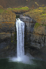
Taken last February from one of the viewpoints on the cliffs across from the falls, the volume of water was high due to snow melt. These are the lower falls of the Palouse River, approximately 198 feet high (60 meters), part of Palouse Falls State Park.
Yellow-bellied Marmot
| 28 Nov 2017 |
|
|
|
This Yellow-bellied Marmot was photographed on the cliff edge at Palouse Falls State Park. Also called a Rock Chuck, it is common in the western USA and Canada. I noticed, though, that I had no photos of this creature posted and so borrowed this photo of my wife's.
Palouse Sunrise
| 24 Nov 2017 |
|
|
|
The Palouse is an area of gently rolling hills of fertile farmland in southeastern Washington. In the middle of the area lies Palouse Falls State Park encompassing the rugged canyon through which the Palouse River runs and the gigantic hole into which Palouse Falls drops. We were there in February, one of our last excursions before a summer filled with medical problems. This was taken early in the day looking south from the area above the falls (see PIP).
Palouse Falls
| 27 Feb 2017 |
|
|
|
This is Palouse Falls, designated the official waterfall of Washington State, whatever that means. The falls are the main feature of Palouse Falls State Park and are found on the Palouse River in the area of southeastern Washington known as the Palouse. The falls drop 198 feet (60 meters) in an even deeper canyon. We were there on February 17 after navigating a very muddy and slippery road into the park and not only saw the falls but hiked the cliffs above the falls and the upper canyon where another set of falls (more cascades than falls) are found. The main falls had more water coming over them than we have ever seen and the water was a very dirty brown, as is evident in the photo.
Lower Palouse Falls
| 06 Dec 2014 |
|
|
|
These are the Lower Palouse Falls once again, this time from one of the viewpoints on the buttes overlooking the falls. It is hard in a photo to give the scale here, but these falls drop 180 feet (55 m) and the canyon at that point is 377 feet deep (115 m). Nor is this a large volume of water for these falls. At certain times of the year the falls appear to have nearly twice as much water coming over and into the canyon below. I wish, too, that it had been a better day, but we take what we get when doing photography.
I've posted this in IMO, not because I think it such a great picture, but because I'm looking for suggestions as to how it might have been improved or might be improved through processing. I've tried a few things but nothing seems to give it the extra bit of pizzazz it needs. Suggestions?
Upper Palouse Falls
| 05 Dec 2014 |
|
|
|
Taken at the edge of the Upper Falls of the Palouse River, the view is downstream where the Lower Falls are found. These Upper Falls are also known as Squaw Falls and the more dramatic Lower Falls are just beyond the cliff on the right.
Palouse Falls
| 01 Dec 2014 |
|
|
|
We were in eastern Washington over the weekend and on Friday visited Palouse Falls State Park. Palouse Falls is in the scablands of southeastern Washington near the town of Washtucna. The falls are on the Palouse River a few miles from its confluence with the Snake River. These, the lower falls, drop approximately 180 feet (55m) into a sheer basalt canyon that is 377 feet (115m) deep and into a huge bowl from which the river flows away south through the canyon. There is also an upper falls that drops 20 feet (6m) around the corner from the top of these falls. We were there last January but wanted to see the falls once again and wanted to show them to our youngest son, Edward, who was with us on the trip.
Upper Palouse Falls
| 03 Feb 2014 |
|
|
|
Another photo of Upper Palouse Falls. Along with the more spectacular Lower Falls they are on the Palouse River in eastern Washington and part of Palouse Falls State park. The Palouse is an fertile area of hills and plains in southeastern Washington north of the Snake River that is used primarily for growing wheat. The falls are in an area of scablands, not so fertile or amenable to farming, but still within the Palouse.
Upper Palouse Falls and the Mohawk
| 31 Jan 2014 |
|
|
|
This is another shot of Upper Palouse Falls, more of a cascade than a falls, but beautiful for all that. The more spectacular lower falls are just around the corner where the river disappears on the right. The formation looming above the falls isa called, I believe, the Mohawk, since from above it looks very much like a mohawk-style haircut.
Lower Palouse Falls
| 29 Jan 2014 |
|
|
|
This is another view of Palouse Falls, the more spectacular Lower Falls, taken by my wife. It gives, I think, a good sense of the dizzying height of cliffs around the falls
Jump to top
RSS feed- RHH's latest photos with "palouse falls" - Photos
- ipernity © 2007-2025
- Help & Contact
|
Club news
|
About ipernity
|
History |
ipernity Club & Prices |
Guide of good conduct
Donate | Group guidelines | Privacy policy | Terms of use | Statutes | In memoria -
Facebook
Twitter


