Erika+Manfred's photos with the keyword: eng
Trollfjord - Durchfahrt am Tag
| 05 Jan 2016 |
|
|
|
Der Trollfjord ist ein 2 Kilometer langer Seitenarm des Raftsunds, der die norwegischen Inselgruppen der Lofoten und der Vesterålen voneinander trennt. Der Name Trollfjord leitet sich von den Trollen, den Zauberwesen der nordischen Mythologie, ab. Die Einmündung des Trollfjords in den Raftsund ist nur 100 Meter breit. Im weiteren Verlauf erweitert sich der Fjord bis auf eine maximale Breite von 800 Metern. Die Südseite des Trollfjords wird durch den 1045 bis 1084 Meter hohen Trolltindan begrenzt, an der Nordseite steigen der 998 Meter hohe Blåfjell und der 980 Meter hohe Litlkorsnestinden fast senkrecht aus dem Wasser.
The Trollfjord (Trollfjorden) is a 2 km long sidearm of the Raftsund between the Norwegian archipelagos of Lofoten and Vesterålen but administratively located in the municipality of Hadsel , which is a municipality in Vesterålen. With its narrow entrance and steep-sided mountains, Trollfjord cuts westwards from the Raftsundet strait. The name is derived from troll, a figure from Norse mythology. The mouth of the Trollfjord where it joins the Raftsund is only 100 meters wide. The fjord widens to a maximum width of 800 meters. The mountains surrounding Trollfjord are between 600 to 1100 metres high. It is surrounded by Trolltindan (1084 meter) in the south and Blåfjell (998 meter) and hohe Litlkorsnestinden (980 meter) in the north. The Trollfjord is 72 metres at its deepest point Quelle: Wikipedia
Der Zaun und die Treppen zu Tintagel Castle
| 02 Aug 2016 |
|
|
|
HFF - Happy Fence Friday to all, and have a good weekend!
Tintagel (kornisch Dintagell oder Tre war Venydh) ist eine Ortschaft an einem zerklüfteten Küstenabschnitt der Grafschaft Cornwall im äußersten Südwesten Englands.Die Ortsbezeichnung ist vor allem bekannt durch die in der Nähe am Meer liegende Burgruine Tintagel Castle, die der Chronist Geoffrey of Monmouth 1136 in seiner Historia Regum Britanniae zu König Artus' Residenz erklärt hat. Im Dorf leben etwa 700 Menschen, die Gemeinde hat 1820 Einwohner (Volkszählung 2001). Bis zur Mitte des 19. Jahrhunderts hieß der Ort Trevena, und Tintagel war die Bezeichnung für das Gemeindegebiet und das Oberland. Die Umbenennung erfolgte durch die Postverwaltung. Erstmals urkundlich erwähnt wurde Tintagel in der Chronik von Monmouth mit der lateinischen Bezeichnung Tintagol.In der Spätantike (ca. 5. bis 7. Jahrhundert) befand sich hier eine größere Siedlung, die von den Archäologen teils als Kloster, teils als Fürstensitz interpretiert worden ist. Auffällig ist, dass sich in den Ruinen große Mengen an aus Ostrom importierter Keramik fanden, was auf recht enge Kontakte zum Mittelmeerraum hinweist. Später wurde der Komplex unter unklaren Umständen aufgegeben. In normannischen Zeiten wurde dann im kleineren, nahgelegenen Dorf Bossiney eine Burg errichtet, was wohl vor der Entstehung des Domesday Books und damit also vor 1086 geschah. Als Bezirke wurden Tintagel und Bossiney im Jahre 1253 unter Richard von Cornwall etabliert. Im Jahr 1927 wurde hier der Orden der Gefährten von den Rittern der Tafelrunde (Order of the Fellowship of the Knights of the Round Table) von Frederick Thomas Glasscock gegründet, drei Jahre später errichtete er für diesen Orden ein Gebäude mit dem Namen King Arthur's Hall, das heutzutage hauptsächlich als Museum dient.
Tintagel Castle (Cornish: Dintagel, meaning "fort of the constriction") is a medieval fortification located on the peninsula of Tintagel Island, adjacent to the village of Tintagel in Cornwall, England, in the United Kingdom. The site was possibly occupied in the Romano-British period, as an array of artefacts dating to this period have been found on the peninsula, but as yet no Roman era structure has been proven to have existed there. It subsequently saw settlement during the Early Medieval period, when it was probably one of the seasonal residences of the regional king of Dumnonia. A castle was built on the site by Richard, Earl of Cornwall in the 13th century, during the Later Medieval period, after Cornwall had been subsumed into the kingdom of England. It later fell into disrepair and ruin. Archaeological investigation into the site began in the 19th century as it became a tourist attraction, with visitors coming to see the ruins of Richard's castle. In the 1930s, excavations revealed significant traces of a much earlier high status settlement, which had trading links with the Mediterranean during the Late Roman period. The castle has a long association with Arthurian legends. This began in the 12th century when Geoffrey of Monmouth described Tintagel as the place of Arthur's conception in his fictionalized account of British history, the Historia Regum Britanniae. Geoffrey told the story that Arthur's father King Uther Pendragon was disguised by Merlin's sorcery to look like Gorlois, Duke of Cornwall, the husband of Igraine, Arthur's mother. Tintagel Castle has been a tourist destination since the mid-19th century. Owned by Charles, Prince of Wales as part of the landholdings of the Duchy of Cornwall, the site is currently managed by English Heritage.
see: en.wikipedia.org/wiki/Tintagel_Castle
Coverack Hafen
| 03 Aug 2016 |
|
|
|
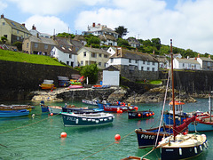
Coverack ist ein kleiner Ort an der Südküste von Cornwall. Die Fischer sind mit kleinen Booten zum fischen rausgefahren, alles strahlte eine zufriedene Ruhe aus. Das Cafe in dem kleinen Haus oberhalb der Treppe nutzte die öffentlichen Bänke an der Straße.
Coverack (Cornish: Porthkovrek, meaning cove of the stream) is a coastal village and fishing port in Cornwall, UK. It is on the east side of the Lizard peninsula, about nine miles south of Falmouth.
Coverack has several hotels and a youth hostel. The area is a centre for watersports, particularly wind surfing, sailing and diving. The nearby rocks known as The Manacles have been the site of many shipwrecks and as a consequence are now a favourite diving destination.
Cadgwith, Cornwall
| 04 Aug 2016 |
|
|
|
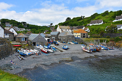
Cadgwith (Cornish: Porthkajwydh, meaning cove of the thicket) is a village and fishing port in Cornwall, England, United Kingdom. It is on the Lizard Peninsula between The Lizard and Coverack.
The village has its origins in medieval times as a collection of fish cellars in a sheltered south-east facing coastal valley with a shingle cove. Fishing subsidised local farmers' livelihoods. Cadgwith was originally called 'Porthcaswydh', becoming 'Por Cadjwydh' in Late Cornish, and is derived from the Cornish word for 'a thicket', literally meaning battle of trees, probably because the valley was densely wooded. From the 16th century, the village became inhabited, with fishing as the main occupation. Subsequently houses, lofts, capstan houses, and cellars constructed of local stone or cob walls and thatched or slated roofs were built along the beach and up the sides of the valley leading to Cadgwith's characteristic Cornish fishing village appearance. In recent times a very small Anglican church was built, next to the path from the car park down to the seafront, dedicated to St Mary. Q:Wikipedia
Villard-Notre-Dame
| 08 Jan 2016 |
|
|
|
Eine Bergstrasse zwischen Gap und Grenoble, die D219 die von Le Bourg-d'Oisans nach Villard-Notre-Dame führt. Man sieht vor unserem Auto eine Ausweiche. Da mussten wir anhalten. Das war ziehmlich eng, denn neben dem Auto ging es so 800 m steil hinunter. Diese Strasse ist die einzige Zufahrt zu dem Ort oben in den Bergen. Ich hab auf Gugel nachgeschaut, die Strasse ist noch nicht breiter geworden. Das Foto ist von 1975.
Taormina, Sizilien
Jump to top
RSS feed- Erika+Manfred's latest photos with "eng" - Photos
- ipernity © 2007-2025
- Help & Contact
|
Club news
|
About ipernity
|
History |
ipernity Club & Prices |
Guide of good conduct
Donate | Group guidelines | Privacy policy | Terms of use | Statutes | In memoria -
Facebook
Twitter


