Erika+Manfred's photos with the keyword: England
Die Bank in Cornwal
| 08 Jan 2024 |
|
|
|
Die Bank in Cornwall
| 05 Feb 2024 |
|
|
|
Take it out ...
| 01 Feb 2017 |
|
|
|
Riesenrhabarber in Trebah Gardens, Cornwall
| 02 Jul 2016 |
|
|
|
Gunnera manicata, known as Brazilian giant-rhubarb or giant rhubarb, a native to South America from Colombia to Brazil, is a species of flowering plant in the Gunneraceae family.
Gunnera manicata, Devon, England
It is a large, clump-forming herbaceous perennial growing to 2.5 m (8 ft) tall by 4 m (13 ft) or more. The leaves of G. manicata grow to an impressive size. Leaves with diameters well in excess of 4 ft (122 cm) are commonplace, with a spread of 10 ft (3 m) by 10 ft (3 m) on a mature plant. The underside of the leaf and the whole stalk have spikes on them. In early summer it bears tiny red-green flowers in conical branched panicles, followed by small, spherical fruit. However, it is primarily cultivated for its massive leaves.
This plant grows best in damp conditions e.g. by the side of garden ponds, but dislikes winter cold and wet.
It has gained the Royal Horticultural Society's Award of Garden Merit.
Despite the common name, this plant is not closely related to rhubarb. Q: Wikipedia
Postbridge, Dartmoor
| 23 Jun 2016 |
|
|
|
www.youtube.com/watch?v=GYKJuDxYr3I
Die Clapper bridge (dt. adaptiert: Klapperbrücke) ist eine Steinplattenbrücke, die durch die Verwendung großer flacher Natursteinplatten als Baumaterial gekennzeichnet ist, und deren Stabilität meist allein auf den aufeinander ruhenden Steinen beruht.
Das Wort „Clapper“ leitet sich nicht von Klappern, sondern vom angelsächsischen Wort cleaca ab, was so viel heißt wie bridging the stepping stones (Trittsteine überbrückend). Das Wort soll aus Sussex, in England stammen und auch Planke bedeuten.
Bei schmalen Fließgewässern sind die zwischen zwei und vier Meter langen Steinplatten direkt von einem zum anderen Ufer verlegt, bei breiteren ruhen sie auf Steinen, die sich im flachen Gewässer befinden, oder auf niedrigen, meist in Trockenbauweise errichteten Steinpfeilern, dann "engl. Postbridge" (Pfostenbrücke) genannt (z. B. zwischen Moretonhamstead und Two Bridges). Meist sind zwei oder drei Platten von annähernd derselben Größe hintereinander angeordnet. Zusätzliche bauliche Befestigungen (z. B. Bindemittelnutzung oder Zapfen-Steinbehau) sind für die unregelmäßig geformten Brücken untypisch. Falls dergleichen dennoch vorhanden ist, wurde es nachträglich eingebracht.
A clapper bridge is an ancient form of bridge found on the moors of Devon (Dartmoor and Exmoor) and in other upland areas of the United Kingdom including Snowdonia and Anglesey, Cumbria, Yorkshire and Lancashire. It is formed by large flat slabs of stone, often granite or schist, supported on stone piers (across rivers), or resting on the banks of streams.
Although often credited with prehistoric origin, most were erected in medieval times, and some in later centuries. They are often situated close to a ford where carts could cross. According to the Dartmoor National Park, the word 'clapper' derives ultimately from an Anglo-Saxon word, cleaca, meaning 'bridging the stepping stones' the Oxford English Dictionary gives the intermediate Medieval Latin form clapus, claperius, "of Gaulish origin", with an initial meaning of "a pile of stones" Q:Wikipedia
Der Zaun im Eden Project in Cornwall
| 07 Sep 2018 |
|
|
|
Das Eden Project ist nicht nur eine weltbekannte botanische Sehenswürdigkeit, sondern auch ein ganz außergewöhnliches Nachhaltigkeitsprojekt: Hier im Eden verfolgen wir das Ziel, Menschen und ihre Umwelt einander näherzubringen, und zu erforschen, wie wir gemeinsam eine bessere Zukunft aufbauen können.
Die zwei riesigen Biome des Eden beherbergen den weltweit größten überdachten Regenwald und eine mediterrane Biosphäre mit prachtvollen Blumen, aromatischen Kräutern und Obstbäumen. Unter den beiden Kuppelformationen und in den weitreichenden Freiluftgärten wachsen mehr als eine Million Pflanzen aus der ganzen Welt.
Unser Projekt ist ein Vorzeigebeispiel in puncto Regeneration und nachhaltiges Leben, mit einer spannenden Entstehungsgeschichte: Entdecken Sie, wie aus einer kargen Tongrube in nur wenigen Jahren ein blühendes Pflanzenparadies wurde.
Das Eden Project liegt in der Grafschaft Cornwall, im Südwesten von England. Diese Gegend zählt zu den schönsten Landstrichen des Vereinigten Königreichs und ist für ihre atemberaubenden Landschaften und Küstenstreifen sowie ihr mildes Klima bekannt. Q:Eden-Project
Eden Project, Tropischer Regenwald
Der Zaun bei Falkirk Wheel, Horses
Der Zaun in Falmouth Hafen
Eden Project - PIP: in den Kuppeln
| 30 Jul 2016 |
|
|
|
PIP 1: Der Tropenwald
PIP 2: Mediterran
Das Eden Project ist ein botanischer Garten bei Bodelva in Cornwall, England, etwa 5 Meilen nordöstlich von St Austell. Die Anlage ist rund 50 Hektar groß und stellt eine bedeutende Sehenswürdigkeit im Süden Englands dar: 2011 wurde sie von über einer Million Menschen besucht.
Das Eden Project entstand nach einer Idee des englischen Archäologen und Gartenliebhabers Tim Smit in einer stillgelegten Kaolingrube nahe St Austell. Von der Idee im Jahr 1995 bis zur Eröffnung der Anlage im März 2001 dauerte es sechs Jahre. Charakterisiert wird der Garten durch die zwei riesigen Gewächshäuser, die aus jeweils vier miteinander verschnittenen geodätischen Kuppeln in der Bauweise von Richard Buckminster Fuller bestehen. Hier werden verschiedene Vegetationszonen simuliert. Die Gewächshäuser des Eden Projects sind derzeit die größten der Welt.
Im größeren der beiden Gewächshäuser des Komplexes wird eine tropisch-feuchte und im kleineren eine subtropisch-trockene und mediterrane Klimazone simuliert. Ziel ist es, eine natürliche Umgebung nachzuahmen, um Pflanzen und auch einige Tierarten der ganzen Welt dort unterbringen zu können. Auch die Kaolingrube selbst wurde landschaftlich gestaltet, bepflanzt und mit Skulpturen ausgestattet. Allerdings ist der Garten immer noch im Aufbau, Erweiterungen innerhalb des Geländes sind geplant.
Laut eigener Aussage des Eden Projects beherbergen das Freigelände und die Gewächshäuser 100.000 Pflanzen aus ca. 5.000 Arten. Vor allem handelt es sich hier um Nutzpflanzen aller Art. Besonderer Wert wird dabei auf die Darstellung und Nachzucht vom Aussterben bedrohter seltener und alter Sorten gelegt, um die Arten- und somit genetische Vielfalt von Nutzpflanzen zu erhalten.
Das Projekt verfolgt einen bewahrenden und erzieherischen Ansatz. Den Besuchern wird neben den Namen der Pflanzen auch deren medizinische Verwendung und deren Bedeutung für unsere Umwelt nähergebracht, um die Menschheit durch Aufklärung von der Zerstörung der Umwelt abzuhalten. Regelmäßige Kunstausstellungen und Informationsveranstaltungen, die einen Bezug zum Thema Natur und Umwelt haben, gehören daher auch zum Programm des Parks.
The Eden Project (Cornish: Edenva) is a visitor attraction in Cornwall, England. Inside the two biomes are plants that are collected from many diverse climates and environments. The project is located in a reclaimed Kaolinite pit, located 2 km (1.2 mi) from the town of St Blazey and 5 km (3 mi) from the larger town of St Austell, Cornwall.
The complex is dominated by two huge enclosures consisting of adjoining domes that house thousands of plant species, and each enclosure emulates a natural biome. The biomes consist of hundreds of hexagonal and pentagonal, inflated, plastic cells supported by steel frames. The largest of the two biomes simulates a Rainforest environment and the second, a Mediterranean environment. The attraction also has an outside botanical garden which is home to many plants and wildlife native to Cornwall and the UK in general; it also has many plants that provide an important and interesting backstory, for example, those with a prehistoric heritage.
The name Eden Project stems from the 1994 TV series Earth 2
At the bottom of the pit are two covered biomes:
The Tropical Biome, covers 1.56 ha (3.9 acres) and measures 55 m (180 ft) high, 100 m (328 ft) wide, and 200 m (656 ft) long. It is used for tropical plants, such as fruiting banana plants, coffee, rubber and giant bamboo, and is kept at a tropical temperature and moisture level.
The Mediterranean Biome covers 0.654 ha (1.6 acres) and measures 35 m (115 ft) high, 65 m (213 ft) wide, and 135 m (443 ft) long. It houses familiar warm temperate and arid plants such as olives and grape vines and various sculptures.
The Outdoor Gardens represent the temperate regions of the world with plants such as tea, lavender, hops, hemp and sunflowers, as well as local plant species.
The covered biomes are constructed from a tubular steel (hex-tri-hex) with mostly hexagonal external cladding panels made from the thermoplastic ETFE. Glass was avoided due to its weight and potential dangers. The cladding panels themselves are created from several layers of thin UV-transparent ETFE film, which are sealed around their perimeter and inflated to create a large cushion. The resulting cushion acts as a thermal blanket to the structure. The ETFE material is resistant to most stains, which simply wash off in the rain. If required, cleaning can be performed by abseilers. Although the ETFE is susceptible to punctures, these can be easily fixed with ETFE tape. The structure is completely self-supporting, with no internal supports, and takes the form of a geodesic structure. The panels vary in size up to 9 m (29.5 ft) across, with the largest at the top of the structure. Q: Wikipedia
Lizard Point, Cornwall
| 31 Jul 2016 |
|
|
|
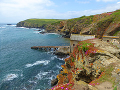
Lizard Point in Cornwall ist der südlichste Punkt der Lizard Halbinsel und gleichzeitig der südlichste Punkt Englands auf der Hauptinsel Großbritanniens. Sein nördliches Gegenstück ist Dunnet Head in Schottland.
Lizard Point markiert die nördliche Einfahrt in den Ärmelkanal und ist der einzige Landpunkt der britischen Hauptinsel, der – wenn auch nur eine Winzigkeit – südlicher als der 50. Breitengrad gelegen ist (entspricht dem deutschen Mainz oder dem nordfranzösischen Amiens); selbst Land’s End, das fälschlicherweise oft als der südlichste Punkt Englands angesehen wird, liegt nördlich des 50. Breitengrades.
Direkt auf der Spitze befinden sich einige Häuser, der eigentliche Ort The Lizard befindet sich etwa einen Kilometer nördlich. Unterhalb der Häuser an der Spitze befindet sich die alte Station der Royal National Lifeboat Institution, die aber nicht mehr in Betrieb ist. Des Weiteren stehen etwas östlich der Spitze die beiden Leuchttürme Lizard Lighthouse, von denen nur noch einer in Betrieb ist. Daneben befindet sich das in viktorianischer Zeit gebaute Hotel, das vom National Trust verwaltet wird, um es vor dem Verfall zu schützen. Es wird heute als Jugendherberge genutzt (YHA Lizard Youth Hostel). Ebenso wie das Hotel befindet sich auch Lizard Point im Besitz des National Trust und steht damit seit 1987 unter dessen Schutz.
Im Sommer kommen pro Tag bis zu 2500 Besucher an den Lizard Point. Um die Landschaft zu schützen, und den Durchgangsverkehr vom Besucherverkehr zu trennen, hat der National Trust Wege und Parkplätze angelegt. Zur Verschönerung der Landschaft wurden oberirdisch verlegte Strom- und Telefonkabel in den Boden verlegt und 51 Telegrafenmasten entfernt.
Lizard Point (from Cornish an Lysardh, meaning "the high court") in Cornwall is at the southern tip of the Lizard Peninsula. It is situated half-a-mile (800 m) south of Lizard village in the civil parish of Landewednack and about 11 miles (18 km) southeast of Helston.
Lizard Point is the most southerly point on mainland Great Britain at 49° 57' 30" N. With the exception of parts of the Isles of Scilly it is the southernmost part of England.
Lizard Point is for many ships the starting point of their ocean passage and a notorious shipping hazard. The Lizard Lighthouse is situated at Lizard Point. Immediately below the lighthouse, situated in what used to be a hotel, is the YHA Lizard Youth Hostel. Lizard Point is situated within Caerthillian to Kennack SSSI (Site of Special Scientific Interest), noted for its biological and geological interest. Polpeor Cove is a small cove to the east of Lizard Point.
The area is famous for its carved serpentine items, which range from ornaments to the pump handles in the local public house, the Lizard Inn (The Top House). The geology of Lizard can be interesting to some, with a number of planned walks available from local tourist authorities to discover more about the local rocks.
The first sighting of the Spanish Armada on mainland Britain was off Lizard Point at 3 pm on 29 July 1588. This was one of the greatest invasion fleets in history and consisted of 120 ships armed with over 1,000 cannon and with 29,000 men on board.
The Battle at the Lizard, a naval battle, took place off The Lizard on 21 October 1707. Q:Wikipedia
Der Zaun und die Treppen zu Tintagel Castle
| 02 Aug 2016 |
|
|
|
HFF - Happy Fence Friday to all, and have a good weekend!
Tintagel (kornisch Dintagell oder Tre war Venydh) ist eine Ortschaft an einem zerklüfteten Küstenabschnitt der Grafschaft Cornwall im äußersten Südwesten Englands.Die Ortsbezeichnung ist vor allem bekannt durch die in der Nähe am Meer liegende Burgruine Tintagel Castle, die der Chronist Geoffrey of Monmouth 1136 in seiner Historia Regum Britanniae zu König Artus' Residenz erklärt hat. Im Dorf leben etwa 700 Menschen, die Gemeinde hat 1820 Einwohner (Volkszählung 2001). Bis zur Mitte des 19. Jahrhunderts hieß der Ort Trevena, und Tintagel war die Bezeichnung für das Gemeindegebiet und das Oberland. Die Umbenennung erfolgte durch die Postverwaltung. Erstmals urkundlich erwähnt wurde Tintagel in der Chronik von Monmouth mit der lateinischen Bezeichnung Tintagol.In der Spätantike (ca. 5. bis 7. Jahrhundert) befand sich hier eine größere Siedlung, die von den Archäologen teils als Kloster, teils als Fürstensitz interpretiert worden ist. Auffällig ist, dass sich in den Ruinen große Mengen an aus Ostrom importierter Keramik fanden, was auf recht enge Kontakte zum Mittelmeerraum hinweist. Später wurde der Komplex unter unklaren Umständen aufgegeben. In normannischen Zeiten wurde dann im kleineren, nahgelegenen Dorf Bossiney eine Burg errichtet, was wohl vor der Entstehung des Domesday Books und damit also vor 1086 geschah. Als Bezirke wurden Tintagel und Bossiney im Jahre 1253 unter Richard von Cornwall etabliert. Im Jahr 1927 wurde hier der Orden der Gefährten von den Rittern der Tafelrunde (Order of the Fellowship of the Knights of the Round Table) von Frederick Thomas Glasscock gegründet, drei Jahre später errichtete er für diesen Orden ein Gebäude mit dem Namen King Arthur's Hall, das heutzutage hauptsächlich als Museum dient.
Tintagel Castle (Cornish: Dintagel, meaning "fort of the constriction") is a medieval fortification located on the peninsula of Tintagel Island, adjacent to the village of Tintagel in Cornwall, England, in the United Kingdom. The site was possibly occupied in the Romano-British period, as an array of artefacts dating to this period have been found on the peninsula, but as yet no Roman era structure has been proven to have existed there. It subsequently saw settlement during the Early Medieval period, when it was probably one of the seasonal residences of the regional king of Dumnonia. A castle was built on the site by Richard, Earl of Cornwall in the 13th century, during the Later Medieval period, after Cornwall had been subsumed into the kingdom of England. It later fell into disrepair and ruin. Archaeological investigation into the site began in the 19th century as it became a tourist attraction, with visitors coming to see the ruins of Richard's castle. In the 1930s, excavations revealed significant traces of a much earlier high status settlement, which had trading links with the Mediterranean during the Late Roman period. The castle has a long association with Arthurian legends. This began in the 12th century when Geoffrey of Monmouth described Tintagel as the place of Arthur's conception in his fictionalized account of British history, the Historia Regum Britanniae. Geoffrey told the story that Arthur's father King Uther Pendragon was disguised by Merlin's sorcery to look like Gorlois, Duke of Cornwall, the husband of Igraine, Arthur's mother. Tintagel Castle has been a tourist destination since the mid-19th century. Owned by Charles, Prince of Wales as part of the landholdings of the Duchy of Cornwall, the site is currently managed by English Heritage.
see: en.wikipedia.org/wiki/Tintagel_Castle
Coverack Hafen
| 03 Aug 2016 |
|
|
|
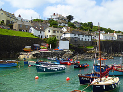
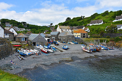
Coverack ist ein kleiner Ort an der Südküste von Cornwall. Die Fischer sind mit kleinen Booten zum fischen rausgefahren, alles strahlte eine zufriedene Ruhe aus. Das Cafe in dem kleinen Haus oberhalb der Treppe nutzte die öffentlichen Bänke an der Straße.
Coverack (Cornish: Porthkovrek, meaning cove of the stream) is a coastal village and fishing port in Cornwall, UK. It is on the east side of the Lizard peninsula, about nine miles south of Falmouth.
Coverack has several hotels and a youth hostel. The area is a centre for watersports, particularly wind surfing, sailing and diving. The nearby rocks known as The Manacles have been the site of many shipwrecks and as a consequence are now a favourite diving destination.
Cadgwith, Cornwall
| 04 Aug 2016 |
|
|
|
Cadgwith (Cornish: Porthkajwydh, meaning cove of the thicket) is a village and fishing port in Cornwall, England, United Kingdom. It is on the Lizard Peninsula between The Lizard and Coverack.
The village has its origins in medieval times as a collection of fish cellars in a sheltered south-east facing coastal valley with a shingle cove. Fishing subsidised local farmers' livelihoods. Cadgwith was originally called 'Porthcaswydh', becoming 'Por Cadjwydh' in Late Cornish, and is derived from the Cornish word for 'a thicket', literally meaning battle of trees, probably because the valley was densely wooded. From the 16th century, the village became inhabited, with fishing as the main occupation. Subsequently houses, lofts, capstan houses, and cellars constructed of local stone or cob walls and thatched or slated roofs were built along the beach and up the sides of the valley leading to Cadgwith's characteristic Cornish fishing village appearance. In recent times a very small Anglican church was built, next to the path from the car park down to the seafront, dedicated to St Mary. Q:Wikipedia
Dartmoor, Rundbogenbrücke gegenüber der Clapper Br…
| 08 Aug 2016 |
|
|
|
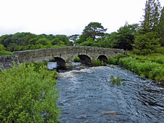
Picture ist taken from the Clapper Bridge.
Postbridge is a hamlet in the heart of Dartmoor in the English county of Devon. It is situated on the B3212, roughly midway between Princetown and Moretonhampstead.
Postbridge is situated next to the East Dart river, one of two main tributaries of the River Dart, and consists of a few houses, a shop, a pub, and a national park tourist information centre.
Postbridge is best known for its fine example of an ancient clapper bridge over the river. First recorded in the 14th century, the bridge is believed to have been built in the 13th century to enable pack horses to cross the river, carrying tin to the stannary town of Tavistock. The clapper bridge which is a Grade II* listed structure, is still complete, and stands alongside another bridge, a Grade II listed structure built in the 1780s
Dartmoor
| 09 Aug 2016 |
|
|
|
Das Gefängnis ist die große Häusergruppe, fast in der Mitte hinten.
Neben den bekannteren und weniger bekannten Sehenswürdigkeiten Dartmoors gehören die verstreut liegenden schönen Weiler und Dörfer zu den Anziehungspunkten; einigen von ihnen hat die Parkverwaltung den Status von „Conservation Areas“ zugesprochen. Am südöstlichen Rand des Parks ist die Kleinstadt Buckfastleigh einen Besuch wert; von dort fährt die South Devon Railway, eine wiederhergestellte Normalspur-Eisenbahnlinie, den Dart River entlang nach Totnes. Nahe der Stadt befindet sich die Benediktiner-Abtei Buckfast Abbey, eines der wenigen noch aktiven Klöster in Großbritannien.
Ganz im Norden des Parks liegt über dem Flusstal des Teign das Castle Drogo; es ist das letzte Landschloss, das in Großbritannien gebaut worden ist. Weiter flussabwärts kommt man zur Fingle Bridge, einem massiven, dreibogigen Bauwerk. Weiter nordwestlich geht es nach Lynford. Dort steht die Kirche St Michal’s de Rupe auf Brentor. In Lydford wurde 1195 das für seinen rüden Umgang mit Gefangenen bekannte erste Gefängnis Dartmoors erbaut.
Von Südwesten her fährt man durch das Zentrum des Parks auf alten Straßen über Bennet’s Cross und Warren House, dem abgelegensten Inn, zur Ortschaft Postbridge, wo die größte noch erhaltene, über den East Dart errichtete „clapper bridge“ zu sehen ist. Sie stammt aus dem 13. Jahrhundert und wurde erbaut, um das Zinn von den Minen mit Packpferden zu den Schmelzöfen von Tavistock und Chagford transportieren zu können. Der nächste Ort ist Princetown, bekannt für sein düsteres Zuchthaus, das 1806 ursprünglich für Gefangene aus den Napoleonischen Kriegen gebaut wurde. Der Ort beherbergt außerdem das Verwaltungszentrum der Duchy of Cornwall. Immer noch im Zentrum, aber in der Osthälfte, liegt das wahrscheinlich am häufigsten besuchte Dorf Dartmoors, Widecombe-in-the-Moor. Schon von weitem ist der 36 m hohe Turm der Gemeindekirche zu sehen. Er wurde nach 1638 errichtet; in jenem Jahr schlug während eines Gottesdienstes ein gewaltiger Blitz in das Gebäude ein und forderte vier Todesopfer.
Einsames Gehöft?
| 10 Aug 2016 |
|
|
|
Neben den bekannteren und weniger bekannten Sehenswürdigkeiten Dartmoors gehören die verstreut liegenden schönen Weiler und Dörfer zu den Anziehungspunkten; einigen von ihnen hat die Parkverwaltung den Status von „Conservation Areas“ zugesprochen.
Falmouth, please come in
| 15 Aug 2016 |
|
|
|
Falmouth (kornisch Aberfal) ist eine Hafenstadt an der Südküste der Grafschaft Cornwall in England. Die Stadt zählt 20.775 Einwohner (Stand: 2001). Ursprünglich hieß Falmouth Peny-cwm-cuic, was im Englischen zu „Pennycomequick“ verballhornt wurde.
Falmouth ist für seinen Hafen berühmt, der zusammen mit den Carrick Roads den drittgrößten Naturhafen der Welt bildet. Die Stadt ist auch als Start bzw. Ziel einiger Weltumsegelungen bekannt, so z. B. der von Sir Francis Chichester und Dame Ellen MacArthur.
Sir John Killigrew gründete die Stadt Falmouth im Jahr 1613. Bereits um 1540 ließ Heinrich VIII. hier die Küstenfestung Pendennis Castle errichten, um die Carrick Roads zu verteidigen. Während des Englischen Bürgerkriegs war Pendennis Castle die vorletzte Festung, die sich den Parlamentsanhängern ergab. Angesichts der Bedrohung durch die spanische Armada wurden die Befestigungen im späten 16. Jahrhundert durch steile Wallanlagen verstärkt.
Der Schoner Pickle überbrachte in Falmouth die Nachricht vom englischen Sieg und Admiral Nelsons Tod in der Schlacht von Trafalgar.
Während des Zweiten Weltkriegs war Falmouth der Ausgangspunkt für einen Kommandotrupp, der 1942 den deutschen U-Boot-Stützpunkt in Saint-Nazaire unter dem Decknamen Operation Chariot angriff und zerstörte.
Falmouth (/ˈfælməθ/; Cornish: Aberfala) is a town, civil parish and port on the River Fal on the south coast of Cornwall, England, United Kingdom. It has a total resident population of 26,767.
Falmouth Parish Church, Church Street, dedicated to "King Charles the Martyr"
The name Falmouth is of English origin, which recent Cornish language enthusiasts have translated to "Aberfal" (or "Aberfala") based on Welsh precedents. It is claimed that an earlier Celtic name for the place was Peny-cwm-cuic, which has been Anglicized to 'Pennycomequick'.
Early history
Falmouth was the site where Henry VIII built Pendennis Castle to defend Carrick Roads, in 1540. The main town of the district was then at Penryn. Sir John Killigrew created the town of Falmouth shortly after 1613.
In the late 16th century, under threat from the Spanish Armada, the defences at Pendennis were strengthened by the building of angled ramparts. During the Civil War, Pendennis Castle was the second to last fort to surrender to the Parliamentary Army.
After the Civil War, Sir Peter Killigrew received Royal patronage when he gave land for the building of the Church of King Charles the Martyr, dedicated to Charles I, "the Martyr".
The seal of Falmouth was An eagle displayed with two heads and on each wing with a tower (based on the arms of Killigrew). The arms of the borough of Falmouth were Arg. a double-headed eagle displayed Sa. each wing charged with a tower Or. in base issuant from the water barry wavy a rock also Sa. thereon surmounting the tail of the eagle a staff also proper flying therefrom a pennant Gu.
The Falmouth Packet Service operated out of Falmouth for over 160 years between 1689 and 1851. Its purpose was to carry mail to and from Britain's growing empire. As the most south-westerly good harbour in Great Britain Falmouth was often the first port for returning Royal Navy ships.
Jump to top
RSS feed- Erika+Manfred's latest photos with "England" - Photos
- ipernity © 2007-2025
- Help & Contact
|
Club news
|
About ipernity
|
History |
ipernity Club & Prices |
Guide of good conduct
Donate | Group guidelines | Privacy policy | Terms of use | Statutes | In memoria -
Facebook
Twitter


