Shooting information for this photo
← Back to the photo page
Want to know more about EXIF?
Check wikipedia page about Exchangeable image file format (EXIF)
Check wikipedia page about Exchangeable image file format (EXIF)
Some of EXIF data are only available in English.
| Camera: | OLYMPUS CORPORATION C5060WZ |
|---|---|
| Exposure: | 0.002 sec. (1/500) |
| Aperture: | f/4.8 |
| Focal Length: | 11.5 mm (35 mm equivalent: 3498.6 mm) |
| Flash: | Off, Did not fire |
| Exposure mode: | Creative (Slow speed) |
| Max Aperture: | 3.1 |
| Resolution: | 72 x 72 dpi |
| Dimension: | 2592 x 1944 pixels |
| Compression: | 2 bits/pixels |
| Original Date: | 2006:12:26 12:57:37 |
| Created on: | 2006:12:26 12:57:37 |
| Modified on: | 2011:06:12 18:51:00 |
| Software: | v756-79 |
| Copyright: | (c) Tomá Kohout, Nový Zéland na kole prosinec 2006 - únor 2007 |
| Artist | Tomá Kohout |
| Black And White Mode | Off |
| Camera Type | Unknown (....`Z) |
| Circle Of Confusion | 0.000 mm |
| Color Space | sRGB |
| Components Configuration | Y, Cb, Cr, - |
| Compression | Uncompressed |
| Creator | Tomáš Kohout |
| Digital Zoom | 0.9999847414 |
| Exif Version | 0220 |
| Exposure Compensation | -1/2 |
| Field Of View | 0.6 deg |
| File Source | Digital Camera |
| Flashpix Version | 0100 |
| Focal Plane Diagonal | 0.1422194541 mm |
| Hyperfocal Distance | 278.97 m |
| ISO | 80 |
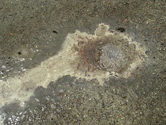
| Image Description | Wai-O-Tapu - vaøicí voda a loue |
| Image Size | 2592x1944 |
| Lens Distortion Params | -29949 -3837 20993 2 -30719 -31231 |
| Light Source | Fine Weather |
| Light Value | 13.8 |
| Macro | Super Macro |
| Metering Mode | Multi-segment |
| One Touch WB | Off |
| Photometric Interpretation | RGB |
| Planar Configuration | Chunky |
| Pre Capture Frames | 0 |
| Quality | SQ (Low) |
| Rating | 3 |
| Resolution Unit | inches |
| Rights | (c) Tomáš Kohout, Nový Zéland na kole prosinec 2006 - únor 2007 |
| Scale Factor To 35 mm Equivalent | 304.2 |
| Scene Type | Directly photographed |
| Special Mode | Unknown (654311424), Sequence: 469771008, Panorama: Unknown (3925807104) |
| Subject | Expedice Zéland 2006-7 na kole, Nový Zéland, sopky a vulkanické jevy, příroda, voda, Panoramio |
| Thumbnail Offset | 2166 |
| User Comment | Wai-O-Tapu - vařicí voda a louže..Keywords: Expedice Zéland 2006-7 na kole;Nový Zéland;sopky a vulkanické jevy;příroda;voda;Panoramio |
| White Balance Bias | 0 |
| White Balance Bracket | 0 |
| White Board | 0 |
| XMP Toolkit | XMP Core 4.1.1 |
| Y Cb Cr Positioning | Centered |
GPS Information |
|
| GPS Altitude | 335 m Above Sea Level |
| GPS Altitude Ref | Above Sea Level |
| GPS Latitude | 38 deg 21' 40.72" S |
| GPS Latitude Ref | South |
| GPS Longitude | 176 deg 22' 7.57" E |
| GPS Longitude Ref | East |
| GPS Position | 38 deg 21' 40.72" S, 176 deg 22' 7.57" E |
Jump to top
- ipernity © 2007-2025
- Help & Contact
|
Club news
|
About ipernity
|
History |
ipernity Club & Prices |
Guide of good conduct
Donate | Group guidelines | Privacy policy | Terms of use | Statutes | In memoria -
Facebook
Twitter
