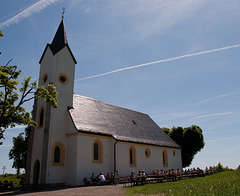
Shooting information for this photo
← Back to the photo page
Want to know more about EXIF?
Check wikipedia page about Exchangeable image file format (EXIF)
Check wikipedia page about Exchangeable image file format (EXIF)
Some of EXIF data are only available in English.
| Camera: | PENTAX Corporation PENTAX K200D |
|---|---|
| Exposure: | 0.00286 sec. (1/350) |
| Aperture: | f/8.0 |
| Focal Length: | 19.0 mm (35 mm equivalent: 28.0 mm) |
| Flash: | Off, Did not fire |
| Exposure mode: | Program AE |
| Resolution: | 300 x 300 dpi |
| Dimension: | 3872 x 2592 pixels |
| Original Date: | 2009:05:17 14:07:25 |
| Digitized Date: | 2009:05:17 14:07:25+02:00 |
| Created on: | 2009:05:17 14:07:25 |
| Modified on: | 2009:05:17 17:56:00 |
| Software: | picnik.com |
| Blue Hue | 0 |
| Blue Saturation | 0 |
| Brightness | +36 |
| Camera Profile | Adobe Standard |
| Chromatic Aberration B | 0 |
| Chromatic Aberration R | 0 |
| Circle Of Confusion | 0.020 mm |
| City | Bad Staffelstein |
| Color Noise Reduction | 25 |
| Color Space | Uncalibrated |
| Color Temperature | 5500 |
| Components Configuration | Y, Cb, Cr, - |
| Compression | JPEG (old-style) |
| Contrast | High |
| Country | Deutschland |
| Country Code | DEU |
| Custom Rendered | Normal |
| Exif Version | 0221 |
| Exposure | +0.55 |
| Exposure Compensation | 0 |
| Exposure Mode | Auto |
| Field Of View | 65.5 deg |
| Flash Fired | False |
| Flash Function | False |
| Flash Mode | Off |
| Flash Red Eye Mode | False |
| Flash Return | No return detection |
| Flashpix Version | 0100 |
| Focal Length In 35mm Format | 28 mm |
| Green Hue | 0 |
| Green Saturation | 0 |
| Has Crop | False |
| Has Settings | True |
| Hyperfocal Distance | 2.21 m |
| ISO | 100 |
| Image Size | 3188x2592 |
| Lens | Sigma or Tamron Lens |
| Light Value | 14.5 |
| Location | Romansthal |
| Luminance Smoothing | 0 |
| Metadata Date | 2009:05:17 17:38:46.848-02:00 |
| Metering Mode | Multi-segment |
| Red Hue | 0 |
| Red Saturation | 0 |
| Resolution Unit | inches |
| Saturation | Normal |
| Scale Factor To 35 mm Equivalent | 1.5 |
| Scene Capture Type | Standard |
| Sensing Method | One-chip color area |
| Shadow Tint | 0 |
| Shadows | 4 |
| Sharpness | Hard |
| State | Bayern |
| Subject | Romansthal, Staffelberg |
| Subject Distance Range | Distant |
| Tint | +10 |
| Tone Curve | 0, 0, 32, 22, 64, 56, 128, 128, 192, 196, 255, 255 |
| Tone Curve Name | Medium Contrast |
| Version | 5.3 |
| Vignette Amount | 0 |
| White Balance | Auto |
| XMP Toolkit | Image::ExifTool 6.54 |
| Y Cb Cr Positioning | Centered |
GPS Information |
|
| GPS Altitude | 515.3 m Above Sea Level |
| GPS Altitude Ref | Above Sea Level |
| GPS Date Stamp | 2009:05:17 |
| GPS Date/Time | 2009:05:17 12:07:25Z |
| GPS Latitude | 50 deg 5' 30.93" N |
| GPS Latitude Ref | North |
| GPS Longitude | 11 deg 1' 36.23" E |
| GPS Longitude Ref | East |
| GPS Map Datum | WGS-84 |
| GPS Position | 50 deg 5' 30.93" N, 11 deg 1' 36.23" E |
| GPS Satellites | 0 |
| GPS Time Stamp | 12:07:25 |
| GPS Version ID | 2.2.0.0 |
Jump to top
- ipernity © 2007-2025
- Help & Contact
|
Club news
|
About ipernity
|
History |
ipernity Club & Prices |
Guide of good conduct
Donate | Group guidelines | Privacy policy | Terms of use | Statutes | In memoria -
Facebook
Twitter
