White Edge
Folder: Peak District
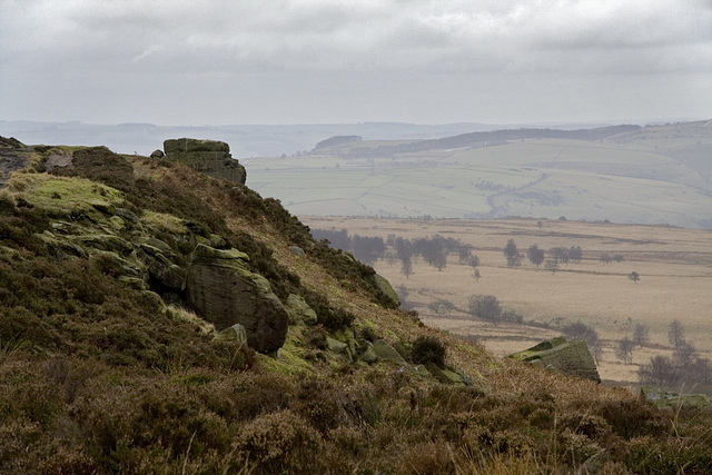
Photos taken on or near White Edge, one of the Eastern Edges in the Peak District National Park, Derbyshire, England.
Snow White Edge
White Edge viewed from Eyam Moor. The Edge is comprised of Crawshaw Sandstone, mostly a coarse sandstone or gritstone very much like the underlying 'Millstone Grit' gritstone horizons, but this is stratigraphically in the basal Coal Measures.
The old quarries just left of centre worked the Rough Rock, the stratigraphically highest sandstone in the 'Millstone Grit' (Namurian).
The building towards the upper left is White Edge Lodge, formerly a gamekeeper's house on the Longshaw Estate. Now owned by the National Trust and let as a holiday cottage. A stunning location.
White (Edge) Christmas
Originally uploaded for the Guesswhere UK group.
Where was I standing on Christmas Day in the morning?
Answer: On White Edge on the Eastern Edges in the Peak District National Park.
Afternoon larches 2
Late afternoon sunshine illuminating larches in the Longshaw Estate in the Peak District National Park.
This is at the ill-defined northern end of White Edge.
Afternoon larches 1
Late afternoon sunshine beaming through larches in the Longshaw Estate in the Peak District National Park.
This is at the ill-defined northern end of White Edge.
White Edge grasses 2
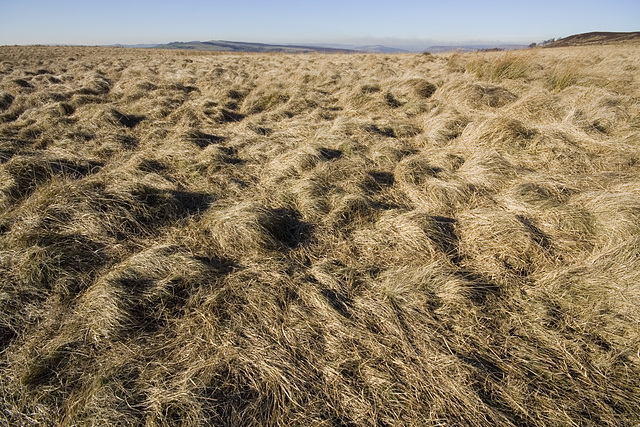
I was intrigued by the textures and silvery-gold light on the grass moorland between White Edge and Curbar Edge. The track on the right is along the route of an old packhorse track to Bakewell.
White Edge grasses 1
I was intrigued by the textures and silvery-gold light on the grass moorland between White Edge and Curbar Edge.
13 Feb 2008
Alternative White Edge 4
This is an experimental treatment of the previous photo.
The vertical scale has been exaggerated three-fold and then the Photoshop 'watercolour' filter applied. Normally I don't bother much with these filters (too much of a gimmick) but in this case I think it works well and might even be considered artistic?? The resulting image, apart from being interesting in its own right, clearly enhances the geological framework of this area. The incised V-shaped notch of the Derwent Valley cut down through a much earlier (Tertiary?) erosion platform is well seen.
This is a view southwards along the low escarpment of White Edge in the Eastern Edges area of the Peak District National Park. The top of Curbar and Baslow Edges are visible off to the right with the Derwent Valley just visible in the distance. To the left of White Edge is Big Moor.
Unlike most of the Eastern Edges which are formed of Namurian 'Millstone Grit', White Edge is comprised of Crawshaw Sandstone which is stratigraphically just above the base of the Coal Measures.
I love the feeling of wide open spaces in the this area, yet we are only a few miles SW of Sheffield.
White Edge 3
This is a view southwards along the low escarpment of White Edge in the Eastern Edges area of the Peak District National Park. The top of Curbar and Baslow Edges are visible off to the right with the Derwent Valley just visible in the distance. To the left of White Edge is Big Moor.
Unlike most of the Eastern Edges which are formed of Namurian 'Millstone Grit', White Edge is comprised of Crawshaw Sandstone which is stratigraphically just above the base of the Coal Measures.
I love the feeling of wide open spaces in the this area, yet we are only a few miles SW of Sheffield.
13 Feb 2008
Alternative White Edge 2
This is an experimental treatment of the previous photo.
The vertical scale has been exaggerated three-fold and then Photoshop 'watercolour' filter applied. Normally I don't bother much with these filters (too much of a gimmick) but in this case I think it works well and might even be considered artistic?? The resulting image, apart from being interesting in its own right, clearly enhances the geological framework of this area. The incised V-shaped notch of the Derwent Valley cut down through a much earlier (Tertiary?) erosion platform is well seen. In the far distance on the middle-left skyline is the Kinderscout plateau; Win Hill is in the centre distance and Bamford Edge at about 0.7, 0.6.
The brown smoke haze is a result of controlled burning of the heather moorland in the Strines area to the west of Sheffield.
Jump to top
RSS feed- Latest items - Subscribe to the latest items added to this album
- ipernity © 2007-2025
- Help & Contact
|
Club news
|
About ipernity
|
History |
ipernity Club & Prices |
Guide of good conduct
Donate | Group guidelines | Privacy policy | Terms of use | Statutes | In memoria -
Facebook
Twitter


