Shooting information for this photo
← Back to the photo page
Want to know more about EXIF?
Check wikipedia page about Exchangeable image file format (EXIF)
Check wikipedia page about Exchangeable image file format (EXIF)
Some of EXIF data are only available in English.
| Camera: | samsung SM-A526B |
|---|---|
| Exposure: | 0.04167 sec. (1/24) |
| Aperture: | f/1.8 |
| Focal Length: | 5.2 mm (35 mm equivalent: 24.0 mm) |
| Flash: | No Flash |
| Exposure mode: | Program AE |
| Max Aperture: | 1.8 |
| Resolution: | 72 x 72 dpi |
| Dimension: | 4624 x 2604 pixels |
| Original Date: | 2025:01:29 19:25:14.642 |
| Digitized Date: | 2025:01:29 19:25:14+00:00 |
| Created on: | 2025:01:29 19:25:14.642 |
| Software: | A526BXXUBGXK4 |
| Copyright: | David H Edwards |
| Artist | David H Edwards |
| Base URL | https://www.flickr.com/photos/ dhedwards/ |
| Circle Of Confusion | 0.007 mm |
| City | Westminster |
| Color Space | sRGB |
| Compression | JPEG (old-style) |
| Country | United Kingdom |
| Country Code | GBR |
| Creator | David H Edwards |
| Credit | David H Edwards |
| Digital Zoom Ratio | 1 |
| Directory Item Length | 2577034 |
| Directory Item Mime | video/mp4 |
| Directory Item Padding | 0 |
| Directory Item Semantic | MotionPhoto |
| Exif Version | 0220 |
| Exposure Compensation | 0 |
| Exposure Mode | Auto |
| Field Of View | 73.7 deg |
| Flashpix Version | 0100 |
| Focal Length In 35mm Format | 24 mm |
| Hyperfocal Distance | 2.32 m |
| ISO | 500 |
| Image Size | 4624x2604 |
| Light Value | 4.0 |
| Location | Middle Temple |
| Metering Mode | Center-weighted average |
| Motion Photo | 1 |
| Motion Photo Presentation Timestamp Us | 2441218 |
| Motion Photo Version | 1 |
| Resolution Unit | inches |
| Rights | David H Edwards |
| Scale Factor To 35 mm Equivalent | 4.6 |
| Scene Capture Type | Standard |
| State | Greater London |
| Sub Sec Time | 642 |
| Sub Sec Time Digitized | 642 |
| Sub Sec Time Original | 642 |
| Subject | 1574, GBR, Greater London, Middle Temple, Middle Temple Hall, Movers & Shakers, The Honourable Society of the Middle Temple, United Kingdom, Westminster |
| Thumbnail Offset | 1136 |
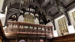
| Title | Minstrel gallery, Middle Temple Hall |
| White Balance | Auto |
| XMP Toolkit | Image::ExifTool 10.96 |
| Y Cb Cr Positioning | Centered |
GPS Information |
|
| GPS Altitude | 19 m Above Sea Level |
| GPS Altitude Ref | Above Sea Level |
| GPS Date Stamp | 2025:01:29 |
| GPS Date/Time | 2025:01:29 19:25:14Z |
| GPS Latitude | 51 deg 30' 44.52" N |
| GPS Latitude Ref | North |
| GPS Longitude | 0 deg 6' 41.11" W |
| GPS Longitude Ref | West |
| GPS Map Datum | WGS-84 |
| GPS Position | 51 deg 30' 44.52" N, 0 deg 6' 41.11" W |
| GPS Time Stamp | 19:25:14 |
| GPS Version ID | 2.2.0.0 |
Jump to top
- ipernity © 2007-2025
- Help & Contact
|
Club news
|
About ipernity
|
History |
ipernity Club & Prices |
Guide of good conduct
Donate | Group guidelines | Privacy policy | Terms of use | Statutes | In memoria -
Facebook
Twitter
