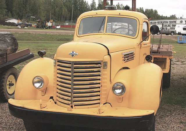
Alaska Highway Truck.
Mural in Dorion, Ontario
Not much left of this one!
Looking for open water???
The Fog always lifts.
Near Dragon Lake.
Dragon Lake
Dragon Lake
Saint Fabien de Panet, Quebec
View over the valley from Pinnacle Park.
Walking towards the Pinnacles. Quesnel, BC -5C
Pinnacle Park, Quesnel, BC
Ford Factory in Belgium
Quesnel' Pulp Industry
Another import from my Flickr.
Sled Dog.
Swap Meet.
Cool old Chev.
Waiting for restoration.
Greenwood, BC Canada
Grouse.
At the side of the road.
Otter.
Moose
Sled Dog.
Motorcycle Trip up North.
Blacksmith Shop Fort Garry, Manitoba
Ukrainian Village, Alberta, Canada
Authorizations, license
-
Visible by: Everyone -
All rights reserved
-
28 visits
Fort Nelson, BC Canada


This community lies east of the northern Rocky Mountains in the Peace River region along the Alaska Highway at Mile 300.The town is approximately a four hour drive from the nearest urban centre, Fort St. John, but could potentially take six hours under winter driving conditions.The Alaska Highway both north and south of Fort Nelson is most often very well plowed in the winter and offers scenic views year round.
According to the 2016 Canadian Census, the population was 3,366, a drop of 5.5% from the 2011 Census.
According to the 2016 Canadian Census, the population was 3,366, a drop of 5.5% from the 2011 Census.
Makrofan, Nouchetdu38 have particularly liked this photo
- Keyboard shortcuts:
Jump to top
RSS feed- Latest comments - Subscribe to the comment feeds of this photo
- ipernity © 2007-2025
- Help & Contact
|
Club news
|
About ipernity
|
History |
ipernity Club & Prices |
Guide of good conduct
Donate | Group guidelines | Privacy policy | Terms of use | Statutes | In memoria -
Facebook
Twitter

Sign-in to write a comment.